
Word is the Swifties had a late night. Our correspondents Amy and Catherine reported it was declared an official rain show. Described as “iconic” and “memorable.” All’s well that ends well.
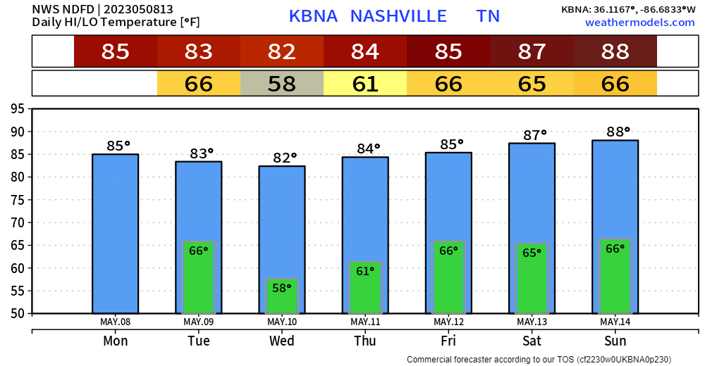
Seems like just yesterday we were watching the above graph for freezing low temps. Now….80s for highs, 60s for lows. Might even need to mow twice this week.
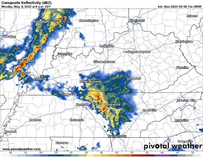
This morning, an outflow boundary snuck in here kicking off some scattered downpours. The HRRR doesn’t currently believe this hangs around very long this AM and clears the radar out for most of the day. Tonight, though, the HRRR appears to be throwing darts at another outflow boundary around 10 pm. It’s very inconsistent run-to-run. One run showing storms. The other not. This particular run (the 8 am run) thinks they won’t be much of a big deal and arrive after midnight. But, this could change on the next run. We’ll be watching radar.
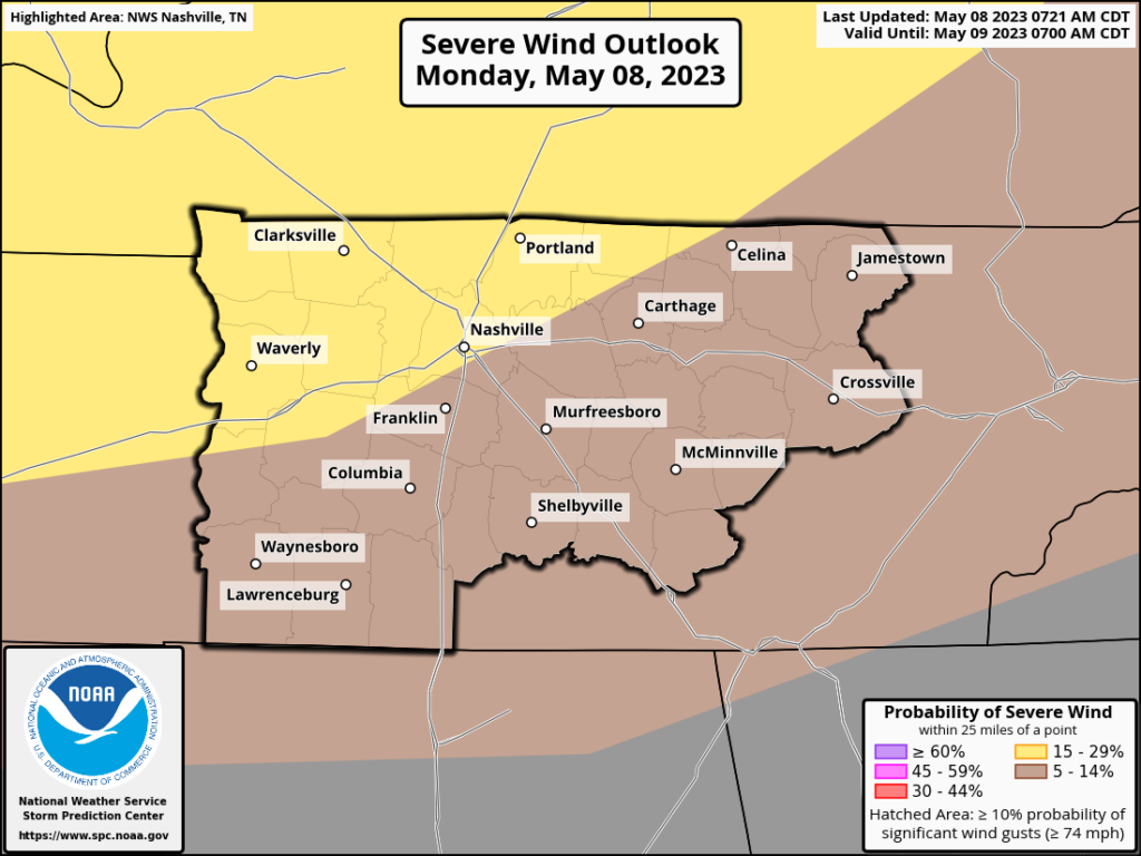
SPC has placed those basically north of I-40 in a 15% chance of seeing damaging winds within 25 miles of you. Lower chances S of I-40.
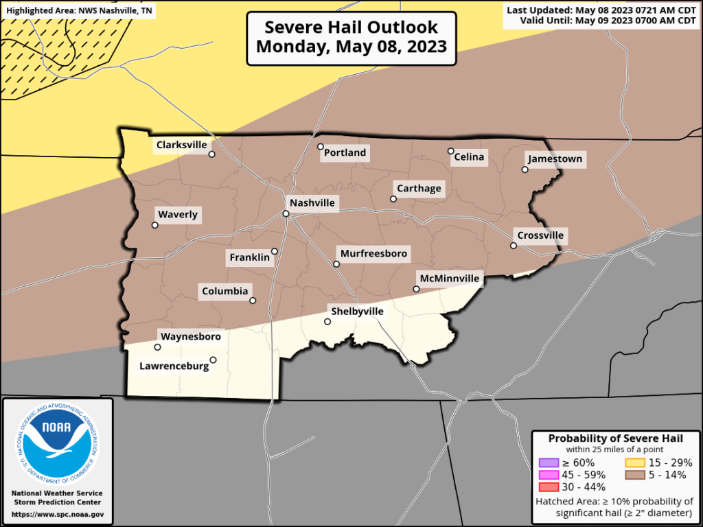
And a 5% of large hail…quarter size or larger within 25 miles of you.
No tornado concerns.
Tuesday and Beyond
The overnight storms should clear out early in the day, leaving a decent couple of days to dry out. Next wave of unsettled weather comes Thursday through the weekend. It’s springtime after all….and our rainiest month of the year on average.
Quick References:
Weather changes constantly.
Follow @NashSevereWx on Twitter for any changes to this forecast.
Live coverage during tornado and severe thunderstorm warnings:

Look good.
Support the mission.

We are 100% community supported. No ads. No subscription fees. Keep it free for everyone.


Categories: Forecast Blogs (Legacy)
You must be logged in to post a comment.