
It has been a wet, damp, moist, whatever word you want to use to describe this morning, and it is only going to continue throughout the day.
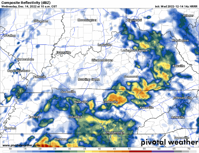
The HRRR model (above) shows on/off rain really all day, before the rain finally pushes east of us at around 11pm, give or take an hour or so.
- Additional rainfall amounts of 1-1.5″ are possible, some locally higher amounts are possible
- Flash flooding concern is greatest for areas to our south, but it is still possible, especially in our usual, vulnerable spots
- You may hear some thunder today, but no severe weather is expected
- Winds today may gust up to 20-30mph, may want to tie down those Christmas decorations
Post-cold front conditions will be dry and cold throughout the rest of the week and into early next week.
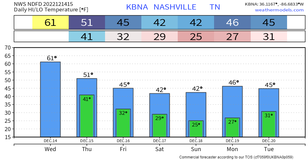
High temperatures will struggle to make it past 40° and lows will drop below freezing most nights. These cold temperatures look to continue into Christmas, making it really feel like Xmas. And yes, there is still no accumulating snow in the forecast, we’re watching it though. Next chance of precipitation looks to be middle of next week.
Quick References:
Weather changes constantly.
Follow @NashSevereWx on Twitter for any changes to this forecast.
Live coverage during tornado and severe thunderstorm warnings.

Look good.
Support the mission.

We are 100% community supported. No ads. No subscription fees. Keep it free for everyone.


Categories: Forecast Blogs (Legacy)
You must be logged in to post a comment.