
Threat of severe weather is low all-around for our area. Best chance east of I-65.
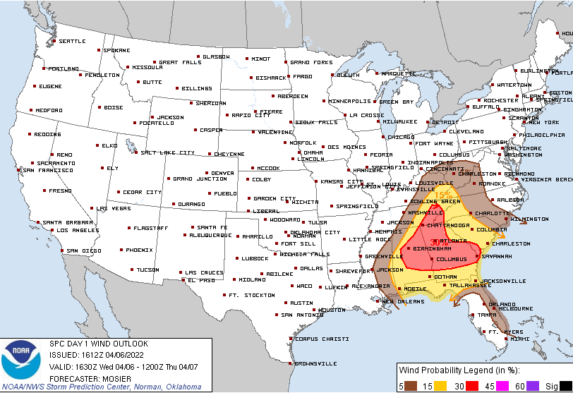
Latest SPC outlooks reflect the downward trend in severe probabilities. No more tornado/hail outlook, just wind (and barely)… 5% probability of damaging thunderstorm winds within 25 miles of you:
Timing of any storms that materialize comes after lunchtime into early afternoon:
It’s looking less and less likely we’ll see any severe storms. Though most ingredients are in place, CAPE and shear are on the up and up. There’s just no means of lift to fire up storms. Think of it like you’re a college student on the weekend… study or sleep in? Atmosphere’s on the fence right now. Leaning towards going back to bed for another hour or two.
What will we see if not storms? Just scattered showers. Very little rain for most, if any.
We’ll be keeping our eyes on any storms trying to fire up. Have a plan in case they do. Know where you are on a map if watches/warnings are issued. Damaging straight-line winds are the main concern. So have a place in mind to take cover if caught outdoors. More updates in the coming hours.
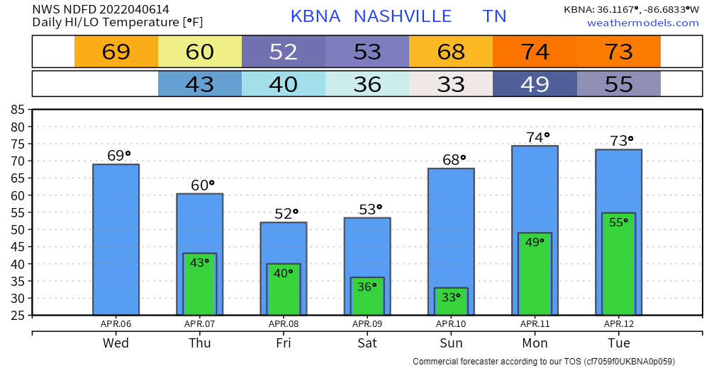
Frost/Freeze Saturday Night, Early Sunday AM
Lows early Sunday morning still look to be in the low 30s. If you have plants outside, think ahead on your plan to protect them before you head to bed Saturday night.
Quick References:
Weather changes constantly.
Follow @NashSevereWx on Twitter for any changes to this forecast.
Live coverage during tornado and severe thunderstorm warnings:
Look good.
Support the mission.
We are 100% community supported. No ads. No subscription fees. Keep it free for everyone.
Categories: Forecast Blogs (Legacy)
You must be logged in to post a comment.