
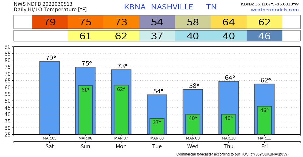
Today is nearly a repeat of yesterday. High temps will be somewhere in the upper 70’s. BTW, record high temp for BNA today is 80°, we’ll see if we make it there. It’ll be windy today, with a wind coming from the south at around 15-20mph, with gusts up to 30mph. You may see a shower tonight around the midnight hour, won’t be anything consequential.
Sunday is where the weather begins to pick up.
You may wake up to some showers on your way to Sunday church or brunch.
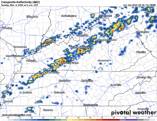
These will continue throughout the day, you may even see a storm or two. Storms should stay below severe limits (the reason: low, unidirectional shear), but would not be shocked to see some lightning with some of these. These showers/storms should lift north sometime around or after dinner.
The HRRR model has been showing some very heavy rain areas but at the moment that risk appears to be north of us. Still think we’ll get a few downpours (NW more likely, SE less likely) but a flash flood event is unlikely.
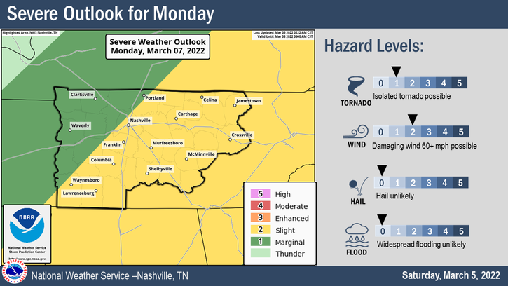
Possible Severe Weather Monday
We have been outlooked by the Storm Prediction Center with a 15% risk of severe weather on Monday. The NWS-Nashville has made the below graphic to take a deeper look into the specific risks. Damaging straight line winds will be the main threat, followed by the chance of a tornado or two. Hail and flooding are not expected.
The below run of the NAM 3k model shows this line of storms arriving around 10 or 11am. ETA is not set in stone and will most likely change some. Be sure Monday to have access to reliable information and access to sufficient shelter Monday. The early ETA is better because earlier arrival = less time for the atmosphere to set up to support severe storms.
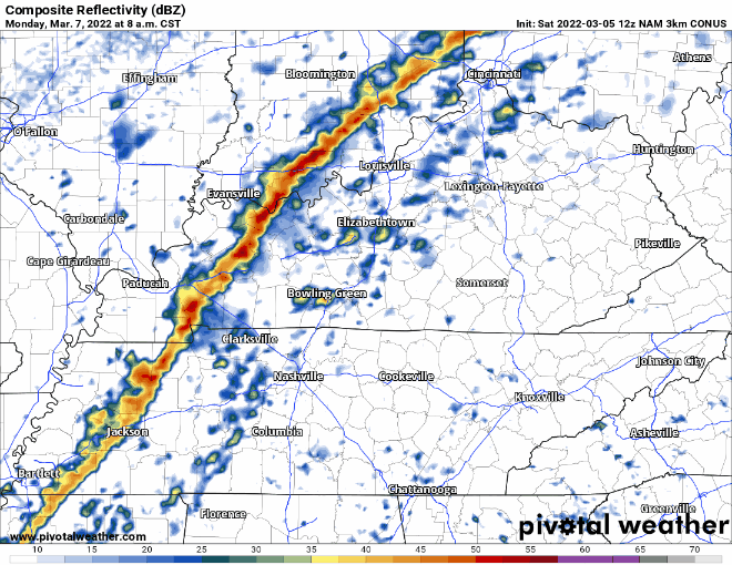
At the time the storms arrive, this model shows very little CAPE (storm fuel). An encouraging sign, but that might change if the line delays and gets here mid/late Monday afternoon. The HRRR (a model that isn’t perfect, but it’s nice to get the opinion of) isn’t even in range yet for this event.
So stay connected for changes. It’s storm season so you need to have your plan for severe weather ready, even if this line comes through without much happening.
Whatever time the line arrives, it will move through quickly, followed by some showers, clearing out by Monday evening. After the line moves through, temps will quickly drop to the 40’s. Gross.
Rest of the Week
Tuesday looks dry. Another chance of rain maybe Wednesday and Friday. Temperatures during the week will be a lot more average for this time of the year. Models hint at sub-freezing temps next Saturday, super far away, but something to consider.

Quick References:
Weather changes constantly.
Follow @NashSevereWx on Twitter for any changes to this forecast.
Live coverage during tornado and severe thunderstorm warnings:
Look good.
Support the mission.
We are 100% community supported. No ads. No subscription fees. Keep it free for everyone.
Categories: Forecast Blogs (Legacy)
You must be logged in to post a comment.