
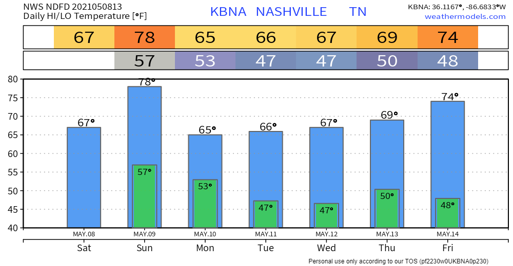
A light rain shower may pass by tonight. If you’re one of the few who get one, do not worry about a rain out. Any shower will be brief. No lightning, either. The Nashville SC and Vandy games look good.
Mother’s Day looks rainy and stormy.
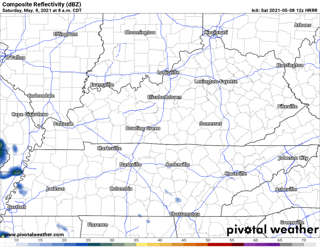
At least the morning should be OK. Pretty windy tho. Gusting almost to 30 MPH.

Two waves of rain and storms expected Sunday. One around lunch:
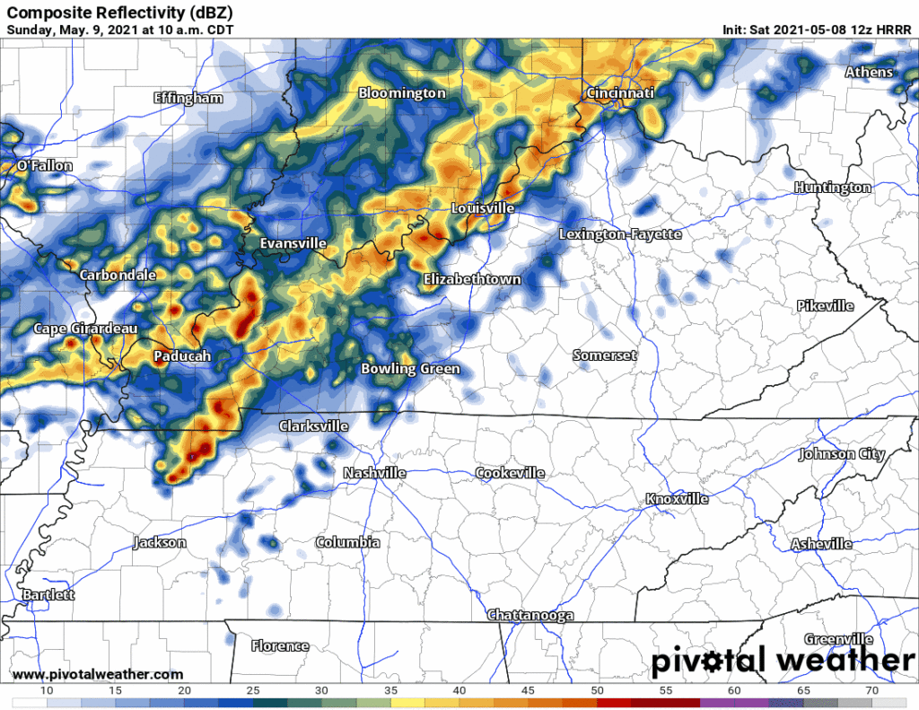
This one looks like rain, maybe a lightning threat. Not much else.
Stronger storms are expected late in the afternoon and into the evening.
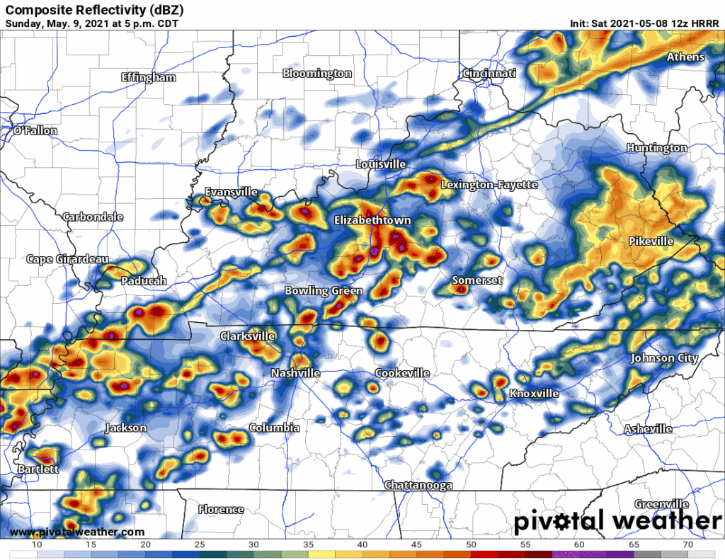
Lightning is likely.
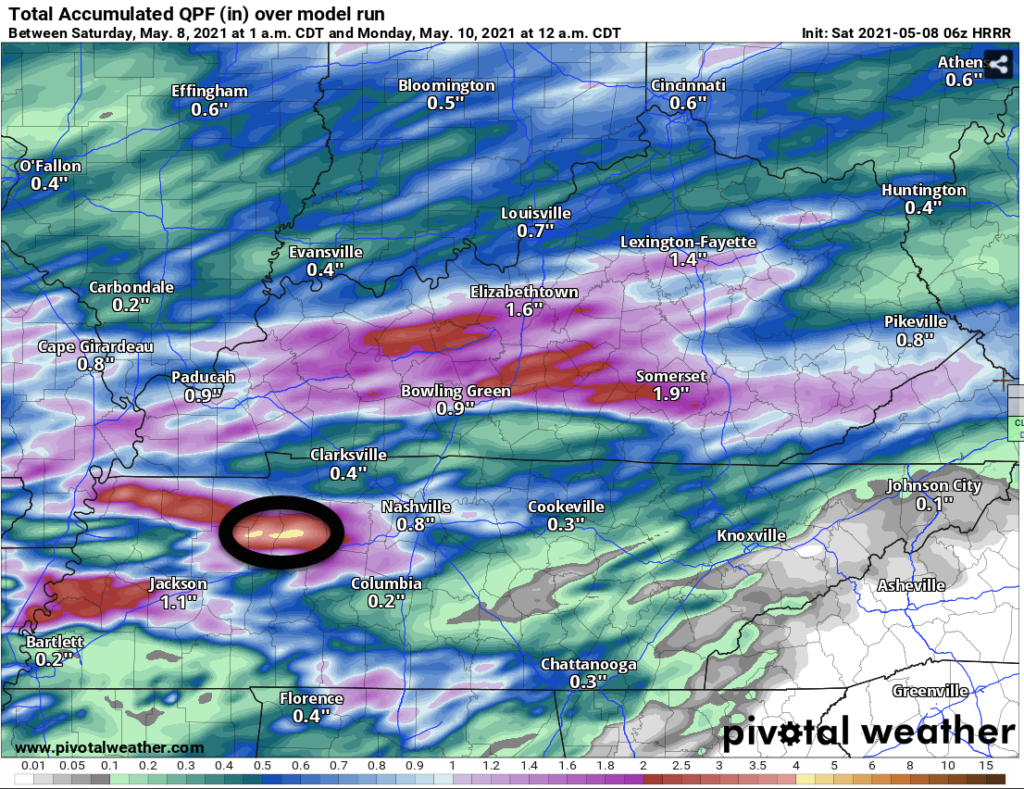
Downpours may be heavy enough for localized/isolated minor flooding in low lying, flood prone areas — but this doesn’t look like a big deal. Total rainfall under 1″ on average; we usually need twice that much to introduce flash flood concerns. I’m not totally unconcerned, though, because the HRRR model has a flash-flood-capable area of rain to our west and I think it’s too soon to say that can’t creep into our counties.
So something we need to watch, but not worry about right now.
Damaging straight line winds are the main concern, probability within 25 miles of you 5%. SPC Day 2 Outlook.
Small hail, maybe, but the SPC Day 2 outlook as us outside its 5% probability.
Tornadoes are also possible but at the moment that appears unlikely, especially if the lunchtime rain lasts long enough and consumes available instability. Tornadomaking shear will be plentiful but relatively low surface based instability and another near-surface temperature inversion will reduce and all but eliminate tornado concerns. SPC thinks the probability of a tornado within 25 miles of us Sunday is 2%.
Stay connected for changes to this forecast.
Models are still trying to figure our whether it’ll rain Wed-Thu. NWS-Nashville says the models are trending drier. Much cooler, too.
May is statistically our wettest month. So far it’s been pretty quiet.
Categories: Forecast Blogs (Legacy)
You must be logged in to post a comment.