
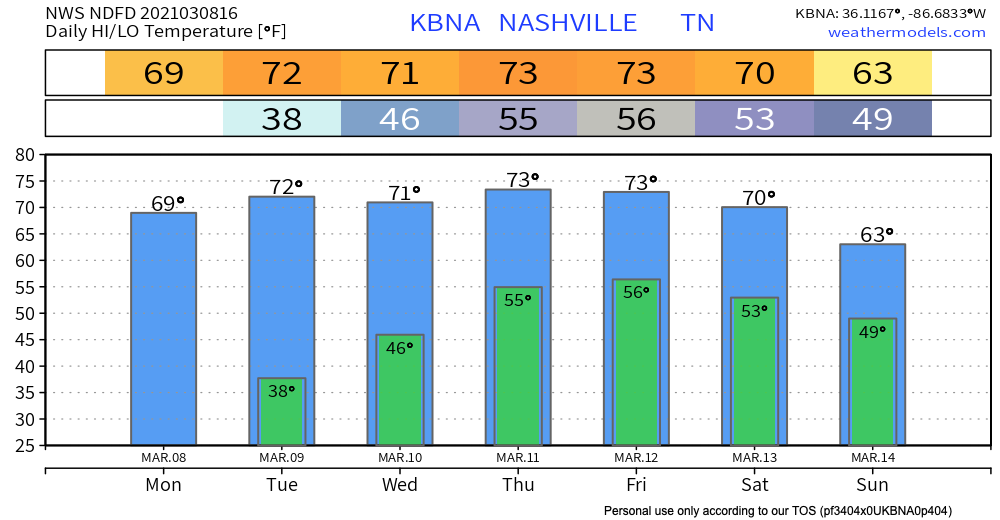

A Quiet Start to the Week
Enjoy the sunshine while it lasts…

High pressure remains in store for us through most of the work week and spring-like temperatures will continue for Nashville sitting at or above 70 degrees for most of the week!

Rain Chance Friday through Monday
The high pressure system sitting over us this week will eventually shift eastward into the Atlantic allowing a frontal boundary to ease into Middle Tennessee by Friday into Saturday.
Here’s what we’re looking like for Thursday afternoon into early Friday morning from the EURO. You can clearly define this boundary moving in from the northwest. We’ll se if it stays near the Kentucky border, or if it comes closer to us.
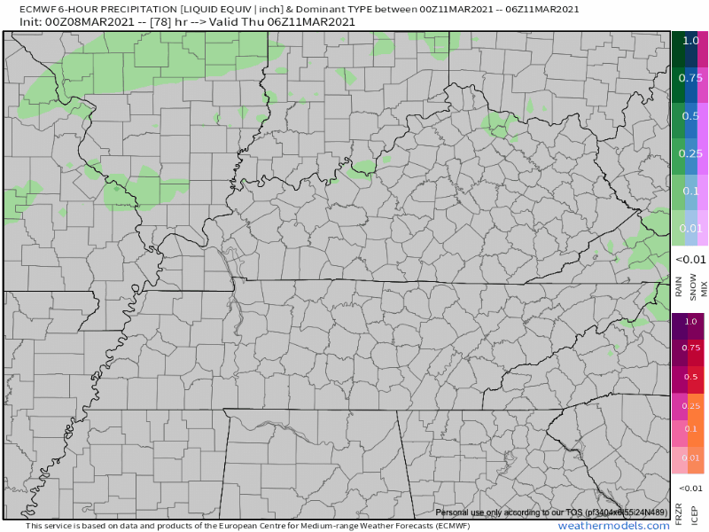
Some spotty showers expected late Thursday night into Friday afternoon. Timing of showers will become more clear as we get closer.
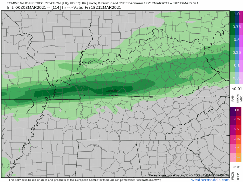
The heaviest rain looks to move through Saturday morning as this boundary drops across Middle Tennessee and continually slides south of us, but that will likely change in future model runs.
Wet weather looks to continue into early next week as a more pronounced system looks to come through.
Although that is past our 7-day outlook, we will monitor this within the upcoming days.
But for now…
Get out and enjoy the sunshine and warm air while it lasts! Clouds swing in Thursday night and we won’t see much sun for a few days.

As always, check back for updates to the forecast, and be sure to follow @NashSevereWx on Twitter!
Categories: Forecast Blogs (Legacy)
You must be logged in to post a comment.