
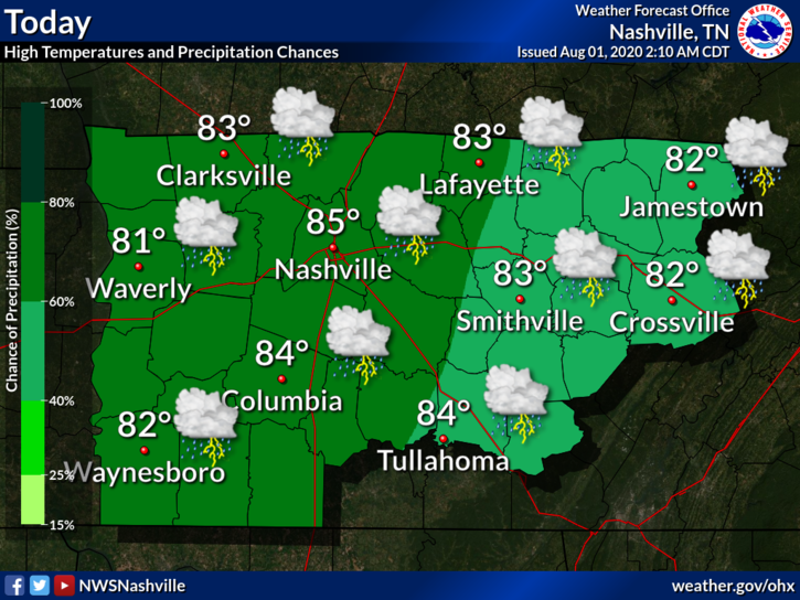
Saturday
Some areas have already gotten wet today and scattered showers and storms will continue throughout the afternoon and evening hours as a cold front moves through the area. They should be heading out before midnight.
There’s no guarantee on where rain will fall, so some people will get wet while others stay dry.
There’s currently no severe weather in the forecast so the main threat with any storms that pop up could be some locally heavy rain.
With the mix of rain and the cold front, temps should continue to stay in the lower 80s and even possibly upper 70s. Dew points will begin to fall into the mid to upper 60s, making the evening hours feel pleasant outside.
If you have any evening plans, keep an eye on that radar for those pop up showers and storms!
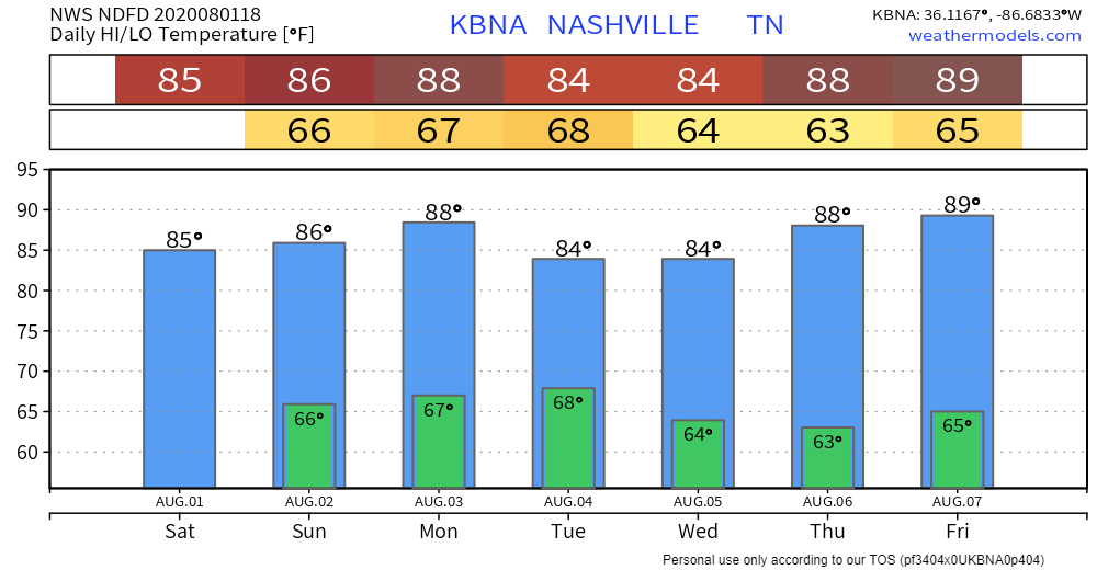
Cooler Temps Ahead
That’s what we’ll be looking at after Sunday!

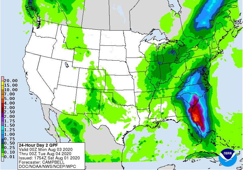
Monday will be our next chance at some rain, but it’s not looking like a washout. According to the Weather Prediction Center, anywhere from a tenth of an inch to a quarter of an inch is possible. There could be some locally higher rain totals.
The rest of the work week looks great!
Dew points are looking to stay in the mid to upper 60s. It will still feel sticky outside, but a lot better than it has been.
Highs should stay around the mid 80s, but will gradually climb as the week goes on.
Categories: Forecast Blogs (Legacy)
You must be logged in to post a comment.