
We’re slowly peeling away the drizzle, fog, and clouds this morning. Rain lingered overnight, but it’s now finally southeast. 0.40″ fell in the official can at BNA.
Today should be pretty nice, high 57°.
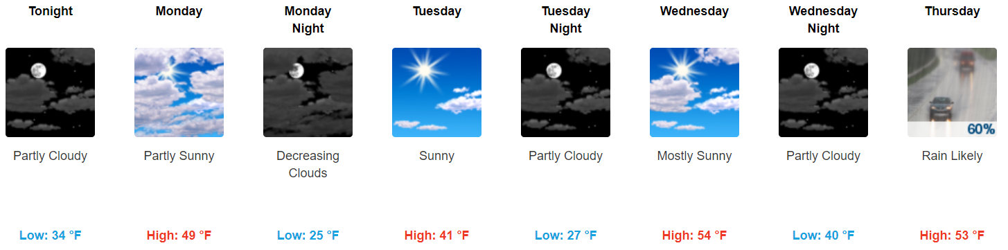
Quick Monday Dusting?
At first glance, the forecast through Wednesday looks uneventful, with clouds decreasing Monday.
As usual the crap app forecast tells the main story, not the whole story for Monday.
A shortwave is seen on recent model runs digging further south, and closer to us. Right now we think this feature will be too dry to produce anything, and even if it could produce something, it would happen east of us. So we think we will get no rain and no snow Monday.
However….
…that’s the NAM3 model thinking we’ll squeeze out snowflakes late afternoon/early evening Monday. If this actually happens, very little/nothing should stick. This model thinks surface temps will be a few degrees above freezing as any snow falls. So, any snow would melt, there would be very little to no impacts, not a snowpocaylpse.
Also the NAM3 could be:

Both the GFS and Euro models think no snow Monday night.
Thursday-Friday Rain or Snow?
There will be plenty of precip arriving mid-day Thursday running into Friday morning. The question is: will it be rain or snow?
Models are continuing their dance around each other with differing solutions, and for this round [of model runs], both the GFS model and Euro model have trended a bit cooler.
That’s from the NWS-Nashville forecast discussion. The GFS and Euro models run a total of 6 times a day, 4 for the GFS and 2 for the Euro. Model accuracy at this range is poor. They’re useful for general ideas, but the predictions produced summarize conditions only in 6 hour blocks, and give us no good idea of how many inches of rain or snow we may see.
The Euro model has a better track record than the GFS. Both are useful tools; don’t discount either.
In general, however, two things have become clear:
1. The GFS model brings colder air into Middle Tennessee faster, and keeps it around longer. This would produce snowfall here just after midnight Thursday night, snowing Friday morning, possibly lasting into early Friday afternoon.
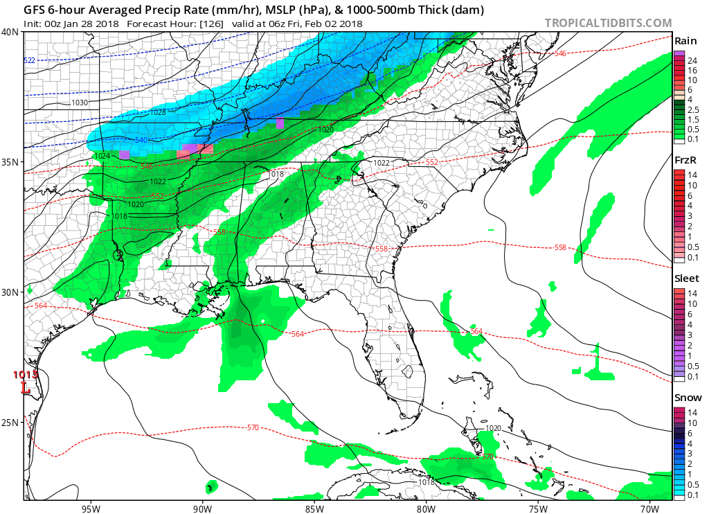
2. The Euro thinks we will transition to a wintry mix after midnight, with the colder, snowy air lagging far behind it. This would produce much less snow over a shorter amount of time.
Both models agree rain will fall, and at some point it will transition to wintry precip and/or snow; however, that may change. This may end up being an all-rain event, although, as quoted above, the models are running a bit colder (making wintry precip more likely).
It May Not Stick. We’ll have been in the mid-50°s Wednesday and Thursday afternoons, and the cold air coming in behind the rain will not be nearly as cold as the air from our 2″ to 3″ event last week. This should limit accumulation everywhere except on bridges and overpasses, and at elevation. We should quickly warm above freezing by mid-morning, rising to 38° Friday afternoon.
Stay connected for changes which I’m sure are coming.
Sled Index: “Not rushing out to replace the sled that broke during our last event.”
Super Bowl Sunday Night Snow Chance?
I’ll just leave this here, from NWS-Nashville:
Saturday looks to be dry before another round of precip moves in later on [Super Bowl] Sunday and into Monday. Model differences with this system are even larger than the Thursday-Friday system as the Euro model is very warm and has all rain for the mid state. The GFS model is quite colder and has the majority of the event as snow. Leaned a bit more towards the Euro model and kept things warmer for now late Sunday into Monday.


Categories: Forecast Blogs (Legacy)
You must be logged in to post a comment.