
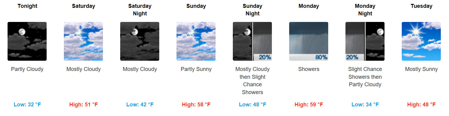
Sunny and Temperatures Well Above Freezing This Weekend!
Happy Friday, everyone. Southerly flow is returning to the area and will continue pumping in warmer air. Afternoon temperatures will peak in the mid 40s, dipping into the low 30s tonight.
Saturday will be a warmer repeat of today, with some additional clouds filtering in from the south. Sunday is a carbon-copy of Saturday, with temperatures climbing into the lower 60s!
Cold Front Brings Rain, Not Much Cold
GFS 6-Hour Precipitation Model – Monday
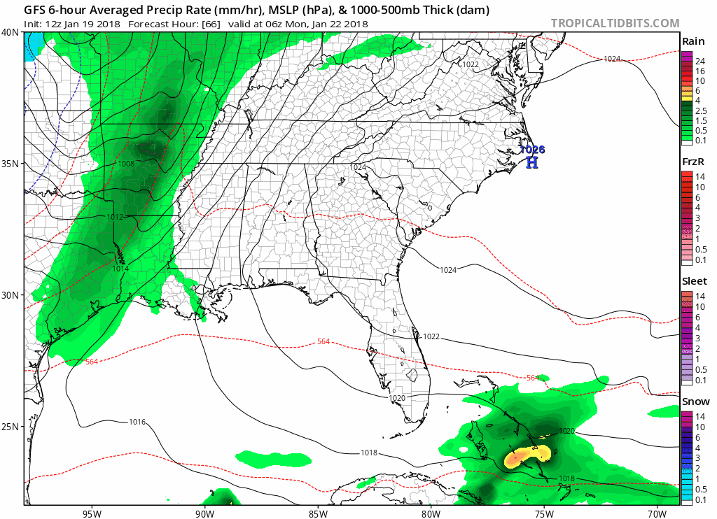
Showers and a thunderstorm or two will develop Monday morning and sweep across the mid-state during the day. No severe weather is expected, but the GFS is spitting out 0.15-0.30″ of total rainfall.
Temperatures will remain fairly steady through the week, in the upper 40s and lower 50s.
Another weather maker bringing rain and maybe a few storms will arrive next weekend, but between systems, we should be able to enjoy the warmer temperatures until then.

Categories: Forecast Blogs (Legacy)
You must be logged in to post a comment.