Current Radar
Tonight: Clearing Skies, Not As Cold – 9PM 51°

...AIR QUALITY ALERT IN EFFECT UNTIL MIDNIGHT CST TONIGHT...

THE TENNESSEE DEPARTMENT OF ENVIRONMENT AND CONSERVATION HAS ISSUED A
CODE ORANGE HEALTH ADVISORY FOR THE NASHVILLE AREA...IN EFFECT UNTIL
MIDNIGHT CST TONIGHT.

A CODE ORANGE AIR QUALITY ALERT FOR PARTICULATE MATTER HAS BEEN ISSUED.
GROUND LEVEL PARTICULATE MATTER CONCENTRATIONS WITHIN THE REGION MAY
APPROACH OR EXCEED UNHEALTHY STANDARDS. THE GENERAL PUBLIC IS NOT
LIKELY TO BE AFFECTED. ACTIVE CHILDREN AND ADULTS, AND PEOPLE WITH A
RESPIRATORY DISEASE SUCH AS ASTHMA, SHOULD LIMIT PROLONGED OUTDOOR
EXERTION. FOR ADDITIONAL INFORMATION...VISIT THE TENNESSEE DEPARTMENT
OF ENVIRONMENT AND CONSERVATION SITE AT
HTTP://WWW.TENNESSEE.GOV/ENVIRONMENT.
Due in part to westerly-southwesterly winds overnight, temperatures won’t drop as low as we’ve recently experienced. Expect to be in the mid and lower 50s if you’re headed outdoors this evening, so it’s probably still jacket-worthy.

Wednesday: Warmer, Mostly Sunny – Wake Up 42° High 72°
South-southeasterly winds will slowly advect (move) warmer air into our region. Temperatures on Wednesday will be 7-10° above normal, with this “above normal” trend continuing into the latter portion of this week.
With a slight easterly component to the winds on Wednesday, we’ll be keeping an eye on wildfire smoke once again. At this time, it appears most will remain to the east of us.

Extended Forecast:
Whoa! Thursday is going to feel like spring again! This is definitely the pick day of the week, based on warm temperatures and clear skies. Friday brings a noticeable increase in southerly flow and gusty winds…as high as 25-30 mph. What does this mean?
Typically in middle TN, when you have very warm air and gusty southerly winds, something is about to change. You would be right.

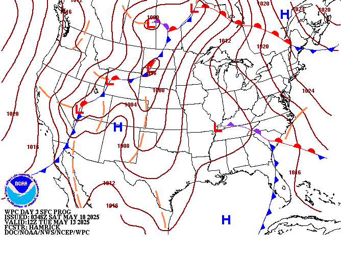
A strong cold front will be incoming, and we expect some associated shower and thunderstorm development. These storms don’t appear to have enough instability to work with to forecast any severe weather right now; however, this idea *could* change and if it does, we will let you know here on NashSevereWx.com.
Following the cold front passage, Saturday will be about 20 degrees cooler for afternoon high temps.

In short, lots of changes are coming in the extended period. Stay up-to-date right here and on Twitter @NashSevereWx!
This website supplements @NashSevereWx on Twitter, which you can find here.
Categories: Forecast Blogs (Legacy)


You must be logged in to post a comment.