
Current Official Hourly Observation (taken at :53 on the hour)

Current Radar Loops
![]()

Temp & Rain Probabilities Next 36 Hours (auto-updating)
Tonight – Partly Cloudy — 64 at 10 PM
The air is very dry and the winds are strong. We are under a Red Flag Warning until 7 pm. Any outdoor fires are likely to rapidly spread out of control.
Don’t be these guys:
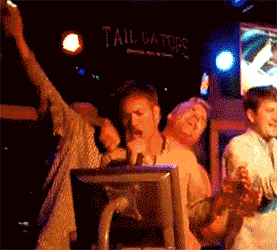
ProTip: Burning after 7 PM tonight — also a bad idea.
Our Wind Advisory remains in effect until 7 pm. Gusts as high as 30 mph are possible. After 7 PM it will still be breezy, with winds up to 20 mph possible.

Friday – Increasing Clouds; Small Chance of Rain – Wake Up 53 / Afternoon High 75
A weak cold front will push towards us from the north. It has very limited moisture to work with and will struggle to produce any meaningful rain for us. I do not think we will have rain out problems for Saturday’s games.
There is a chance that these showers could overachieve with a heavier isolated thunderstorm, but I doubt it.
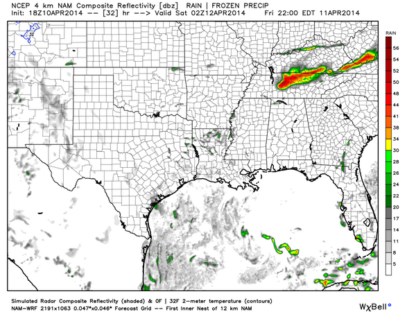
Ahem! However…the Hi-Res NAM thinks it’ll rain tomorrow night at 9 PM:
Saturday – Partly Sunny – Wake Up 54 / Afternoon High 80
Beautiful Spring Day! 80s!!! Get out there and enjoy it!
Official Extended NWS Forecast:

Rain/Thunderstorms Monday PM; Colder Temps Rest of Work Week
GFS model Monday 1 am – Tuesday 1 pm:

Climate Prediction Center gives us a 50% chance of seeing below average temps April 16 – 20:

This website supplements info @NashSevereWx on Twitter.
Categories: Forecast Blogs (Legacy)
You must be logged in to post a comment.