Current Official Hourly Observation (taken at :53 on the hour)

Temps Next 24 Hours (auto-updating)
Current Radar Loop

It’s Severe Weather Awareness Week across the State of Tennessee. The NWS picked the right week — there’s a chance of severe weather Thursday.
Tonight – Chilly; Increasing Clouds
Clouds will increase tonight. It’s going to rain tomorrow.
Monday – Rain – Morning Low 31 / Afternoon High 58
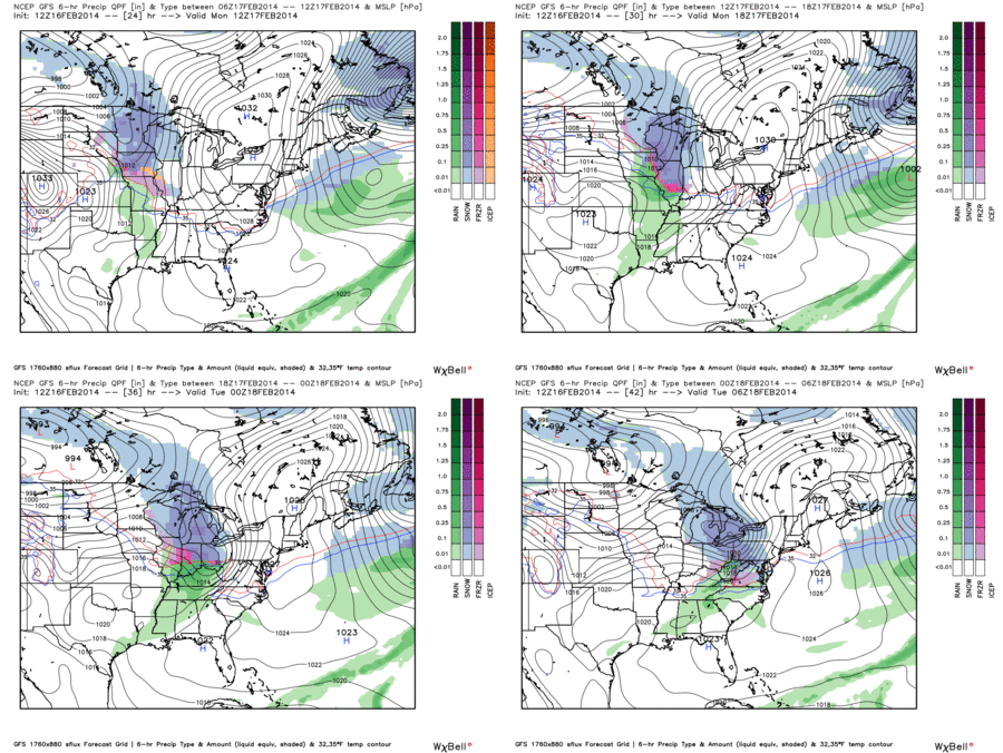
Rain will be slow, steady, and relatively light. It should begin by late morning, and continue through the evening rush hour. About 0.17″ of rain is expected. We can’t rule out a thunderstorm, but we aren’t expecting one, either.
GFS model Monday 6 am – Midnight:

Tuesday – Sunny & Warm! – Morning Low 34 / Afternoon High 69
Such a beautiful day! Get outside and do something!!!!! We may even make it to 70!

Official extended NWS Forecast:
Severe Weather Possible Thursday – Friday AM
The SPC (Storm Prediction Center) has included us in its “Day 5” outlook. They say there is a 30%+ chance for severe weather happening within 25 miles of us:
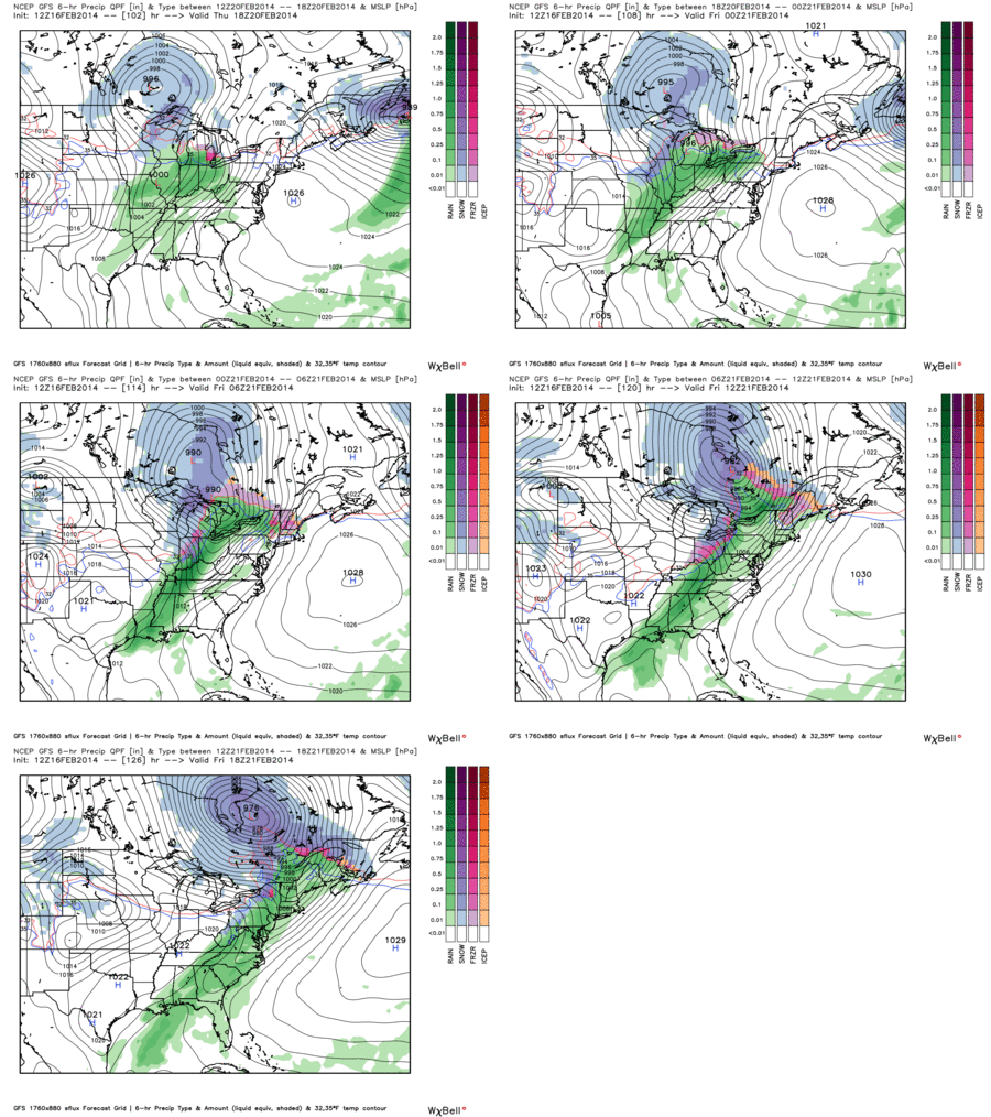
This timing may change, but right now we think storms will arrive as early as late afternoon Thursday, and as late as the wee hours of Friday morning. We’re still too far away to nail down the time frame.
Our main concern at this time is damaging winds with these storms. We can’t get a warm-up like this for almost a week in February and expect we won’t see severe weather.
GFS model Thursday Noon – Friday Noon:

The outlook area may shift tomorrow, which is when the next SPC Outlook is due. We’ll update you then.
Additional information can be found on Twitter @NashSevereWx.
Categories: Forecast Blogs (Legacy)


You must be logged in to post a comment.