Today – High 88
For the first full day of summer, it hasn’t been so bad regarding temps or humidity.
(Editor’s Note: Humidity levels decreased this morning. Nice morning on the bicycle).
A weak outflow boundary came through the area earlier, giving us all a slight gust of wind. This is should limit our chances for afternoon thunderstorms, although a few rain showers have defiantly sprouted. None of the models are picking up on any meaningful rain for us until tomorrow. Tonight looks to be a little warmer than the last few nights with lows in the 70s.
Sunday – High 92; Pop up Thunderstorms
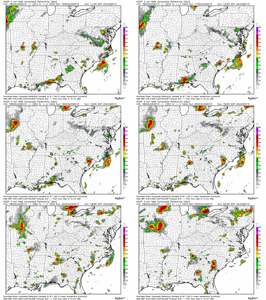
Dew points begin to rise a bit more into the upper 60s, giving the area a slight better chance for thunderstorms. All the models have afternoon thunderstorms in the Middle Tennessee area; but we can’t say whether we’ll see any. Here is how the Hi-Res NAM model plays things out.
Sunday 10 AM – Sunday 7 PM (one frame an hour):

Super Moon details!

Monday – High 93; Slightly Better Chance of Thunderstorms
Another slightly warmer morning: 70 is forecast. Afternoon showers and thunderstorms will be possible. Our NWS gives us a 30% chance for pop up thunderstorms, instead of the 20% we have seen the past week.
Any pop-up storms could produce, according to the NWS, “gusty winds to 50 mph… small hail… frequent lightning… and brief torrential rainfall will be possible with the strongest storms.”
Categories: Forecast Blogs (Legacy)
