Search Results for:
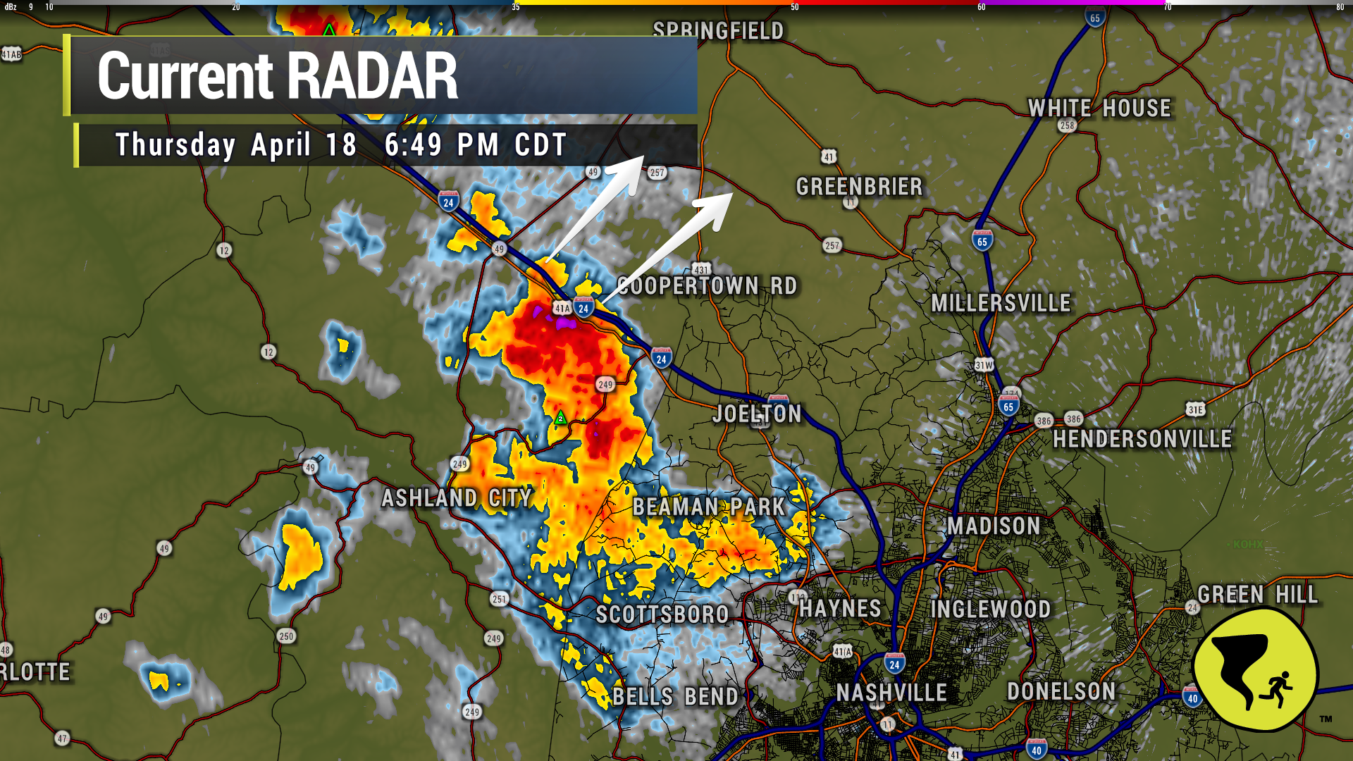
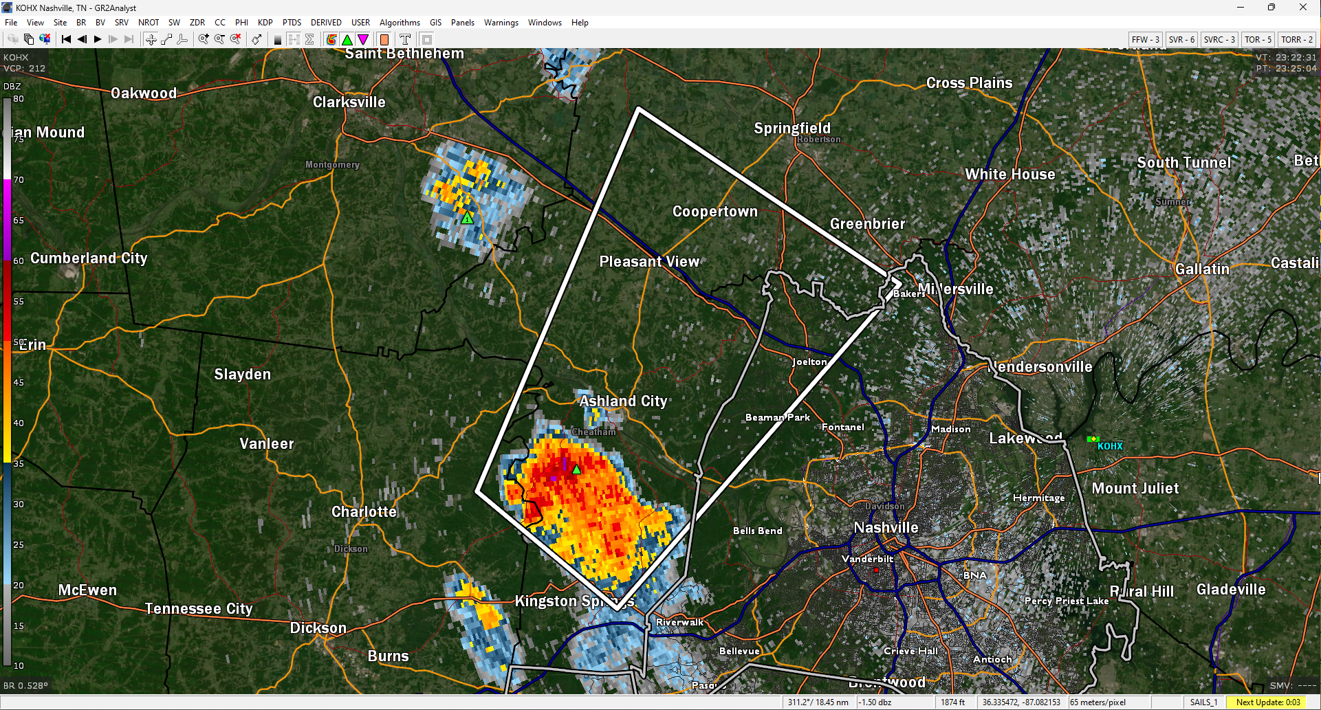
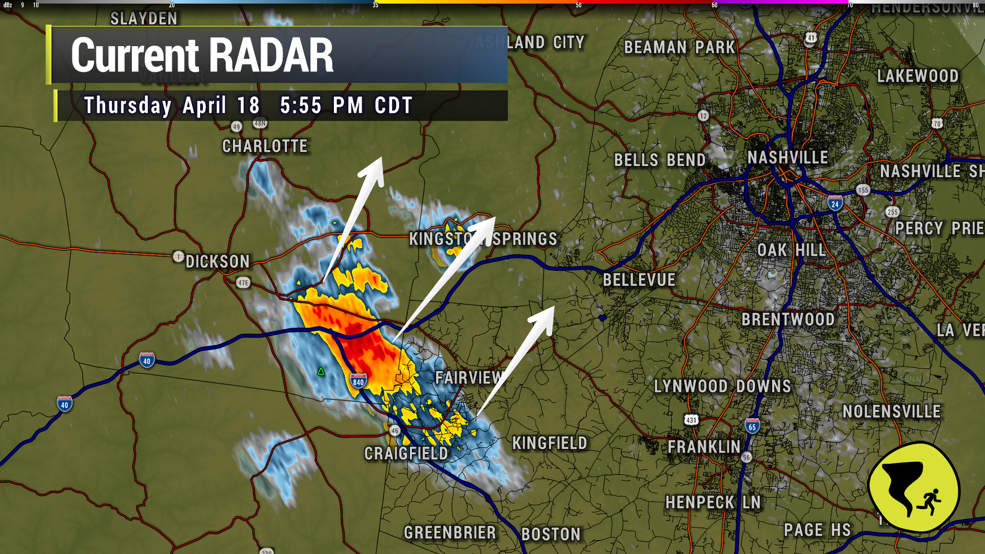
The winds aloft are trying to push this storm into Nashville, but there’s a carrot on a stick pulling the horse’s head toward the left as it follows a good lift source just ahead of the storm. So…the strongest part of the storm will stay near that lift source and tend to be on the north side. Should miss downtown Nashville. Might even miss Joelton. We’ll see. Lightning still an issue with this storm. 6:18 pm
Low End Threat of Severe Weather This Evening and Tonight, Cooler Temps This Weekend.
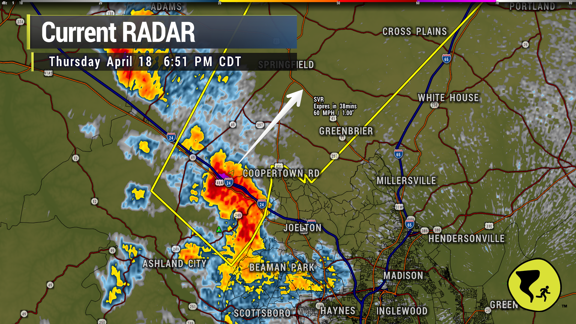
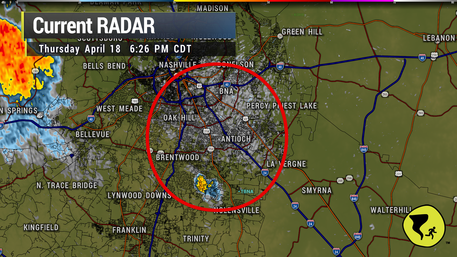
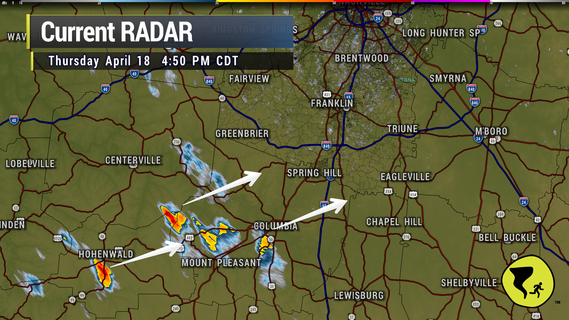
A couple of storms have popped up to our southwest as expected and will continue to throughout the evening. These storms could contain heavy rain, lightning, gusty winds and small hail.
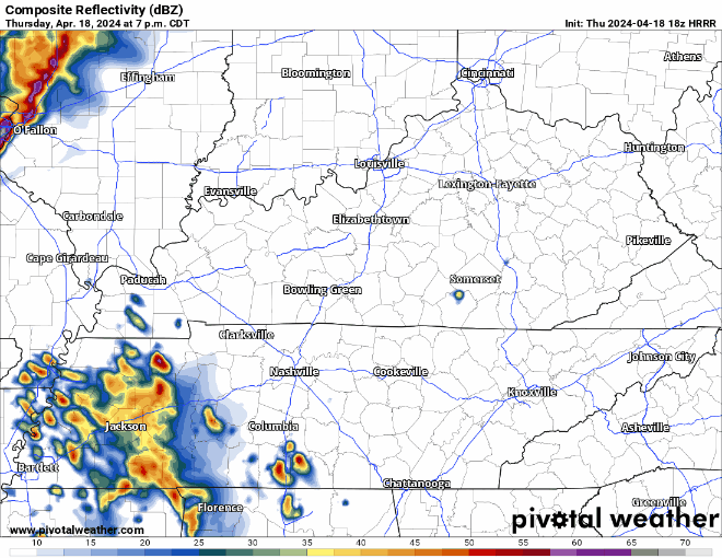
The HRRR model above advertises those evening storms coming from the SW, and then a line of weakening showers/storms coming thru in the early hours of Friday morning. Model guidance has been pretty consistent with thinking this line weakens a lot before it arrives, but still could contain some strong winds, small hail, and lightning. The tornado threat is very low, but it isn’t zero.
NWS: “We continue to expect a few instances of localized gusty winds and marginal severe hail with the early evening scattered storms. Later storms coming in from the west northwest after 10 PM will have better shear, so gusty winds and maybe a QLCS spinup tornado cannot be ruled out as the storms approach. But the late storms will weaken considerably as they push into our area and especially toward I-65.”