Storms Possible This Evening, Heat Advisory for Sunday

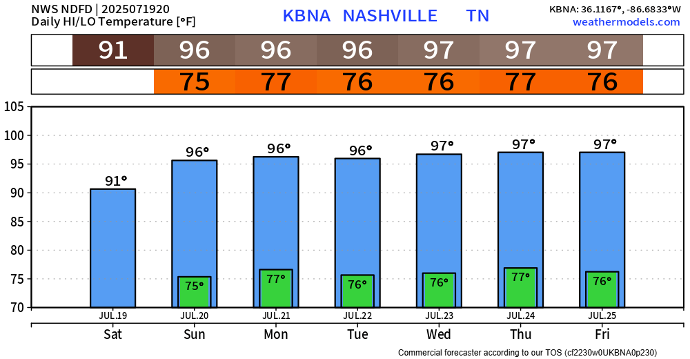
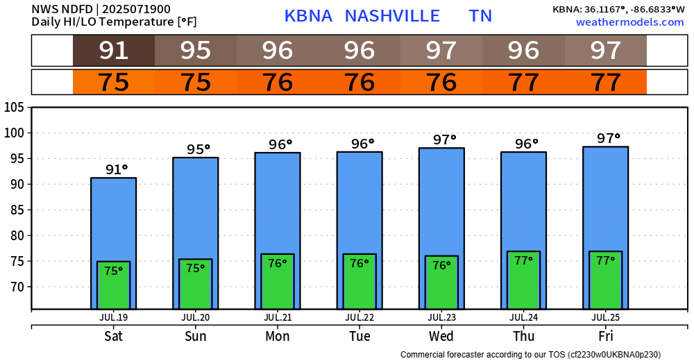
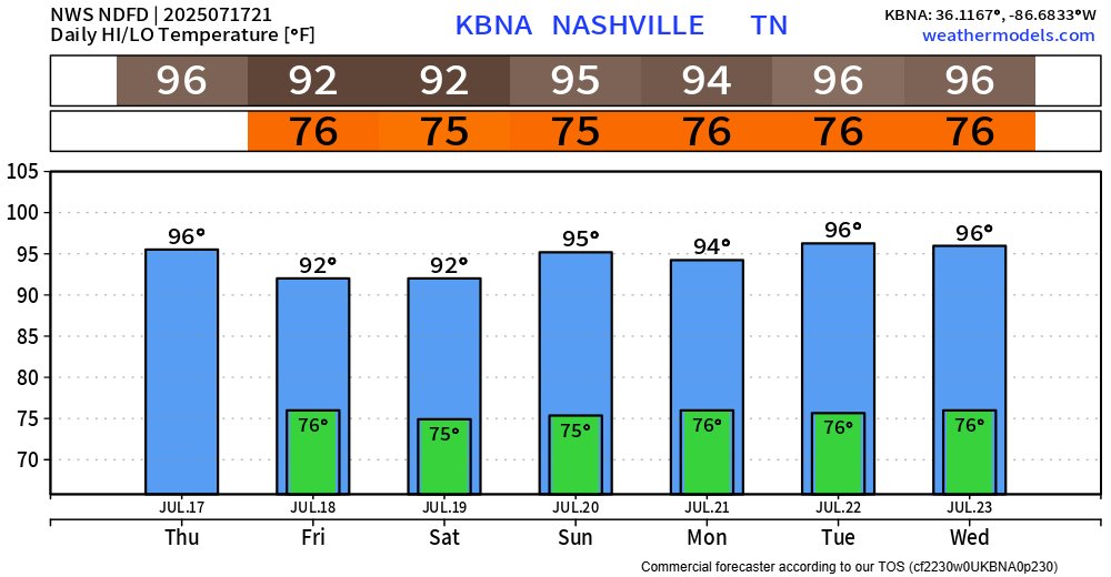
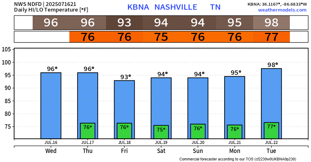
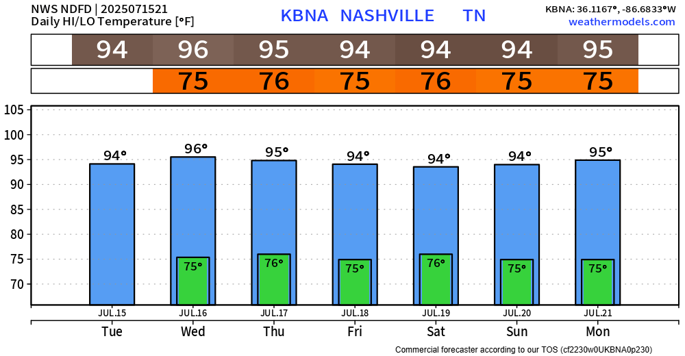
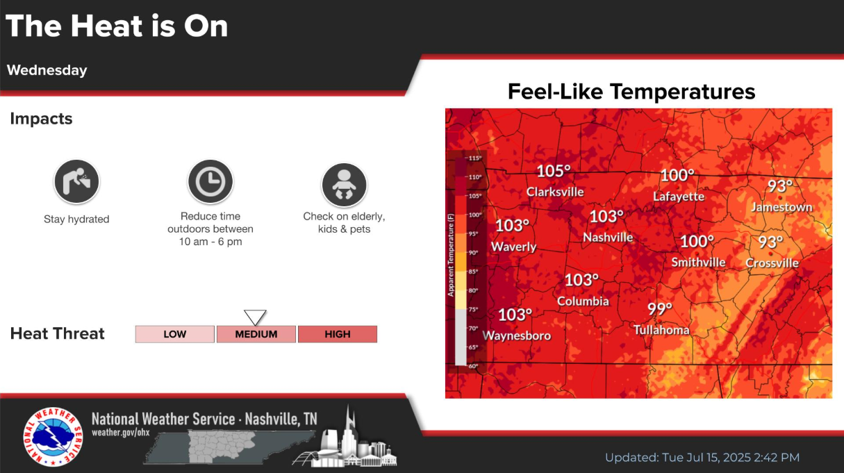
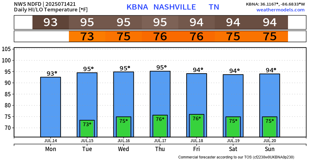
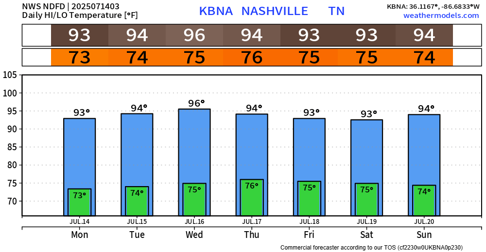
At the time of writing (4:30p), we are currently watching a line of storms that’s in KY and slowly moving south. It’s unknown if this will make it all the way here – but it’s something worth watching. Any severe threat is very low, and the main concern will be the potential for isolated flooding (especially those that saw heavy rain yesterday), frequent lightning and gusty winds. read more

Heat Index Values Near 105°, Chance of Rain Daily

The main highlight of the upcoming forecast will be the heat.

The graphic below from NWS Nashville is valid for Wednesday but can really be applied to most days this week.

Our high temps will stay fairly consist in the mid 90s, while our dewpoints creep up into the mid 70s. This is a gross combo and will send our heat index values (“feels like”) near 105°. This is right around the criteria for a Heat Advisory, so while none are currently out for us – I wouldn’t be shocked if we saw one a day or two. read more

Hot with Wattery Chances on Repeat

Last week’s weather continues on into the new week.

Low to medium chances for showers & storms continue daily, with chances being highest from midday thru early evening.

Some days you may see no rain, others you may see a little too much rain – like those near Hermitage today. Isolated flooding continues to be our main threat, along with frequent lightning and gusty winds. If you encounter a flooded roadway – turn around, don’t drown. read more