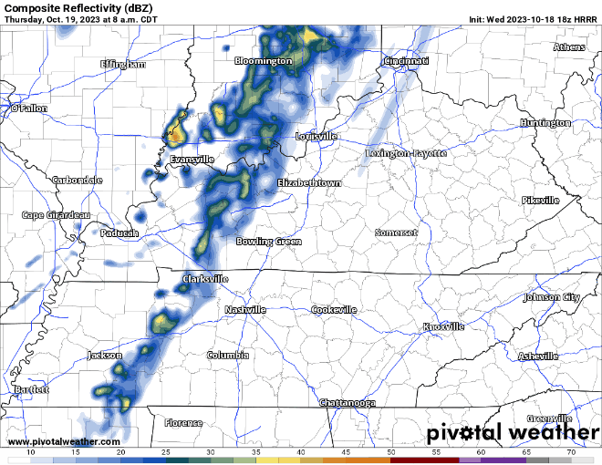
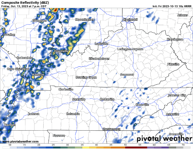
Some of us have seen heavier storms today, some of us haven’t seen much at all. Some more showers/storms will continue to move thru for the next couple hours. You can always check the radar here: Radar – Nashville Severe Weather

Some of us have seen heavier storms today, some of us haven’t seen much at all. Some more showers/storms will continue to move thru for the next couple hours. You can always check the radar here: Radar – Nashville Severe Weather
Another beautiful day today, unfortunately the same cannot be said about tomorrow.
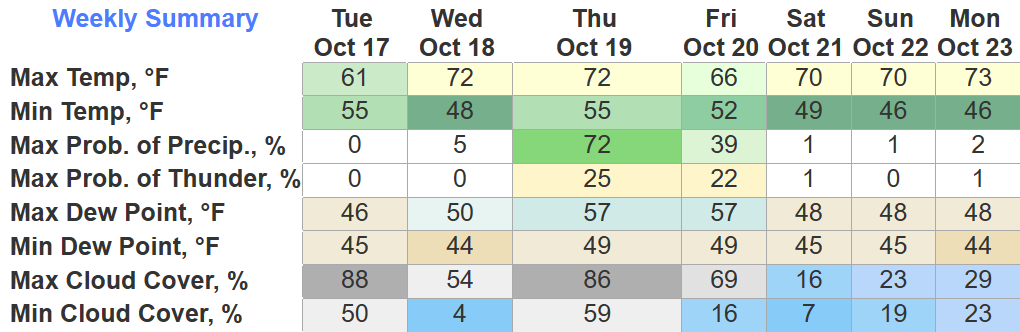
Looks like there will be two lines of showers. First one looks to arrive around mid-morning – just some light showers.
The clouds are finally moving out; thus allowing us to cool down and wake up to a chilly morning. Tomorrow will be a bit warmer thanks to the big yellow light in the sky showing out.
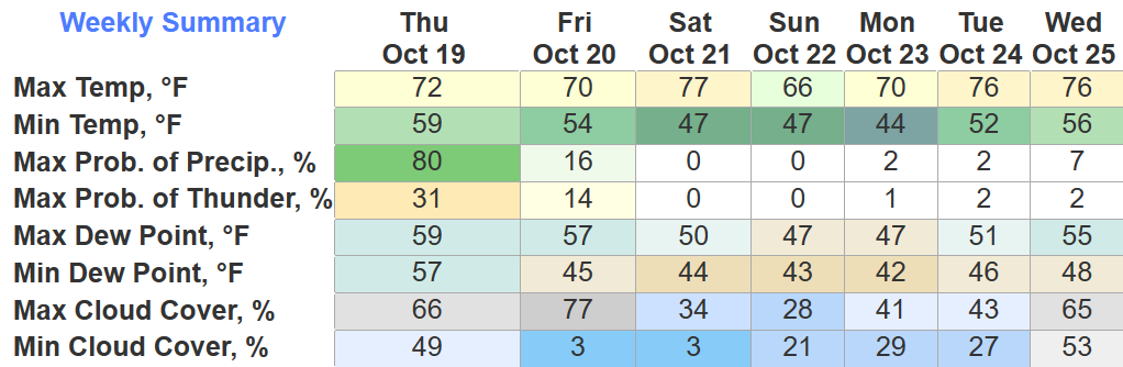
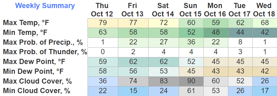
Rain chances pick back up Thursday, models show most of the rain during the back half of the day, but we’ll have to wait and see for specifics.
Drizzle is moving out, and the clouds will finally break around midday tomorrow; this will allow temps to get up into the mid 60s.
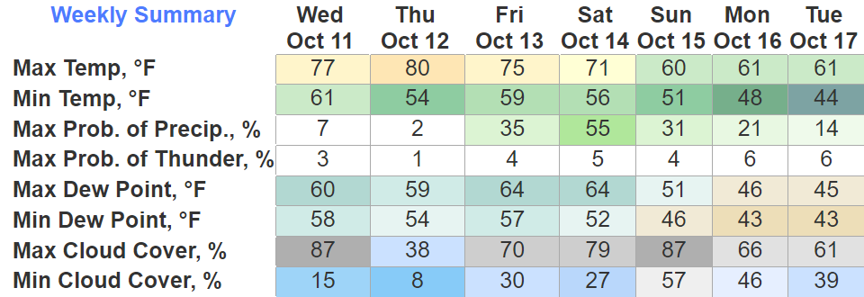
Temps continue to climb into the 70s Wednesday and Thursday, but this will also come with some decent rain chances.
Very dreary, drizzly day. Hey fall.
Very similar conditions Monday, cool temps, on/off drizzle. Drizzle chances dimmish Tuesday.
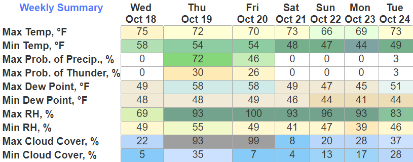
We see the 70s come back Wednesday and Thursday. Rain chances come back around Thursday night into Friday. Should clear out before your Friday night activities, but too far to know fo sho.
Some cloud cover moving thru may partially block your viewing of the partial eclipse.
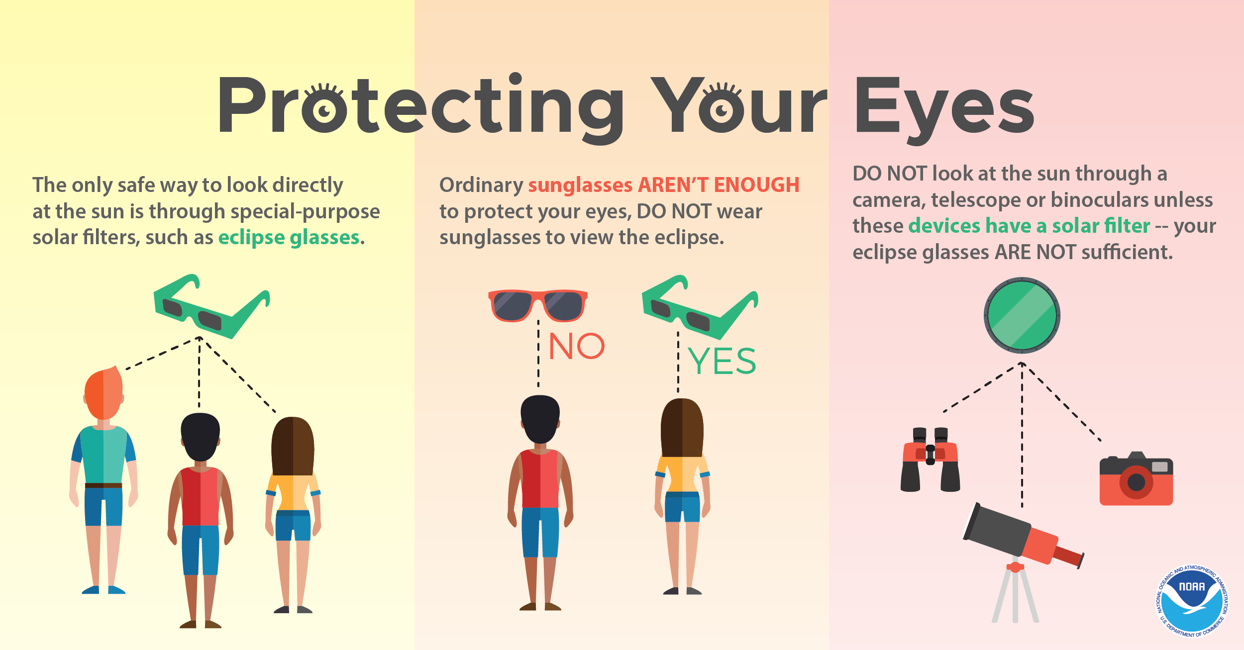
Hopefully the cloud cover can move on outta here so we can get a cool viewing.
Besides blocking the show, the cloud cover will also help keep our temps down in the 60s today. Bring a sweater to your viewing party.
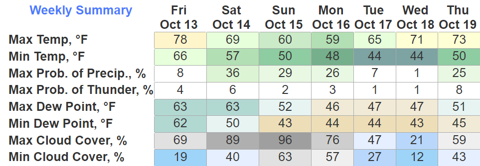
Nothing crazy on this Friday the 13th.
Some very light rain possible overnight, should be gone by sunrise Saturday morning.
Some more light, NBD rain possible Saturday night + Sunday as well. No rainouts.
Lovely day outside today, and tomorrow will be much of the same.
Our only legit rain chance to talk about looks to come around overnight Friday.
Won’t be much, just a light watering. It’ll get on outta here before sunrise Saturday. Friday + Saturday outdoor activities look good to go.
Tonight + Thursday look dry before some rain chances finally come back in the forecast.
Don’t get your hopes up too much, it doesn’t like it’ll amount to much. It’ll be disappointing. Am I describing the rain or the Braves? This is my way of grieving (I am a fan; I am allowed to say this).
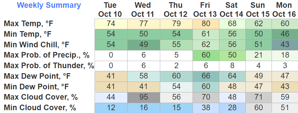
Wednesday + Thursday look fantastic weather-wise. No rain chances until Friday; Friday night looks like it’ll have our best chances.
No severe weather expected, no thunderstorms in the forecast either. Rainfall totals look slim.
You must be logged in to post a comment.