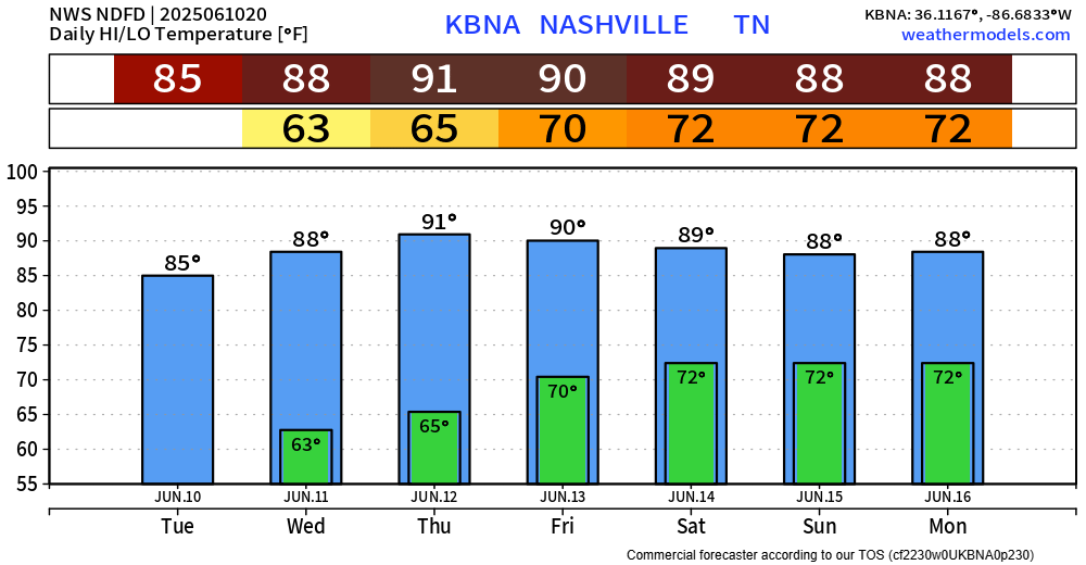
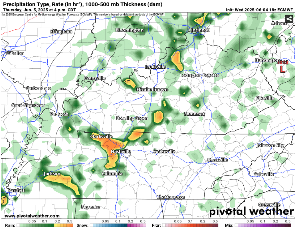
We’ll get a well-earned break from the rain thru Thursday.
While we get a few dry days strung together, temperatures will be warming up. Rest of the forecast temps will be in the upper 80s/low 90s.

We’ll get a well-earned break from the rain thru Thursday.
While we get a few dry days strung together, temperatures will be warming up. Rest of the forecast temps will be in the upper 80s/low 90s.
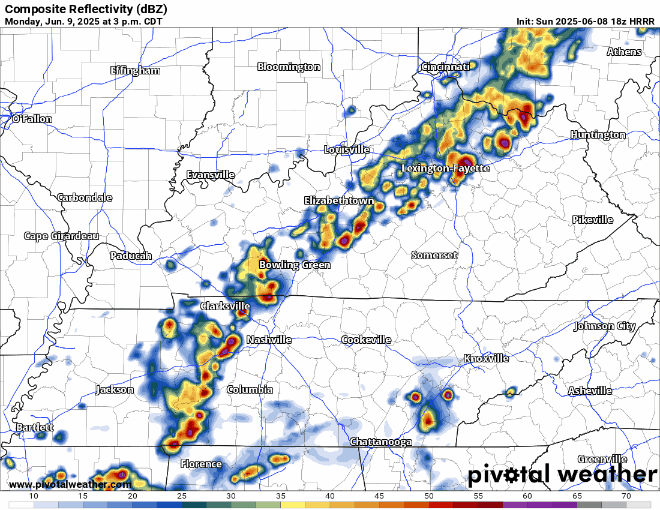
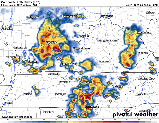
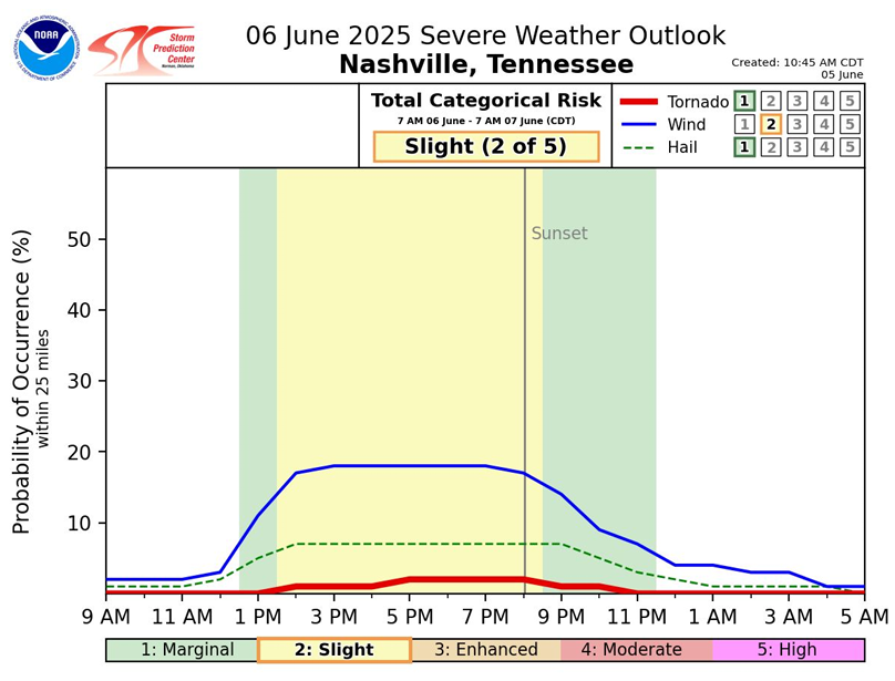
The past several runs of the HRRR model have been consistent on bringing in a few more storms later this evening, around 7 – 9p. While I’m not totally sold on that, with the consistency in recent runs – it will be worth watching. While I suppose a storm could be strong, maybe briefly severe, I think most should stay below severe limits.
Beautiful day ongoing, and this will continue thru the evening. Great night for any outdoor plans, including the closing of the CMAs.
Monday:
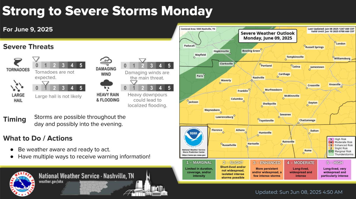
We unfortunately have another day to watch for severe weather.
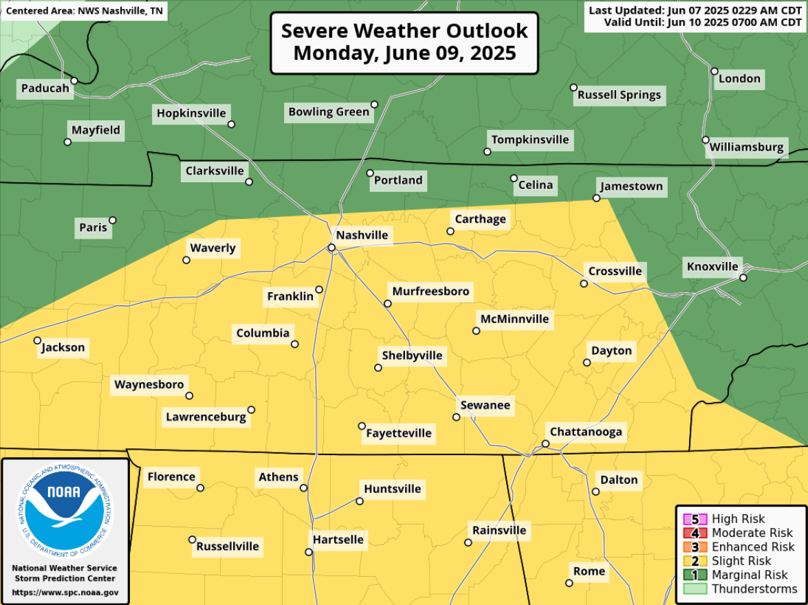
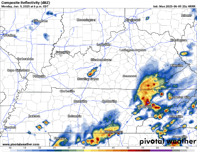
We are currently watching an MCS move safely to our south, but we’re likely to still see some rain – heavy at times, with some lightning.
We’ll be posting updates as needed throughout the day, you can also check the radar anytime on our website, fo free: Radar | Nashville Severe Weather
As we get a break from the rain and storms, we’ll be watching for any activity upstream of us to our west. There’s relatively low confidence in additional showers/storms – it all depends on if our atmosphere is able to regroup.

Hi, David here.
I am leaving Nashville Severe Weather.
No scandal, no internal discord, no problems, we all good fam.
I’m emotionally and mentally exhausted from 15 years of running NSWX from the margins of my free time.
As of 6p, the radar is mostly clear in Middle TN and think it probably will stay that way throughout the rest of the day. Can’t totally rule a quick popup shower/storm, but most of us likely to stay dry.
This evening will be the last evening for a good bit without rain chances, enjoy it!
Quite a bit to talk about over the next several days. Think the easiest way to go about this will be to be break it down day by day.
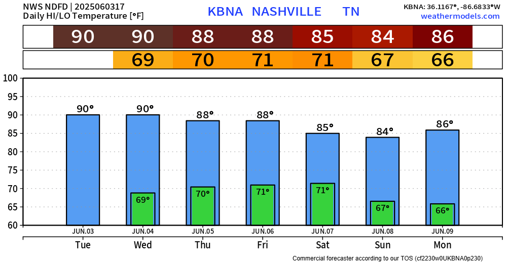
We are currently on our way towards 90°, we’ll likely get there but could end up just short. If we do get there, it’ll be the first time since October 6th of last year.
And if we don’t get there today, we have another go at it Wednesday.
Tuesday and Wednesday will be pretty much a repeat of today’s weather, just a couple degrees warmer.
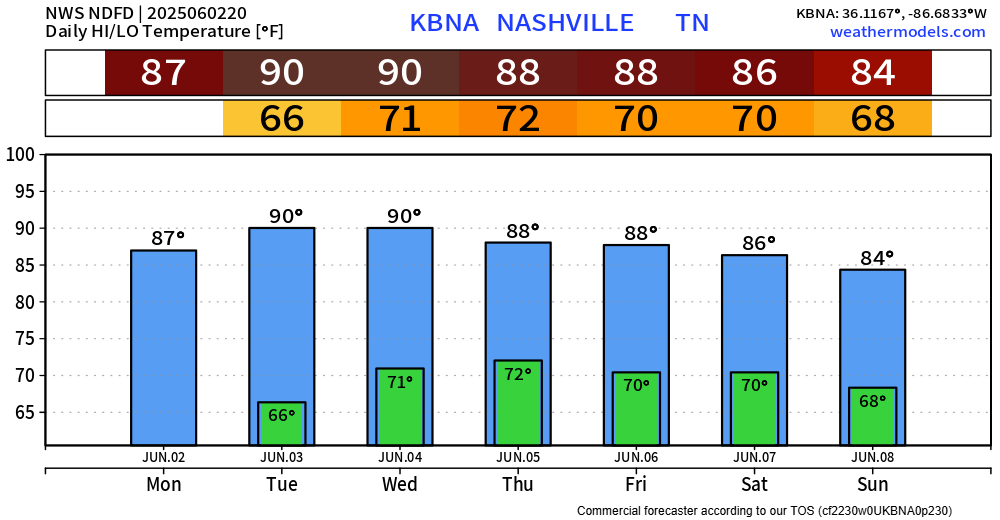
BNA touched 89° today, just short of breaking our streak of sub 90° temps. We haven’t hit 90° since October 6 of last year, per NWS Nashville. Quite the stretch, but hey, we’ll take it.
You must be logged in to post a comment.