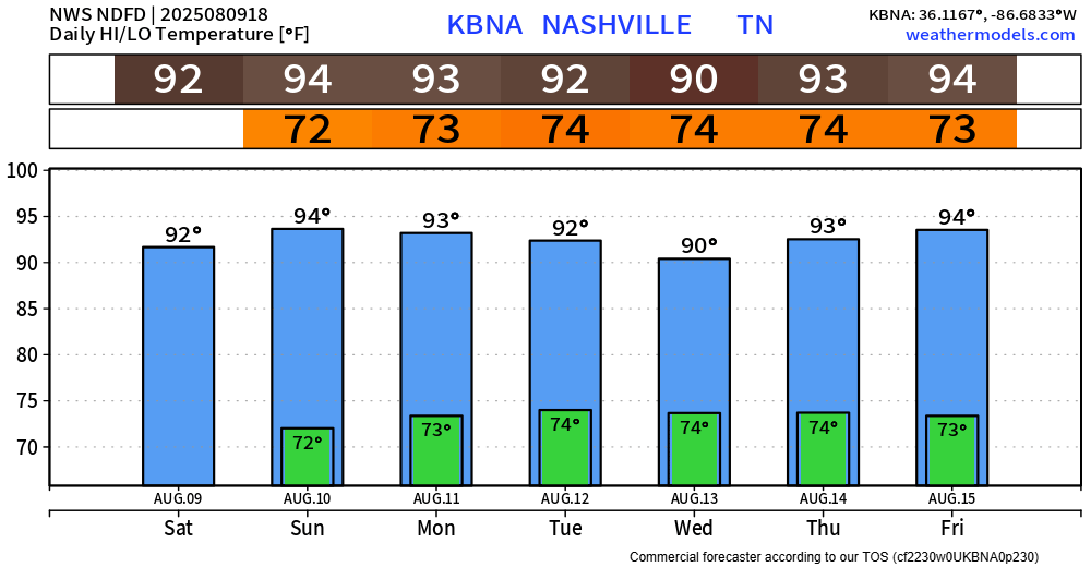
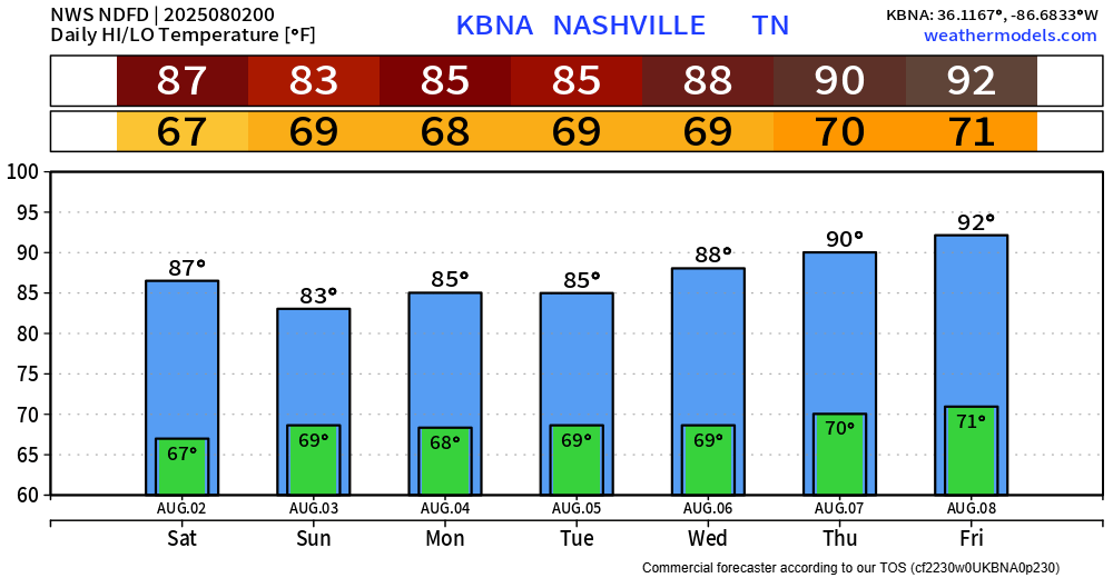
Not much else to say about this weekend other than the title. Sure, high temps will run a few degrees above average – but with rain chances so low (>10%), it’s hard to complain too much.

Not much else to say about this weekend other than the title. Sure, high temps will run a few degrees above average – but with rain chances so low (>10%), it’s hard to complain too much.
Besides a few folks in extreme northern Davidson Co., we’ve stayed dry so far today. A few more showers and storms could be possible this evening, but chances will continue to decrease as we head towards sunset.
Today felt like yesterday. Earlier showers/storms have moved out of the area, and I’d feel good with any outdoor plans this evening.
Rain chances will be even lower Friday thru Sunday – good news for any outdoor plans this weekend. Chances only around 10% so majority of us will stay dry, maybe for the entirety of the weekend.
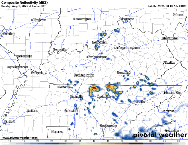
Finally saw a few Wattery winners today – although coverage was still fairly isolated.
Still a few showers out there at the time of writing (~7p). Activity should diminish the closer we get to sunset. If you plan on going to the fair, or other outdoor plans tonight – I’d feel pretty good about them.
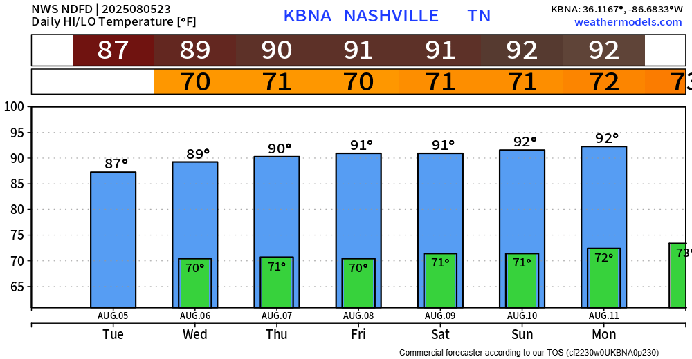
BNA reached 89° today – exactly on average for August 5th.
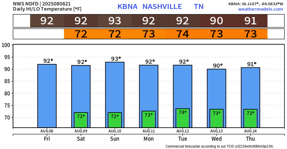
Temperatures won’t stray too far away from that number this week, but they’ll slowlyyy climb up into the low 90s.
Dewpoints will also climb up a tad throughout the week, reaching the upper 60s (compared to the low 60s we had today). All of these things will cause heat index values to creep up near 100° by this weekend. Thankfully, nothing like we saw last week – but hot regardless.
Pretty boring week ahead, weather wise. Which, I will always take.
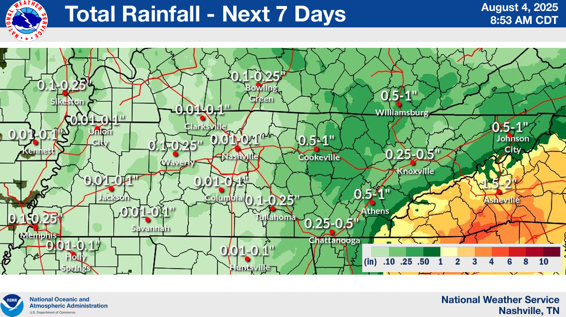
Low rain chances will continue daily throughout the next week or so.
Instability levels (storm fuel) will continue to be low over the next couple of days, so any rain will likely in the form of just a shower, with low chances of any thunder.
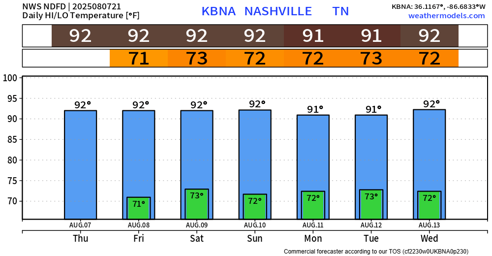
Well, the HRRR model from yesterday was pretty spot on in regard to today’s forecast. Majority of the activity has stay off to our east, and rain chances will remain low (but not zero) thru the remainder of today.
I’ll take today’s weather for early August every single day. It felt amazing.
Although similar temperatures will stick around for the next couple of days, it probably won’t be as dry.
Well, we just tied 1954 for the hottest July on record. So, congrats on making it thru that.

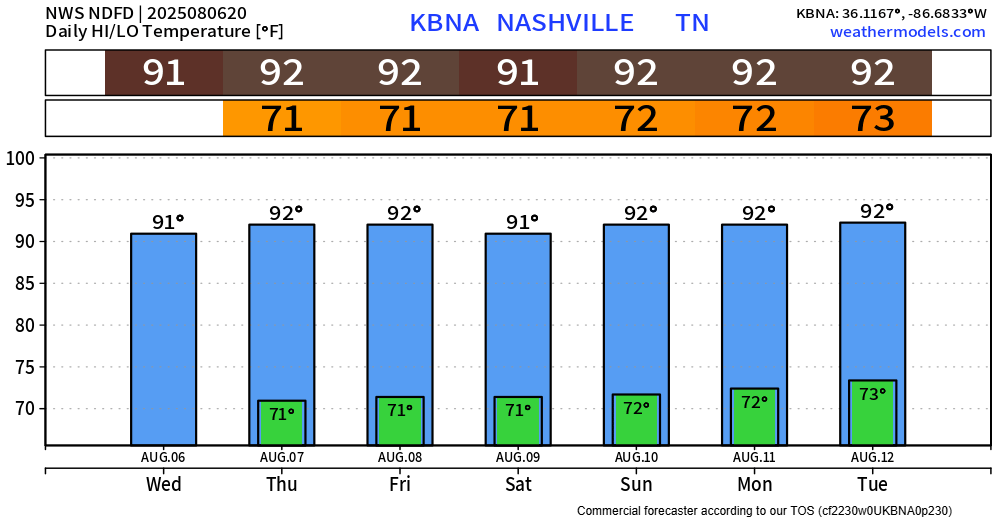
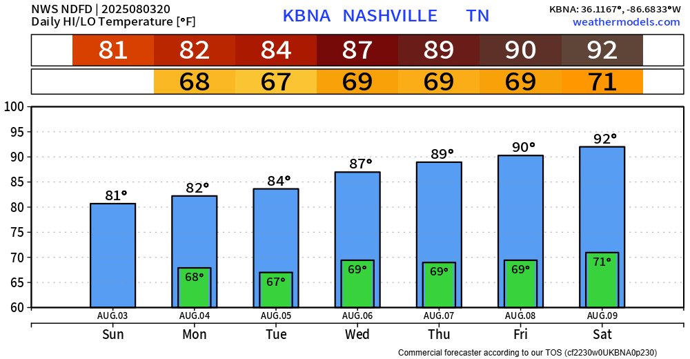
We get rewarded with some below average temperatures for a little.
Official high today was 83° with dewpoints in the mid 60s. A noticeable difference.
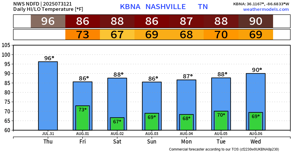
Today marked the 30th consecutive day we reached 90°+.
I am honored, humbled, and thankful to announce that streak will end tomorrow.

It will still be hot – but high temps will “only” get into the mid to upper 80s thru early next week.