
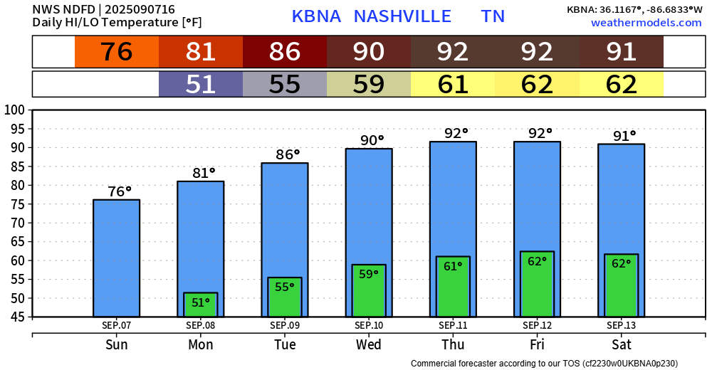
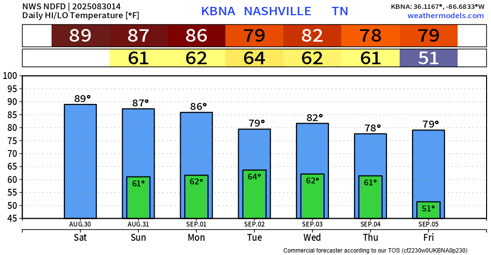
BNA got all the way down to 51° this morning. Some could say that was signaling that football season is in full swing.
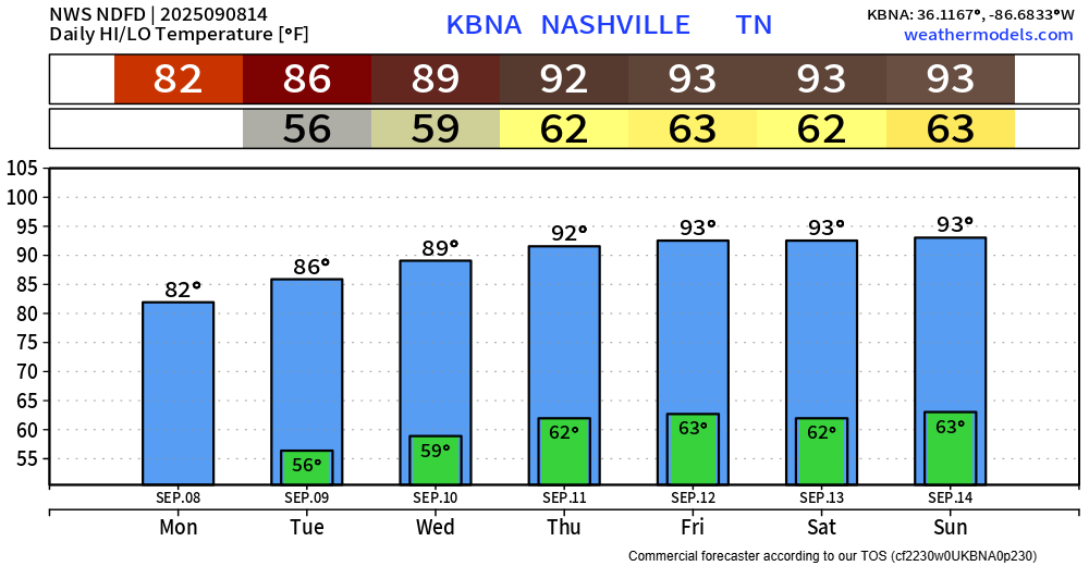
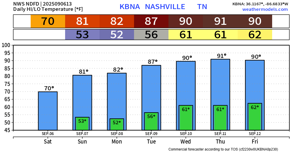
Probably won’t get that cool again for a while. Temps will slowly warm up throughout the week. High temps making it to the low 90s by late this week – nearly 10° above average.

You must be logged in to post a comment.