
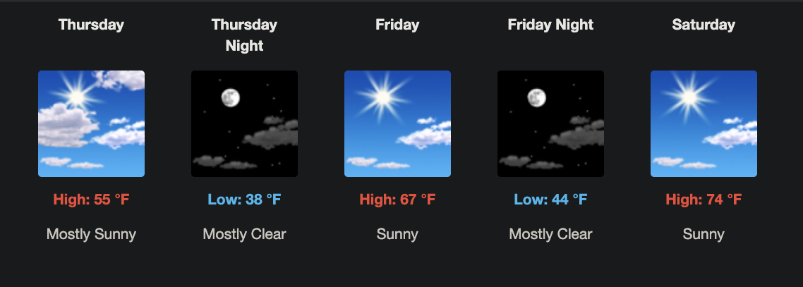
Take a look at that! Something for everyone. 50, 60, 70 for the last-half of the week and weekend. Incredible! And dry! Dew points will stay below 50º the whole time. Can’t say enough about it.

Take a look at that! Something for everyone. 50, 60, 70 for the last-half of the week and weekend. Incredible! And dry! Dew points will stay below 50º the whole time. Can’t say enough about it.

This week, temperatures remain above normal. Very springlike. But springlike also means the risk for rain and storms. Let’s get into it.
Today, our neighbors to the south have a chance for severe weather along the TN-AL border. Storms and rain could drift our way, but no significant impact is expected. A rumble of thunder might be heard in southern Williamson county. Overnight and into Tuesday our chances for rain increase. Still, scattered at best, but some overnight thunder is possible. If that’s the case our morning Dense Fog Advisory could be replaced by a Dense Dog Advisory tonight.

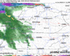
A line of storms is expected to arrive in our two counties in the 1-4 pm range, carrying a risk for damaging straight-line winds and possibly a tornado, although the risks are low. HRRR model from 11 am – 8 pm.

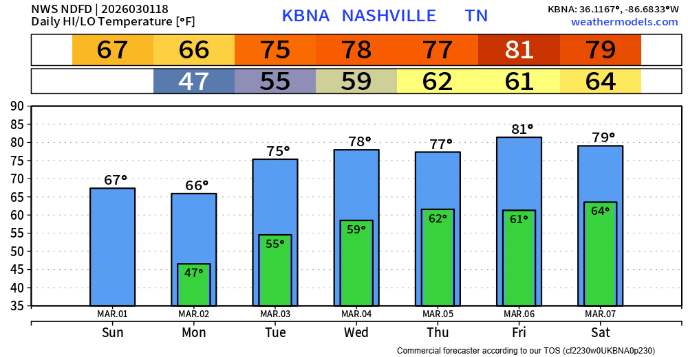
It will feel absolutely nothing like early March today. As of 11a we are already at 79°, likely on our way to breaking the daily record high of 83° – around 25° above average.
There’s a very low chance a quick shower passes thru this afternoon – but most of us will stay dry, if not all of us.

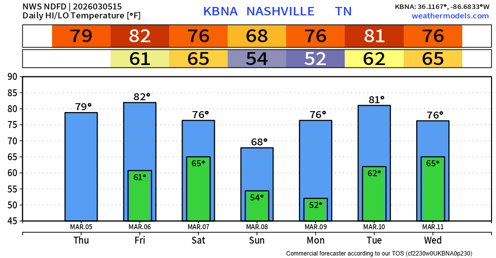
Our abnormally warm stretch of weather continues. Today (Thursday) and Friday both near 80°, which will threaten the daily high records. We “cool” down a bit on Sunday post-cold front, but warm right back up into the mid to upper 70s by early next week.

We’ll be on daily record temperature watch over the next several days, starting today.
Wednesday –> Forecast = 80° | Record = 84° (1976)
Thursday –> Forecast = 80° | Record = 80° (1910)

Rain should start to taper off this afternoon, clearing out by this evening. Clouds will hang around all day, keeping temperatures down all day. Today will be our “coolest” day for the foreseeable future.
High temperatures will be well above average this week, nearly 20-25° above our average highs by the end of the week – threatening daily record highs.
How about that – groundhog.
Rain chances return early Monday morning, continuing on/off thru the afternoon. Just some light showers, with rainfall totals only around 0.25″.
You must be logged in to post a comment.