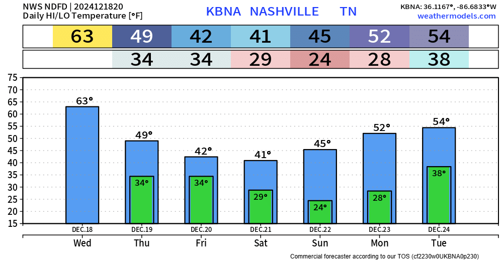
Upper 20°s tonight in Columbus. No precip. Winds unlikely to be an issue. Dewpoints falling through the teens, you’ll want chapstick.
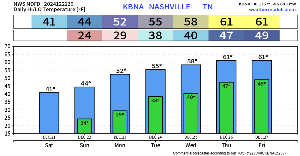
Back home: warmer each day this week.
Rain possible Christmas Day thru at least Saturday.

Upper 20°s tonight in Columbus. No precip. Winds unlikely to be an issue. Dewpoints falling through the teens, you’ll want chapstick.
Back home: warmer each day this week.
Rain possible Christmas Day thru at least Saturday.

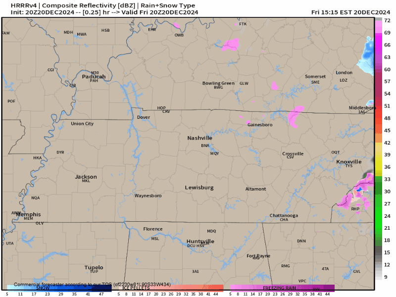
Some of us could see a few inconsequential flurries tonight. No accumulation expected for the vast majority, maybe a dusting on elevated surfaces – but certainly no travel issues expected.
Besides that, a dry but cold weekend ahead. Highs only in the low to mid 40s Saturday and Sunday.
New data is always arriving which means the forecast is pretty much always changing in some sort of fashion. This is no big change, but I suppose something to note!
There is a relatively low probability that we could see some flurries Friday evening and into the overnight hours.
The rain is outta here and cooler air is moving on in.
Dry + cool will be the theme for the rest of the week, even continuing into the beginning of next week.
Our average high temps for this time of year is upper 40s, with a low around 30° – so we’ll be around average to a lil’ below average.
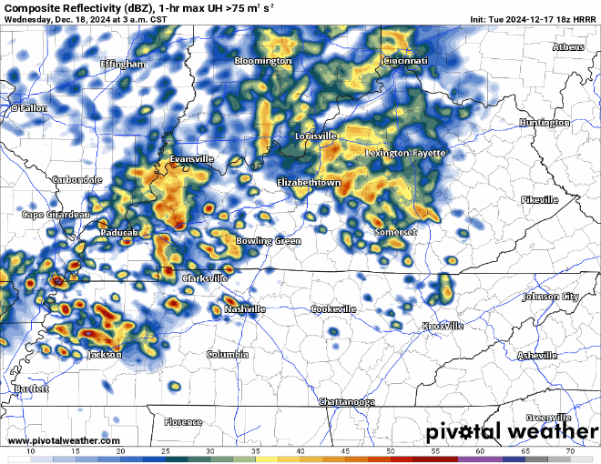
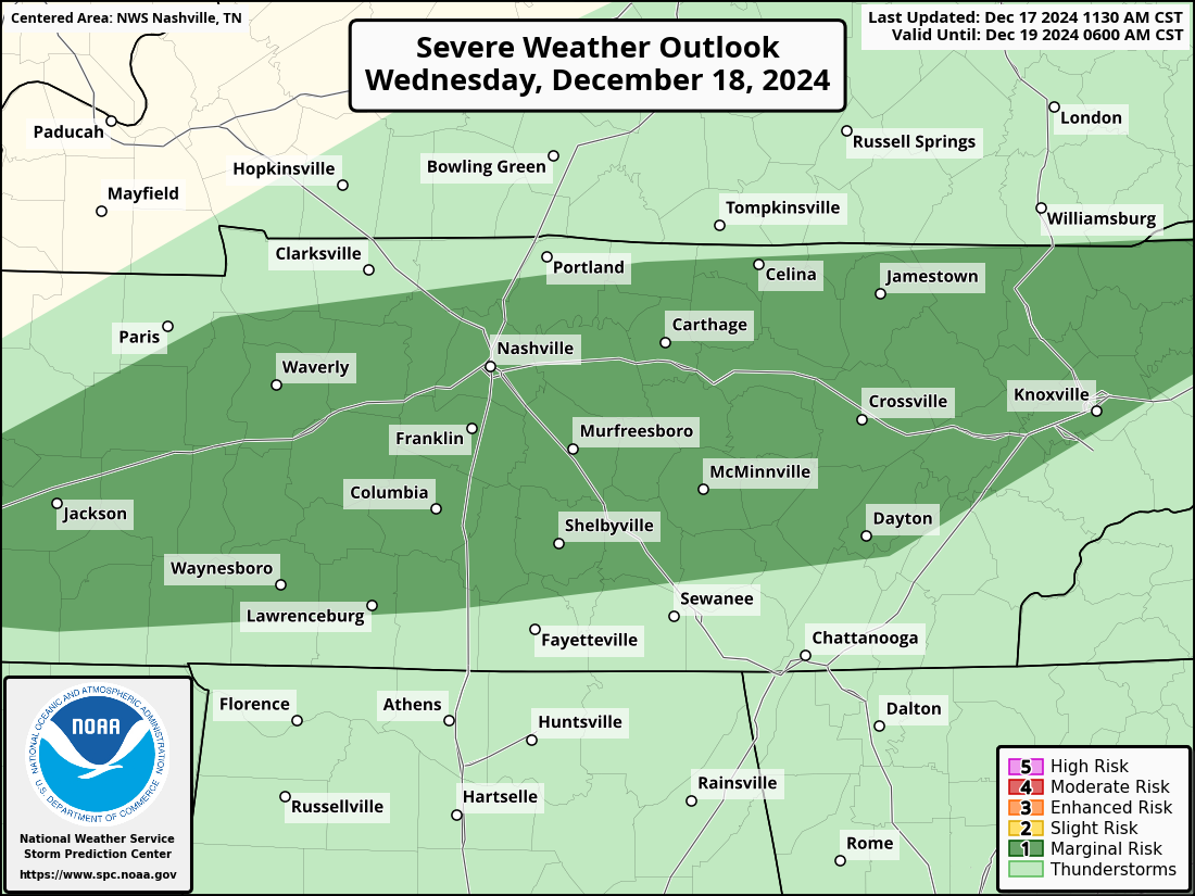
The Storm Prediction Center has outlooked our two counties with a low-end severe weather threat Wednesday morning.
Although this is a very low threat, this is still something to keep an eye on. Probabilities subject to change.
Some rain currently moving thru the area and will continue to do so throughout the evening at various intensity. No severe weather expected but can’t rule out a rumble of thunder or two. You can check the radar anytime on our website here: Radar | Nashville Severe Weather
A few of us could see some a shower late tonight, but that’s likely after most of us are asleep – unless you are a night owl. NBD.
Much better rain chances arrive Monday afternoon thru the evening.

This Evening thru Sunday Morning:
Rain will soon spread across our area, bringing on/off showers lasting into the overnight hours.
Rain gear probably a good idea for tonight and tailgating Sunday morning. The game itself tomorrow should be mostly dry but can’t rule out a shower or two.

All your Friday evening plans look a-o-k weather wise. Temps do us a favor and (barely) stay above freezing tonight.
“Conditions should be comfortable for any AM Christmas parades on Saturday but for any parades that are planned for the afternoon close to the Tennessee River, it will be a closer call in regards to rain.” – NWS Nashville AFD
FRIDAY LATE AFTERNOON – EARLY EVENING
Sprinkley rain may pull up. Meh.

SATURDAY AFTERNOON TO SUNDAY AFTERNOON
The problem: I’m not sure when it will stop. Most of the rain should be gone by Sunday mid-morning, but for the rest of Sunday we could get a stray shower. Poncho up, fans. Tailgates need tents!
You must be logged in to post a comment.