
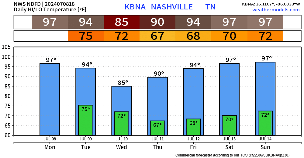
Hot temps and moist dewps have returned today. Low chances of seeing any rain this afternoon and evening.
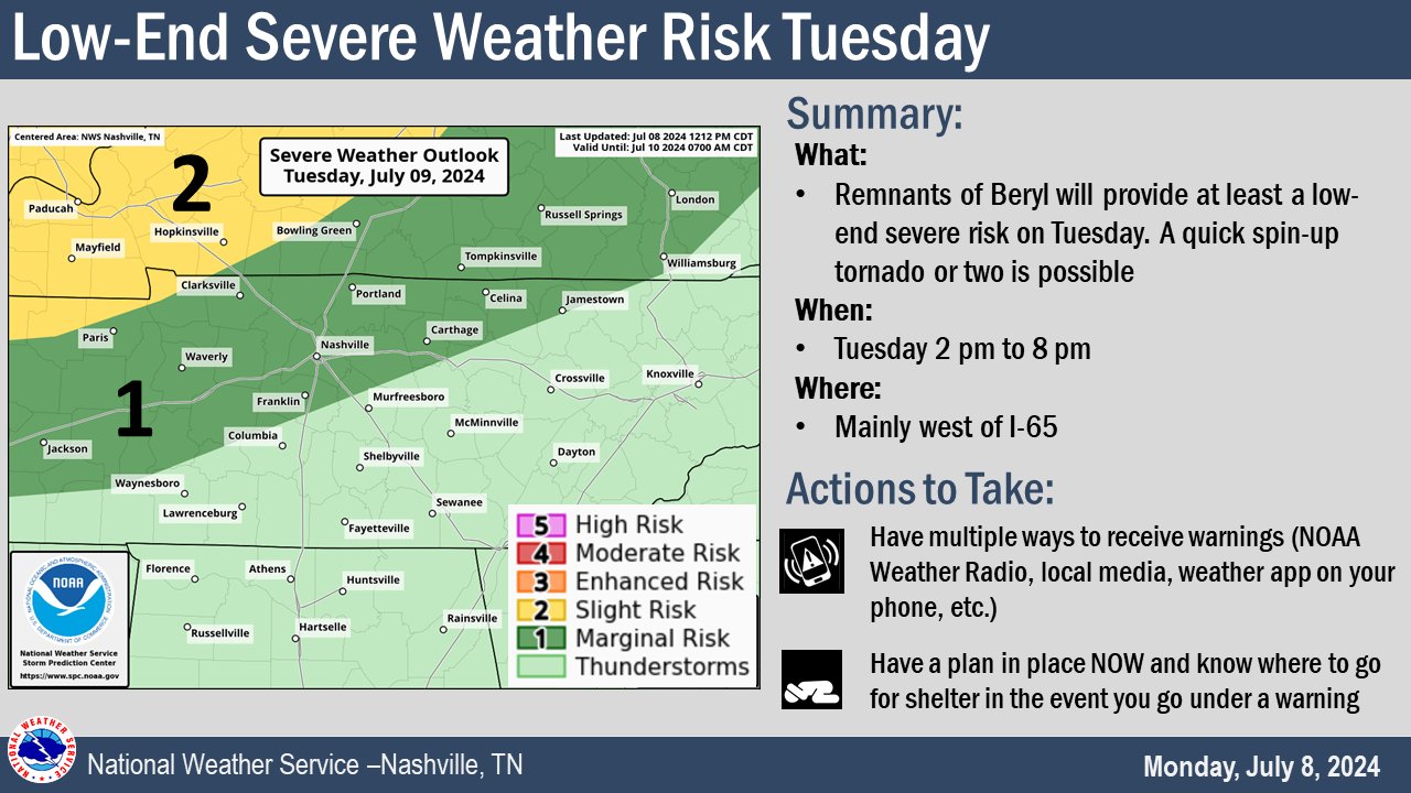
The Storm Predicition Center currently has our counties outlooked with a 2% chance of a tornado within 25 miles, and a 5% chance of damaging straight-line winds within 25 miles – higher probs to our NW.
The timeframe for our low-end severe potential looks to be 2p – 8p on Tuesday.
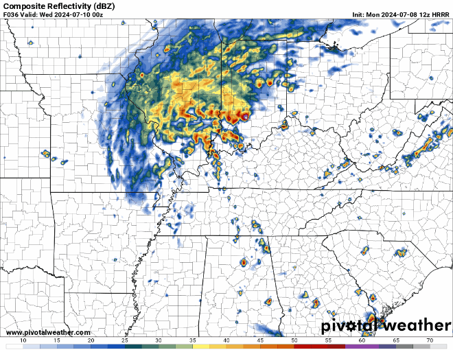
The loop above shows what 7 different models think the radar might look like tomorrow at 6pm. No model is perfect, but looking at the plethora of available models can help us get a general idea of what to expect.
Tomorrow, particularly during the afternoon and evening will be a great time to be weather aware. Have multiple ways to receive warnings and know where to go if a warning is issued for you. Tornadoes associated with tropical systems are often weak and brief, but they tend to spin up quickly. Be prepared to act quick if a warning is issued for you.
Rainfall totals continue to look low – some of us may stay dry. A strong storm could drop up to an inch, but flooding is not a concern tomorrow.
ex-Beryl will be outta here by Wednesday, leaving us with a mostly dry rest of the week. Only very low rain chances to deal with.
Heat will still be around, especially as we get into the weekend.
Categories: Featured Blog