
So far today rain has been kind to us – mostly missing us. Models continue to think this trend will continue throughout the day, with only the occasional shower and low thunderstorm chances.
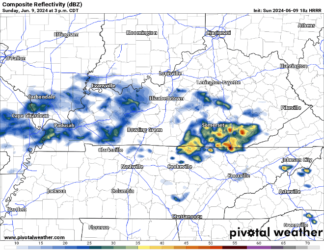
The HRRR model, shown above, thinks we’ll get away with a dry afternoon and only a few light showers along a cold front that will push thru around sunset, bringing relief from the humidity for the next couple of days. Still not a bad idea to bring rain gear to the CMA Fest, just not sure how much you’ll need it.
We are left with a nearly rain-free week ahead.
"Through this week, a stray pop-up shower or storm cannot be ruled
out, particularly late week when humidity creeps up. But for the
most part, models show the dry air and strong ridge suppressing
any significant rain chances." - NWS Nashville AFD
Temperatures the first half of the week will be tolerable, the back half of the week is a different story.
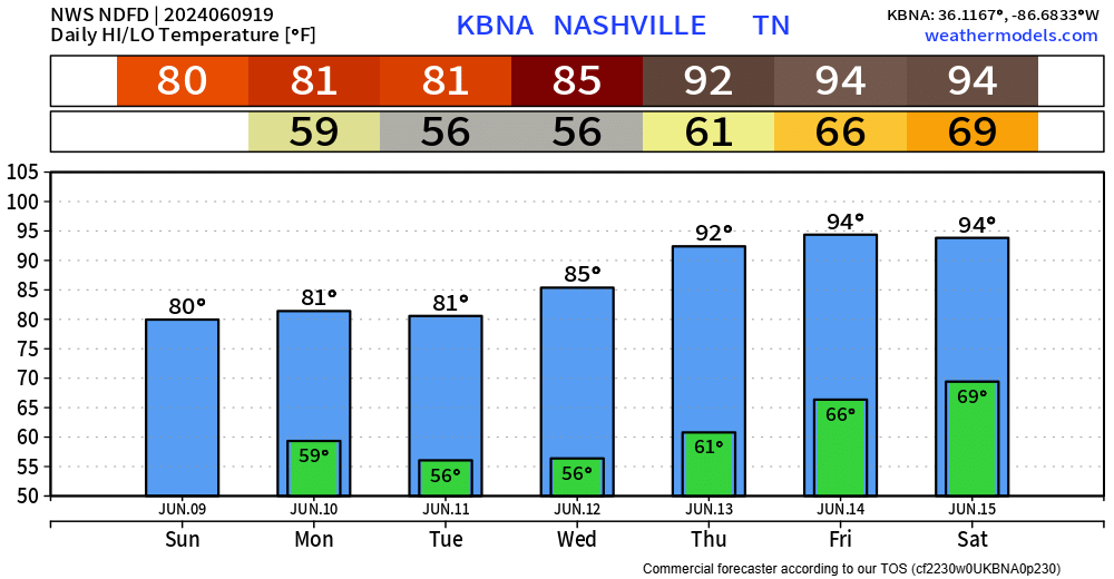
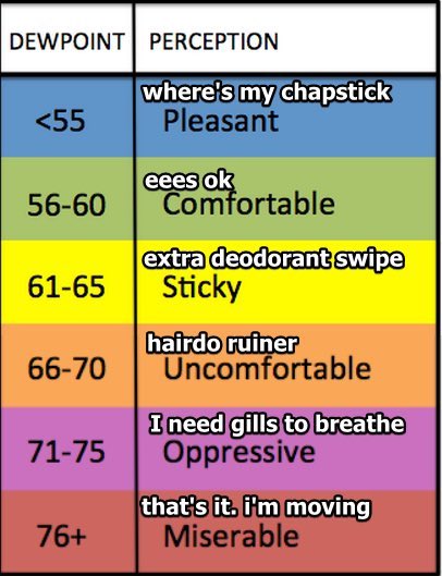
By Thursday high temps will be up in the low 90s, mid 90s by the weekend. Dewpoints will creep back into the upper 60s by the weekend, it’s that time of the year to break this chart out again.
As of right now, there is good news and bad news for folks headed out to Bonnaroo.
Good news – Rain chances look low, this definitely change between now and then, but good signs so far.
Bad news – Hot. High temperatures in the low to mid 90s combined with dewpoints in the upper 60s = a heat index near 100°.
Again, a lot can change, but heat looks to be a possible issue. More on Bonnaroo throughout the week, and we’ll fire up @BonnarooWx on X/Twitter here soon.
Categories: Featured Blog