
This afternoon/tonight. Clouds are limiting storm potential. Models think rain will fade through afternoon. Graduations tonight may be OK but we cannot rule out an isolated storm popping up.
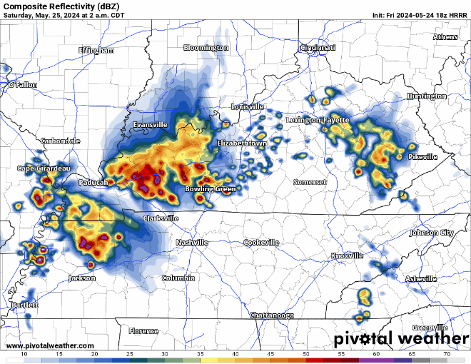
Storms overnight should mature over Kentucky and drop south. HRRR model ETA 3-4 AM. Lightning, heavy rain, strong straight line winds main hazards. Tornado risk much further west where only a 2% probability within 25 miles is outlooked.
Saturday likely quiet. Storm Prediction Center removed us from severe risks. General, sub-severe thunderstorms possible but unlikely.
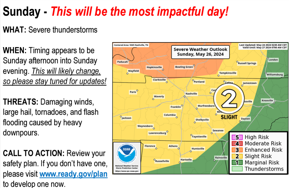
Concerned about Sunday night. NWS-Nashville called a special briefing today. They highlighted two things.
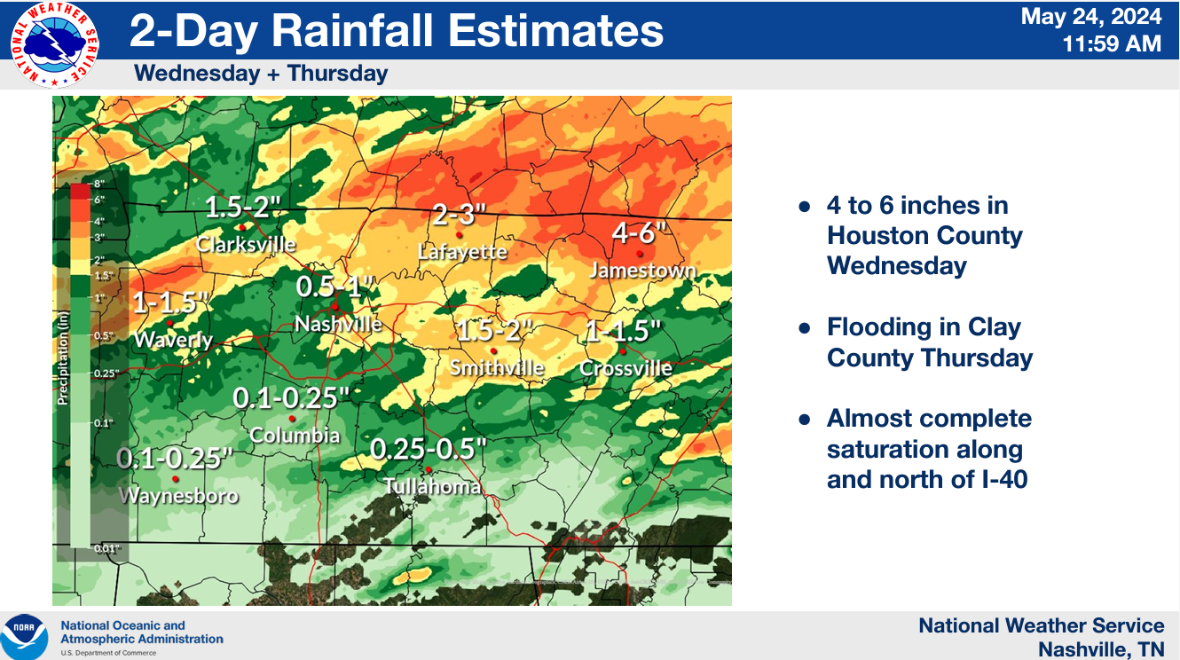
- Flash Flooding. Risk areas mostly outside Nashville/Williamson Co. Areas northeast and northwest of us were inundated by heavy rainfall last few days. Water rescues, etc., were needed. Those areas can’t handle much more water. Locally we’ll see 1″ to 1.5″ total which we should probably be able to handle. Some of us got a lot of rain and may need to find higher ground as the main event comes through. Camping discouraged.
2. Late Sunday night. ETA needs to be worked out. Rough window 8 PM Sunday to 4 AM Monday. This’ll be adjusted as high res data arrives tonight thru the weekend. Forecast soundings show a powerful storm set up with all hazards of severe weather possible: large hail, damaging straight line winds, and yes (unfortunately) tornadoes.
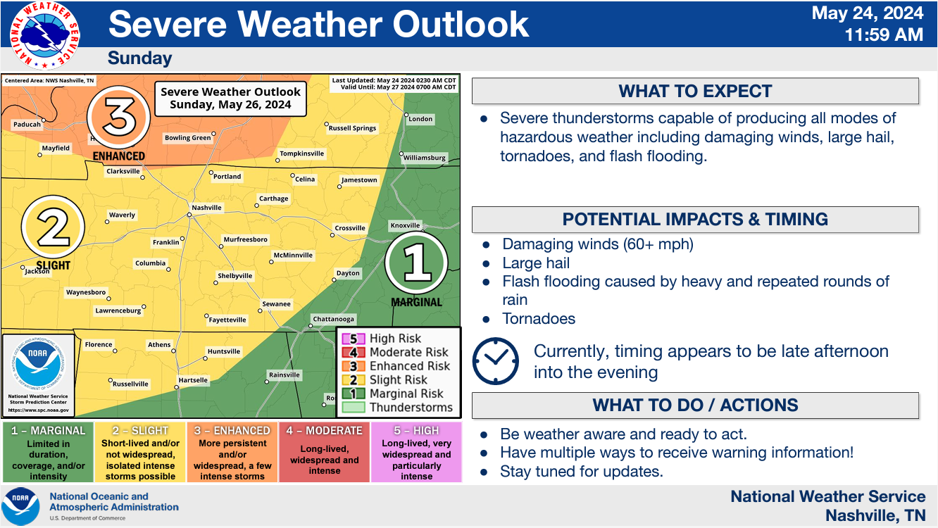
That orange “Enhanced” area above will be reassessed at least five more times before storms arrive (twice tomorrow, three times Sunday). It was drawn before new data arrived earlier today. That data suggests there should be no meaningful difference in the risk categories. It has our attention.
- Do not leave yourself exposed to the elements Sunday night into Monday morning. Camping discouraged.
- Mobile and Manufactured Home residents should consider another place to sleep should the forecast remain – hopefully the concern will go down! – but maybe not.
- Get a NOAA weather radio and wake me up app like StormWatchPlus so you can sleep responsibly Sunday night.
Rest of Monday is questionable and will entirely depend on what happens Sunday night into Monday morning.
More on X and in this space throughout the day & weekend.
Categories: Featured Blog