

1–Strong, scattered afternoon storms possible today.
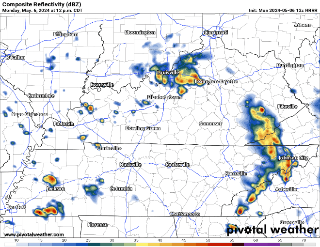
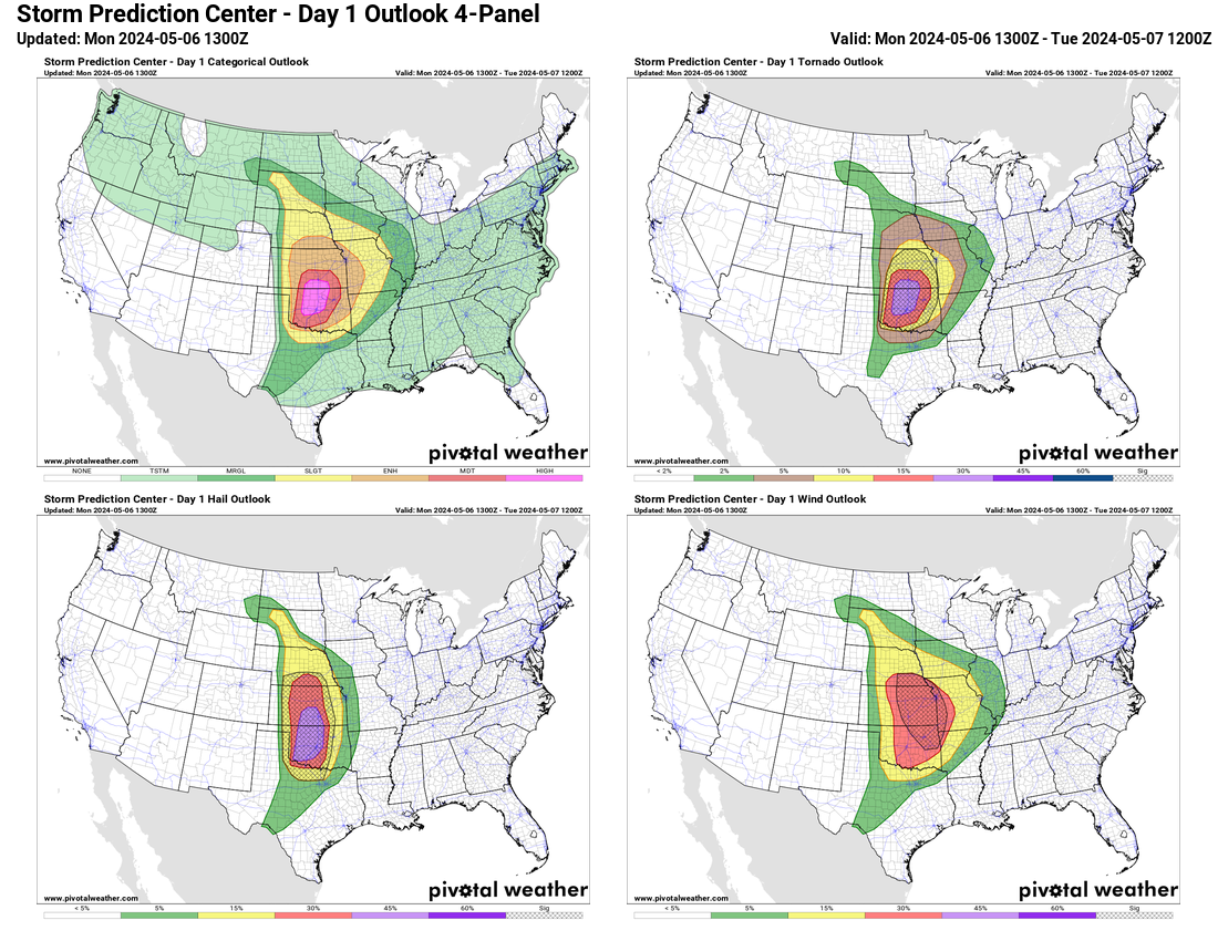
Storms forming near Memphis may arrive here this afternoon. Not everyone will see a storm. Those that do will want to be inside. We are not severe-outlooked by SPC; however, our local NWS office notes enough instability and shear to power storms up. This is suggested by the HRRR model below. Storms may be strong, maybe severe, with damaging straight line winds the main severe feature. Data does not support tornado. Hail, if any, will be small. Heavy rainfall running above already saturated grounds may create temporary, localized, but real flooding in the “usual spots.” We’ll be covering this on Twitter/X today. On YouTube Live if any warnings are issued. Activity should end after dark.
2–Severe potential Tuesday.
Damaging winds and large hail will be possible Tuesday afternoon through the evening. Any storm that gets going will tap plenty of energy. Winds twist with height. Looks like a big event … except latest model runs show only a few storms forming. Those that do run into a “cap” – a temperature inversion aloft that prevents storms from reaching their full potential. If that “cap” breaks, things will ramp up. SPC notes 15% probability of hail or damaging straight line winds within 25 miles of us. Tornado probability 2%. NWS says confidence for severe storms in Middle TN is 2 out of 5.
3–Biggest concern: Wednesday late afternoon – night.
Damaging straight line winds, large hail, and tornado all possible Weds evening into the overnight hours. Note: “There is a small possibility that a couple isolated storms could develop as early as the afternoon on Wednesday, but the likelihood of that happening looks low at the moment.” –NWS-Nashville.
NWS says confidence for seeing severe storms in Middle TN Wednesday is 4 out of 5. SPC outlook below issued a hatched 30% probability of severe weather within 25 miles of us. The CSU Artificial Intelligence model also supports widespread severe weather late Wednesday.
The hope is the system develops late and weakens late Weds night. This looks like a system we get in April, during peak severe storm szn.
4–Website change.
As you probably know, we’ve made recent attempts to become less dependent on Twitter and instead create a website from the ground up that would serve as our main timeline and push to social media platforms secondarily. The site would serve as a one stop shop. Pull it up, let it sit there, and be fed all NashSevereWx content automatically. While our developers have done amazing things with this concept under the hood of the site – and it works well most of the time for most people – none of us think it’s quite ready for us to depend on during a week when potentially severe, storms are forecast. We’re committed to getting it perfect. In the meantime, we’ll be posting our updates to Twitter (X), and only long-form blogs like this one to the website like we used to. We’ll be on our YouTube channel covering any warnings. Cool things are coming. We’ll keep you updated!
5–Finally, in Oklahoma today. A rare “high risk” has been outlooked for all modes of severe weather including long tracked, powerful tornadoes. All the weather world will be watching. Contact family, friends, and enemies in OK to be sure they know about this. I can’t imaging they don’t know, but just in case.
Categories: Tweet