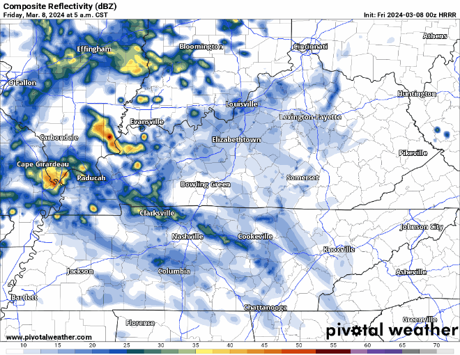
HRRR model update thinks most of the rain tonight/overnight will be gone by sunrise Sat. Few passing lunchtime showers possible.

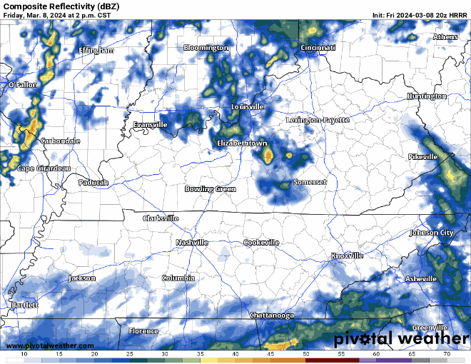
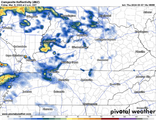
Heaviest rain scoots just east of us. If the model is off by just 30-40 miles, we could be really soggy in the AM. read more

Today’s blog feat. sunshine south of I-40 that won’t last.

More light, off and on rain incoming tonight and Sat morning. Latest HRRR below, time stamp upper left:

Downpours Sat AM may ruin dry-required activities. 0.75″ average rainfall, enough to waterlog most fields. However, variance will be high so your results may vary. read more

Light rain this morning. Break this afternoon and early evening. More off and on heavier rain overnight and Sat AM. Totals about 0.75” on average.

On/Off Rain Friday Thru Saturday AM.

Showers will begin Friday morning and continue on and off until around midday Saturday. HRRR model shown below.

Heaviest rain looks like it’ll fall overnight Friday.

No severe weather concerns for us, those probabilities are to our south and west. read more

Rain off & on begins Friday morning and continues to around lunch Saturday. HRRR model:

Rainfall totals will vary. HRRR has 0.3″ in some local spots, others 1″. Rainouts will be hit or miss. read more

Nice Thursday, Rain Returns Friday/Saturday

Fog possible tonight into Thursday morning, low beams might get some work in.

We’ll get by with a dry and warm Thursday. High temperatures get into the upper 60s.

Friday morning our rain chances return. read more

Fog likely late – overnight into Thu morning. Temp and dewpoint should 🤝🏽 around 49°, light winds.

Rain returns light and off/on Friday morning. See HRRR below thru lunch Friday. Then Friday night and Saturday morning we expect another rainout-quality event. Another 0.75″ to 1″ by Saturday lunch. No severe forecast. read more

Rain moving out. Mist and drizzle for the morning commute. Radar at 5:54am.

More rain expected overnight. No severe worries. We good, fam. 🛌.