
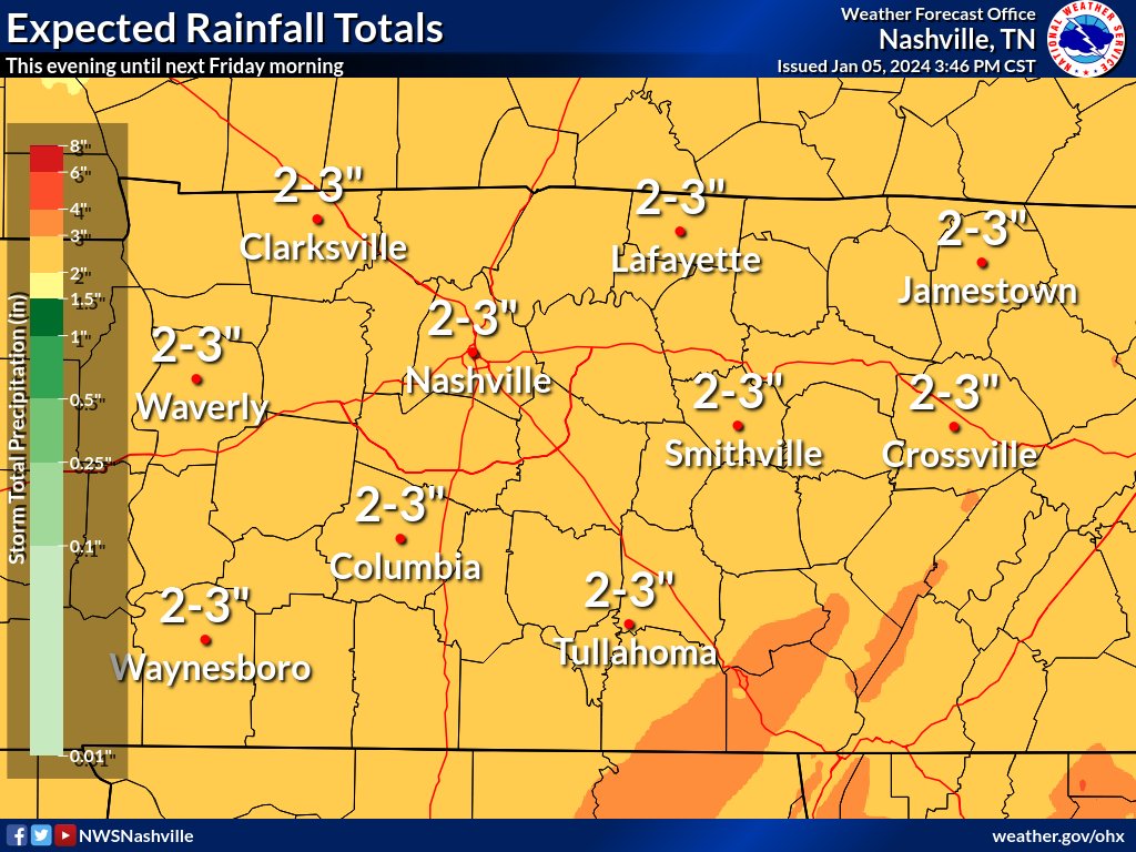
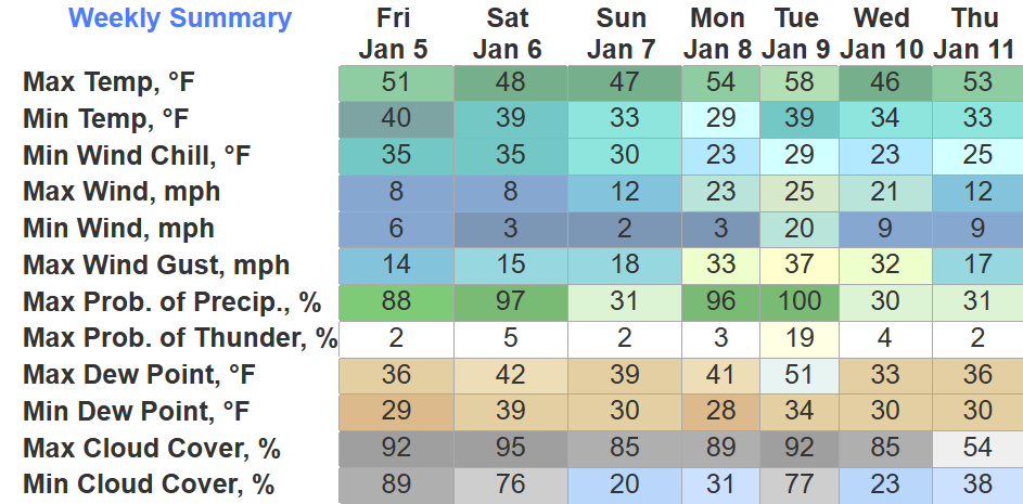
Rain will be a common theme in our forecast for the next 7 days.

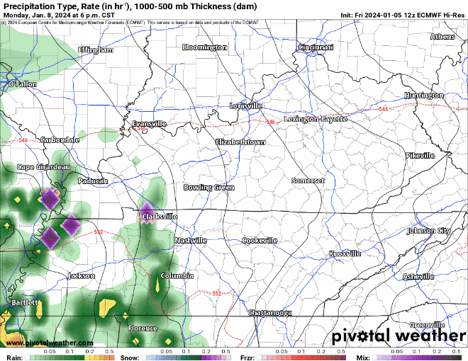
HRRR above gives a good look at what the radar might look like tonight into early Saturday morning:
- a cold rain (just rain)
- arriving ~ 9 – 10 pm
- departing ~ 6 – 7 am Saturday
- 0.5″ – 1″ of rain expected
Rest of the day Saturday should mostly be dry. A few isolated, quick rain showers are possible Saturday evening.
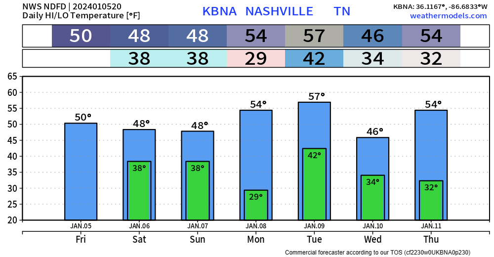
Sunday, last home Titans game of the season looks cool + dry.
Rain chances return Monday PM, along with some strong wind gusts.
The EURO illustrates the current thinking of:
- rain arriving sometime Monday PM
- on/off, heavy at times thru Tuesday AM
- some wrap-around moisture may provide some more rain Tuesday night, maybe some flakes mixed in, but these would melt on contact with the ground
- wind gusts up to 35 – 50(!) mph possible, if you haven’t already, might want to make sure to store away X-mas decor before then
- no severe weather expected for us
- 1″ – 2.5″ of rain possible
Details still iffy this far out, changes to the forecast are possible.
Long-range model data suggests that we’ll be in an active pattern for a few weeks. We shall see.
Quick References:
Weather changes constantly.
Follow @NashSevereWx on Twitter for any changes to this forecast.
Live coverage during tornado and severe thunderstorm warnings:

Look good.
Support the mission.

We are 100% community supported. No ads. No subscription fees. Keep it free for everyone.


Categories: Forecast Blogs (Legacy)
You must be logged in to post a comment.