
New drought monitor came out today and showed little change to our drought situation.
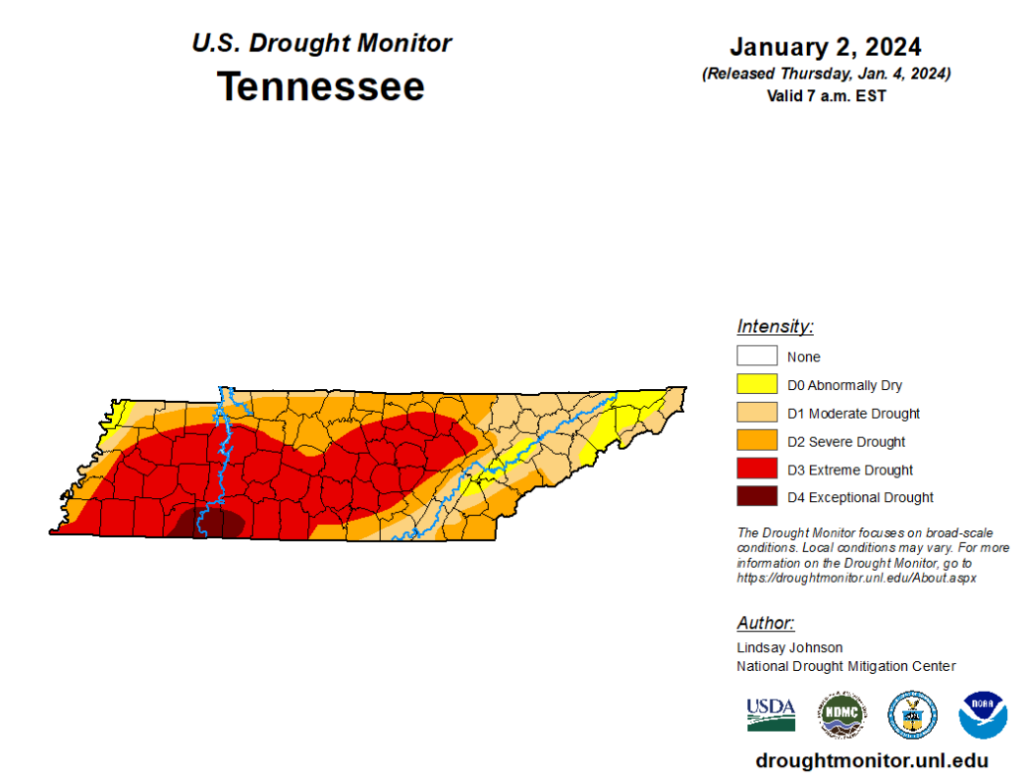
Majority of WillCo. still in an Extreme Drought, while the rest of us are in the Severe Drought category.
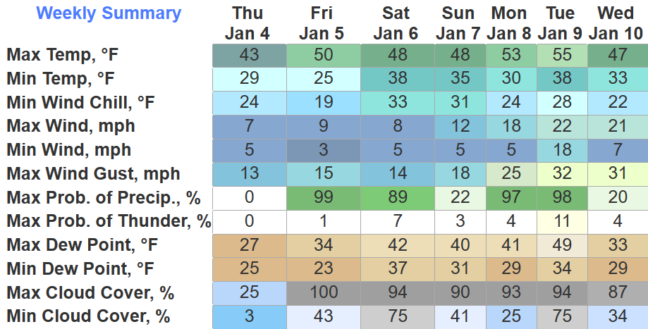
Good news is, we have two upcoming rains that will help, not solve, our drought situation.
First Chance: Friday Night thru Saturday Morning
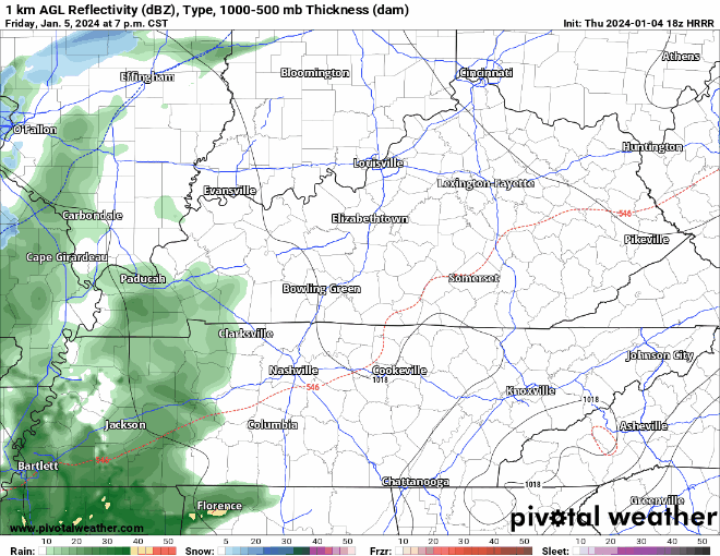
The HRRR model above illustrates the best chances for rain begin Friday night and taper off around sunrise Saturday morning. This will be a yucky, cold rain. Between 0.5″ – 0.75″ of rain is expected. Frozen stuff will stay well north of us.
After that moves out, the rest of Saturday should be dry + cool.
A few spotty rain showers can’t be ruled out on Sunday, but it appears as if a majority of the day will be dry. Temps still fairly cool for those headed to the Titans game.
A Good Soaking: Monday PM thru Tuesday
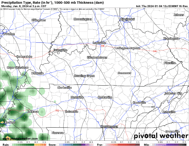
The radar will likely not look identical to this, but this run of the Euro gives us a general idea of what is expected for Monday and Tuesday.
- on/off rain, heavy at times
- few rumbles of thunder possible, but no severe weather expected
- rainfall totals around 1.5″ – 2″
- wind gusts up to 35 – 40 mph are also possible Monday + Tuesday
- wrap-around moisture may spit out some flurries Tues. night, but with surface temperatures above freezing, these would melt on contact with the ground
Timing may have to be refined as we get closer. We’ll keep you posted.
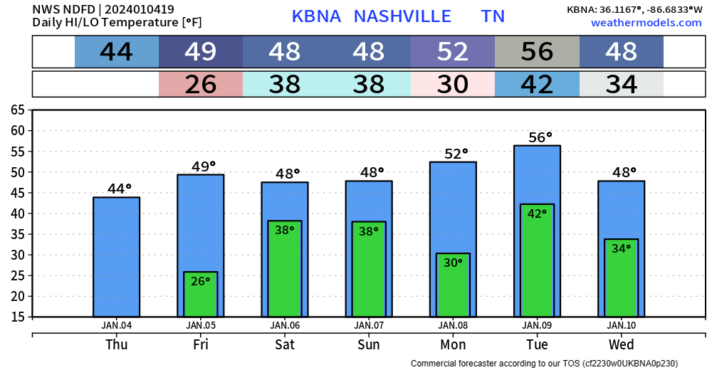
Quick References:
Weather changes constantly.
Follow @NashSevereWx on Twitter for any changes to this forecast.
Live coverage during tornado and severe thunderstorm warnings:

Look good.
Support the mission.

We are 100% community supported. No ads. No subscription fees. Keep it free for everyone.


Categories: Forecast Blogs (Legacy)
You must be logged in to post a comment.