

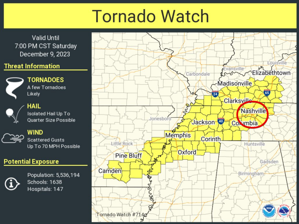
A Tornado Watch has been issued for both of our counties until 7pm tonight.
Our probabilities from the Storm Prediction Center are:
- 15% chance of damaging straight-line winds within 25 miles
- 15% chance of severe hail within 25 miles
- 10% of a tornado within 25 miles (10% or greater chance of EF2+ tornado)
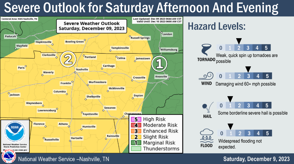
Our main threat today continues to be damaging straight-line winds, but severe hail and a tornado or two cannot be ruled out.
Timing
Best chance for potential severe weather appears to be from 4pm – 9pm. However, severe storms are possible before this timeframe. It will be important to be weather aware all day.
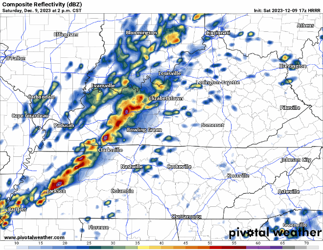
The HRRR model (above) shows the main line of storms arriving for us around 5-6pm, give or take an hour or so. Storms are possible ahead of the main line. ETAs will continue to be updated throughout the day.
Preparing
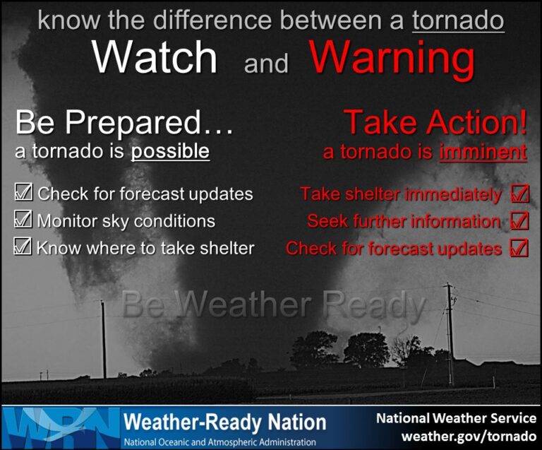
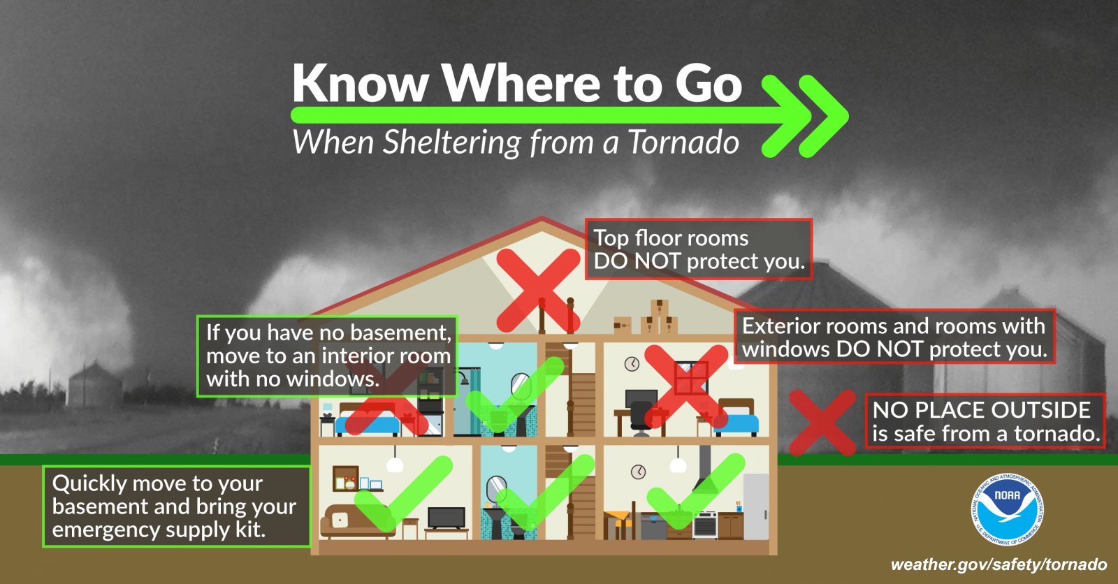
It’s been a while since we’ve dealt with any severe weather. Now is a good time to review where to go *if* a warning is issued for you.
*If* a warning is issued for any part of our two counties, we will go live on our YouTube channel: Nashville Severe Weather @NashSevereWx – YouTube
We’ll be tweeting updates as needed on X (Twitter) all day long.
Heartrates can go up when talk of severe weather comes around and that’s okay. Here’s an article we have on storm anxiety.
Sunday and beginning of next week looks dry and cool.
Quick References:
Weather changes constantly.
Follow @NashSevereWx on Twitter for any changes to this forecast.
Live coverage during tornado and severe thunderstorm warnings:

Look good.
Support the mission.

We are 100% community supported. No ads. No subscription fees. Keep it free for everyone.


Categories: Forecast Blogs (Legacy)
You must be logged in to post a comment.