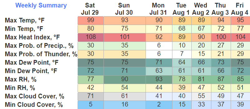
Another day, another Heat Advisory from noon to 7pm. Heat index values up to 108° possible.

We’ll be hoping for a shot at some rain/storms this afternoon to cool us off.

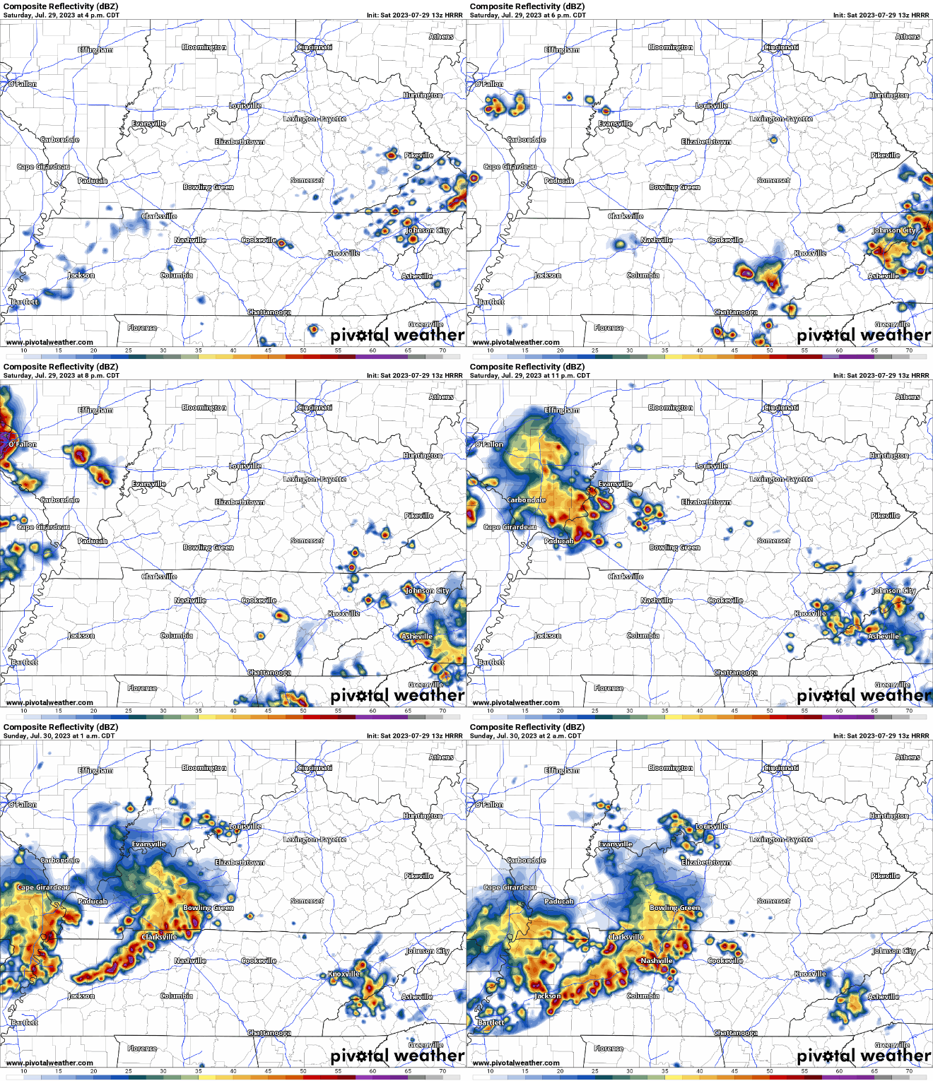
HRRR model (above) thinks very little activity will pop-up near us this afternoon, likely leaving us to bake. Any lightning delays for the concert look unlikely, but you just never know exactly where these will pop-up at.
Late night, it thinks a cluster of storms moves down I-24. The Storm Prediction Center has us outlooked with a 5% chance of damaging straight-line winds and/or severe hail within 25 miles.
HRRR, as of right now, thinks there is an ETA of 1-3am. If you have plans to be out at this time, stay connected. You won’t want to be outside or driving during in these storms. Some earlier model runs hinted at storms falling apart before they arrived. This would be cool too. We’ll be watching.
We’ll see a Blue Clear Sky by Sunday mornin’. Sunday looks dry and a few degrees cooler than what we’ve had. We should finally break the Heat Advisory streak, but heat index will still be around 100°.
First half of the week looks great, mostly dry, temps around 90° and humidity keeps in check. If I had to Check Yes or No for this forecast, I’ll go with Yes. I can’t just Give It Away.

Quick References:
Weather changes constantly.
Follow @NashSevereWx on Twitter for any changes to this forecast.
We are 100% community supported. No ads. No subscription fees. Keep it free for everyone.
Categories: Forecast Blogs (Legacy)


You must be logged in to post a comment.