The National Weather Service calls our weekend weather “unsettled” which is exactly what it is — off and on showers moving in from the west, but exactly where and when no one is exactly sure.
So let’s try and settle it a little, understanding forecasting isn’t perfect.
Before 9:30 AM we see rain moving closer from west Tennessee:
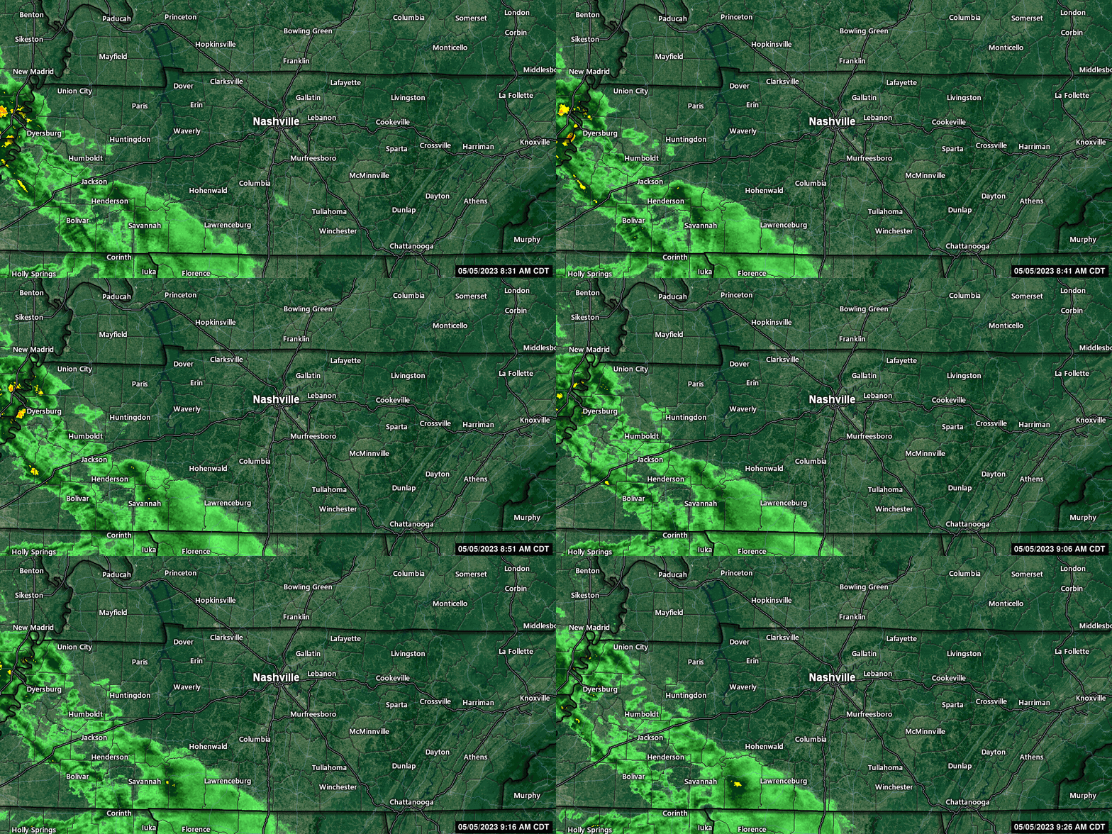
We think this light rain will break up a bit, scatter, and move across Nashville and Williamson Co this afternoon through tonight. This includes tonight’s Taylor Swift concert. You should pack a poncho and wear water-tolerant shoes. A rain jacket may be the move because it may be a bit chilly. Rain will be off and on, but mostly off.
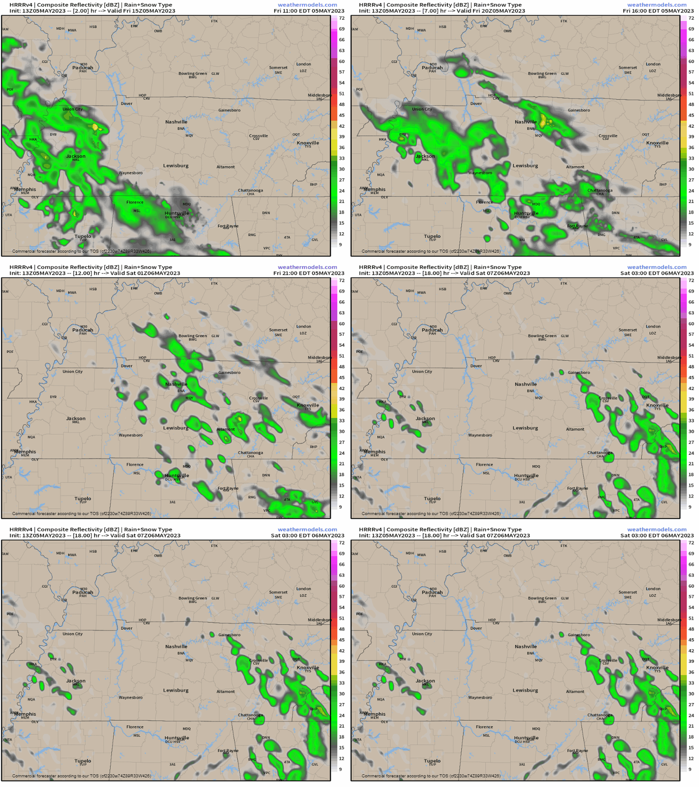
We see nearly no chance of lightning in the forecast data tonight, which is fantastic news for those who worried about a repeat of the Garth Brooks show a few summers ago, when Thor sent an intense lightningstorm across town. That won’t happen today. Data only shows a less than 5% of a lightning event during tonight’s show. Not saying it can’t happen, but this should be primarily/exclusively a rain event.
You’d have to be pretty unlucky to get rainout-Saturday-games quantity rainfall tonight.
Most of Saturday looks uneventful. A few scattered showers are possible. It’ll warm up and get more humid.
I’m mostly interested in a large thunderstorm complex shown by the HRRR model. It is a snotty little family all dressed in pastel. It develops storms in KY and drops them south into Nashville then Williamson County around 11 PM Saturday night. This complex would almost certainly delay the show — so we’ll monitor updated model runs and post those to Twitter. Models often err on the timing and location of these storm complexes, which could be good for us (if it misses or comes after midnight), or bad for us (if it develops during the show).
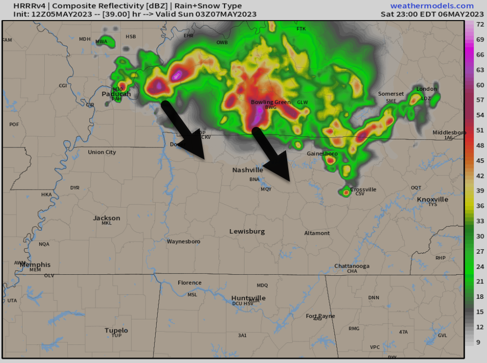
Horrified looks from everyone in the room / But I’m only looking at the HRRR model
The good news is that only the HRRR model develops these storms. The NAM does not. The Euro does not. Most (not all) of the HRW do not.
So, just something to watch. The HRRR usually has a good track record, but is often wrong.
Sunday remains unclear. The higher resolution models are not yet in range. That said, the lower resolution models look pretty clear for the Sunday night show, but it’s too early to start worrying about it. In an unsettled pattern, assurances of clear skies, while comforting, are white lies.
We can plan for a change in the weather and time by packing ponchos and wearing rain tolerant shoes for all shows this weekend.
The unsettled pattern continues into next week as heat and humidity rise. Mow your grass today, because next week it’s going to be hotter and sticky. Summer waits for no one.
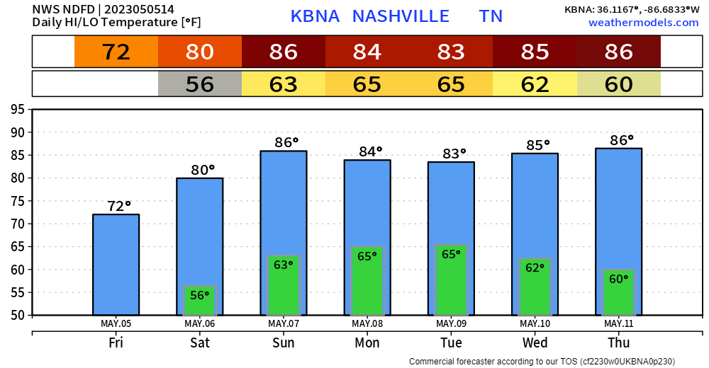
Quick References:
Weather changes constantly.
Follow @NashSevereWx on Twitter for any changes to this forecast.
We are 100% community supported. No ads. No subscription fees. Keep it free for everyone.





 Log In To Facebook To Comment