
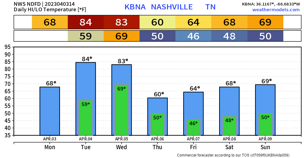
Some light showers continue to move through this morning. These should move out around lunch time leaving us with a dry rest of the day. High today is supposedly 68°, not sure we make it there with this cloud cover.
Tuesday continues to look like a warm, borderline hot, and dry day.
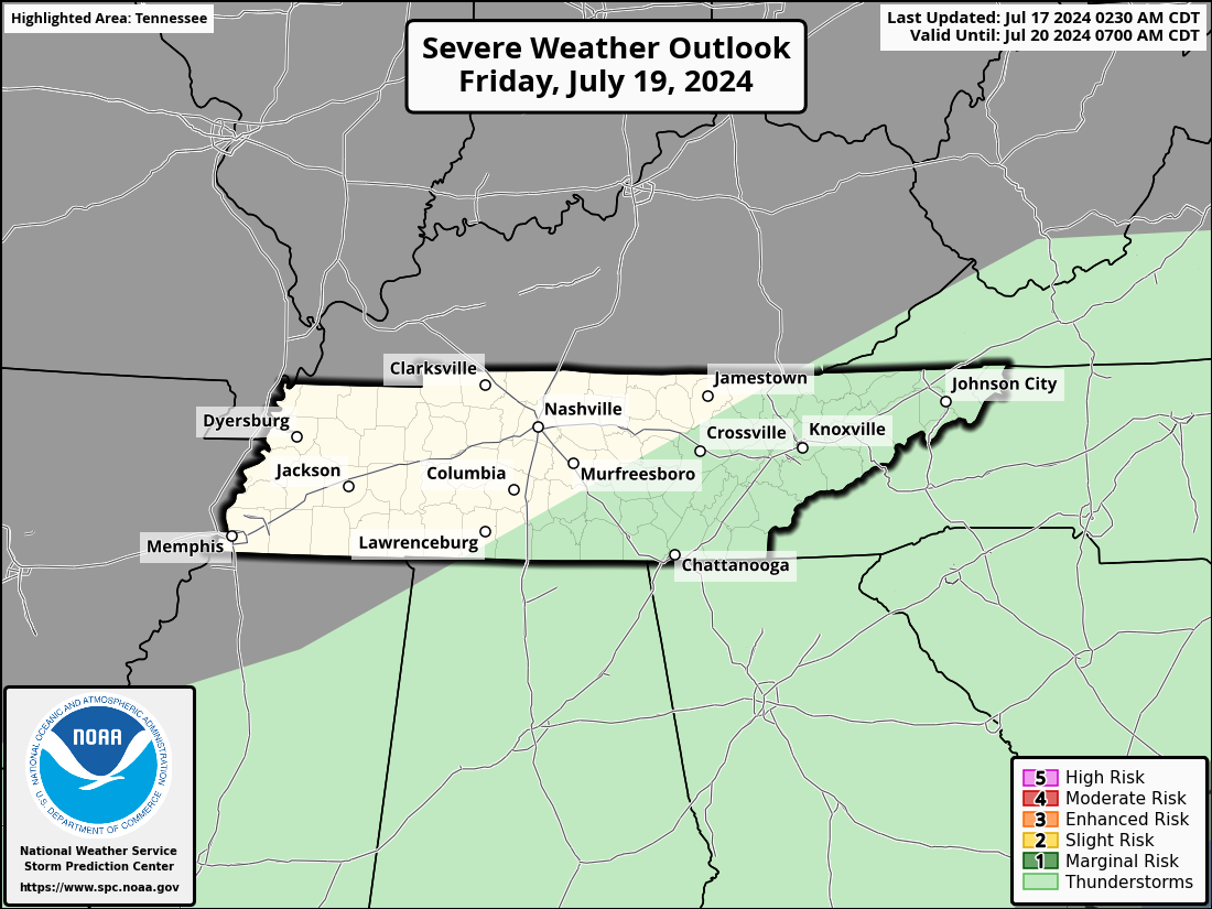
Davidson and Williamson counties are under a 15% chance of severe weather within 25 miles for Wednesday. As of right now, current thinking is that the greater risk of severe weather will be to our north. It appears that a line of storms will move through sometime Wednesday PM, still too far out to say a specific timeframe, but best guess right now would be Wednesday evening/night. Still ~3 days out so things will change as they always do, we’ll keep you posted.
After Wednesday, we’ll cool down to more average temperatures for this time of the year. For now, Easter weekend appears dry.
Quick References:
Weather changes constantly.
Follow @NashSevereWx on Twitter for any changes to this forecast.
Live coverage during tornado and severe thunderstorm warnings:

Look good.
Support the mission.

We are 100% community supported. No ads. No subscription fees. Keep it free for everyone.


Categories: Forecast Blogs (Legacy)
You must be logged in to post a comment.