

A lil’ foggy out this morning, take it easy if you have to. Should clear out sooner than later.
Temperatures started off relatively cool this morning in the 40’s, we’ll work our way up to the upper 60’s by this afternoon.
The Storm Prediction has the western half of our counties outlooked with a 5% chance of damaging straight-line winds within 25 miles. Don’t worry too much about where exactly the lines are drawn. We are NOT outlooked for tornadoes, hail or flash flooding, yay.
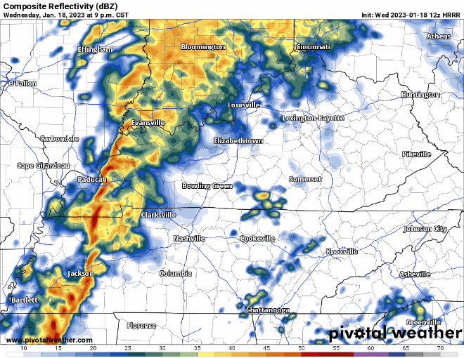
Some showers are possible ahead of the line this afternoon and evening, but they’ll just be showers, nothing special.
HRRR model (above) thinks ETA of the main line looks to be around 10pm-midnight.
With the timing being at night, make sure you have your weather radio or wake-me-up app ready to go in the off chance a warning is issued for you. Probably won’t go off, but you can never be too sure.
Rain should clear out by your Thursday AM commute.
After the front sweeps through, temperatures will gradually drop throughout the day on Thursday. Our high temperature will likely be as soon as the clock turns to midnight on Thursday. Temperatures will stay around average for this time of the year for the weekend and start of next week.
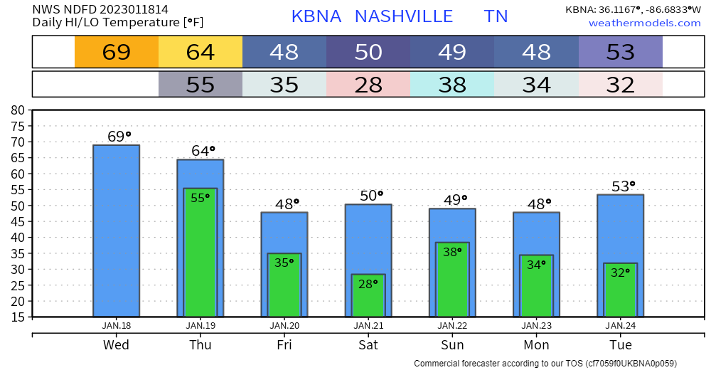
Sunday looks wet, but just rain, no frozen precip expected at the moment.
Quick References:
Weather changes constantly.
Follow @NashSevereWx on Twitter for any changes to this forecast.
Live coverage during tornado and severe thunderstorm warnings.

Look good.
Support the mission.

We are 100% community supported. No ads. No subscription fees. Keep it free for everyone.


Categories: Forecast Blogs (Legacy)
You must be logged in to post a comment.