
Today through the majority of Thursday will be “nice” as temps reach the upper 40’s, maybe even low 50’s. Dry. Not too shabby.
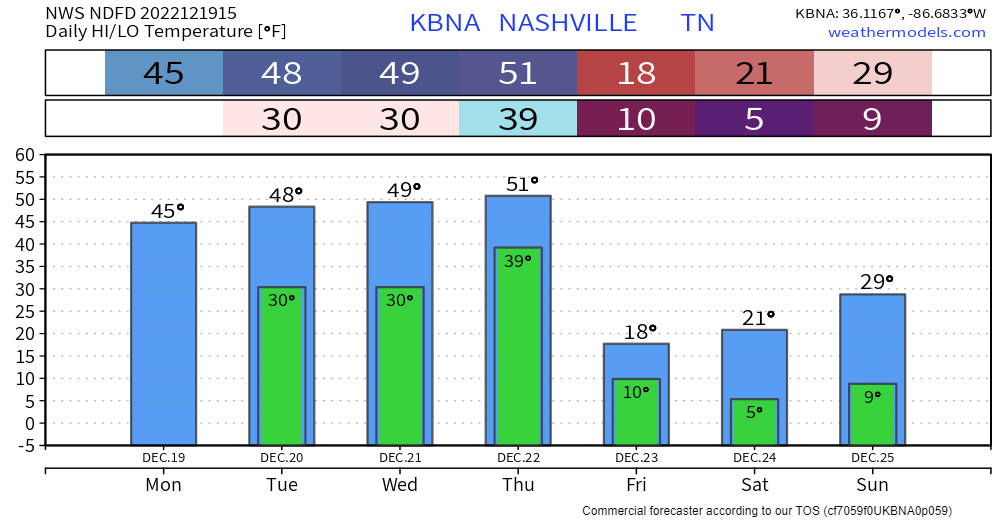
Thursday night, temperatures are expected to plummet into the single digits/low teens. Temperatures will likely stay below freezing until midday Monday. This will leave us with dangerous conditions. It’s time to start preparing now, especially if you are heading out of town.
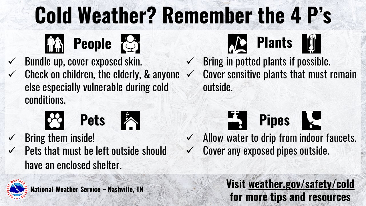
Follow the 4 P’s.
Along with the cold temperatures, winds Thursday night and Friday will be howling, with sustained winds around 15-20mph, with gusts up to 35-40mph. This will make temperatures feel a lot worse, with wind chill values as low as ten degrees below zero. Wind chill values may not get above zero degrees at any point on Friday.
Now to snow chances.
Thursday afternoon/evening it’ll start to rain while temperatures are still well above freezing. The cold air will be playing catch up with the moisture. It looks like it will be able to, but the question is for how long? The GFS is starting to lean a little more toward the Euro, which would mean less snow. However, confidence is still fairly low. If snow falls, it’ll likely stick. Prepare for minor travel impacts. Higher-res models will start to get in range later today and tomorrow, always nice to have more opinions.
Quick References:
Weather changes constantly.
Follow @NashSevereWx on Twitter for any changes to this forecast.
Live coverage during tornado and severe thunderstorm warnings.

Look good.
Support the mission.

We are 100% community supported. No ads. No subscription fees. Keep it free for everyone.


Categories: Forecast Blogs (Legacy)
You must be logged in to post a comment.