
Windy start to the day as both of our counties are under a Wind Advisory. May need to tie down some Christmas decor, also heads up Titans special teams…it’s coming from the SW.
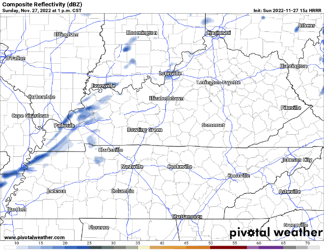
Could see some drizzle this afternoon/evening. Won’t be much, but just enough to notice it. Below is what the HRRR model thinks.
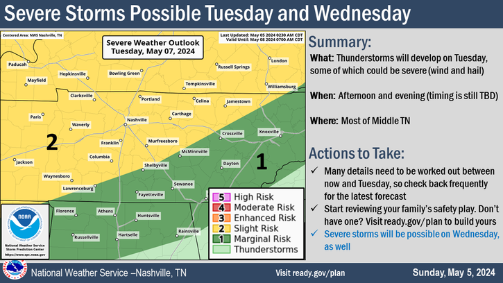
Stormy Tuesday
The Storm Prediction Center has outlooked our counties with a 5% chance of severe weather within 25 miles for Tuesday.

The greater risk is to our south and west. Timing is still iffy, but looks as if we could start seeing rain/storms sometime Tuesday afternoon.
The details will get more ironed out in the coming days, but this does not look like any “grand slam” type of event. Main concern will be damaging straight-line winds. We’ll be watching it close and keeping you updated.
Temps hang around average for this time of the year, end of the week mornings will be cold, but high temps will rebound somewhat nicely.
Quick References:
Weather changes constantly.
Follow @NashSevereWx on Twitter for any changes to this forecast.
Live coverage during tornado and severe thunderstorm warnings.

Look good.
Support the mission.

We are 100% community supported. No ads. No subscription fees. Keep it free for everyone.


Categories: Forecast Blogs (Legacy)
You must be logged in to post a comment.