

Rain amounts in last night’s sprinkler barely registered. The big winner was five hundredths of an inch in southern Davidson Co. Most much less than that. That was to be expected.
Our next rainer will bring more rainfall Saturday night. Sometime around or after dark, rain will move in from the SW. Could even get a few lightning strikes out of the heavier rain cells. HRRR illustrates what the radar could look like. Loop Saturday 3:00 pm – Sunday 6:00 am (when rain should be moving out).
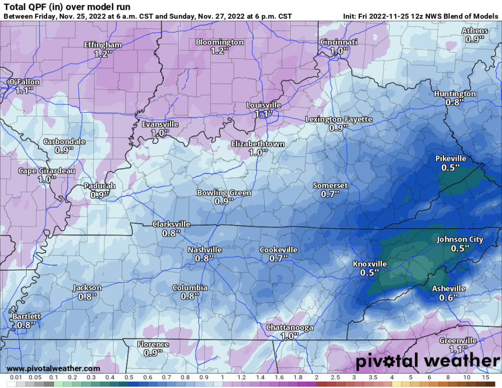
Generally looking at less than an inch of rain (NWS Blend of Models)
Next System Could Be Stormy
A strong cold front comes through Tuesday night-Wednesday. Ahead of this front, moisture will surge up from the Gulf along with a few ingredients needed for storms. But, models disagree on to what extent.
For example, the GFS shows ample moisture (measured by the dew point) surging up for storms to feed off of, maybe even to severe levels.
But other models, especially ensemble models, disagree. Ensemble models are given more weight because they are a combination of several models, rather than just looking at one. NWS Blend of Models:
Less blue is good.
NWS has outlooked areas SW of us for the possibility of severe weather, but we are not included as of today. But, that could change as we get closer.
We’ll keep an eye on it.
Quick References:
Weather changes constantly.
Follow @NashSevereWx on Twitter for any changes to this forecast.
Live coverage during tornado and severe thunderstorm warnings.

Look good.
Support the mission.

We are 100% community supported. No ads. No subscription fees. Keep it free for everyone.


Categories: Forecast Blogs (Legacy)
You must be logged in to post a comment.