
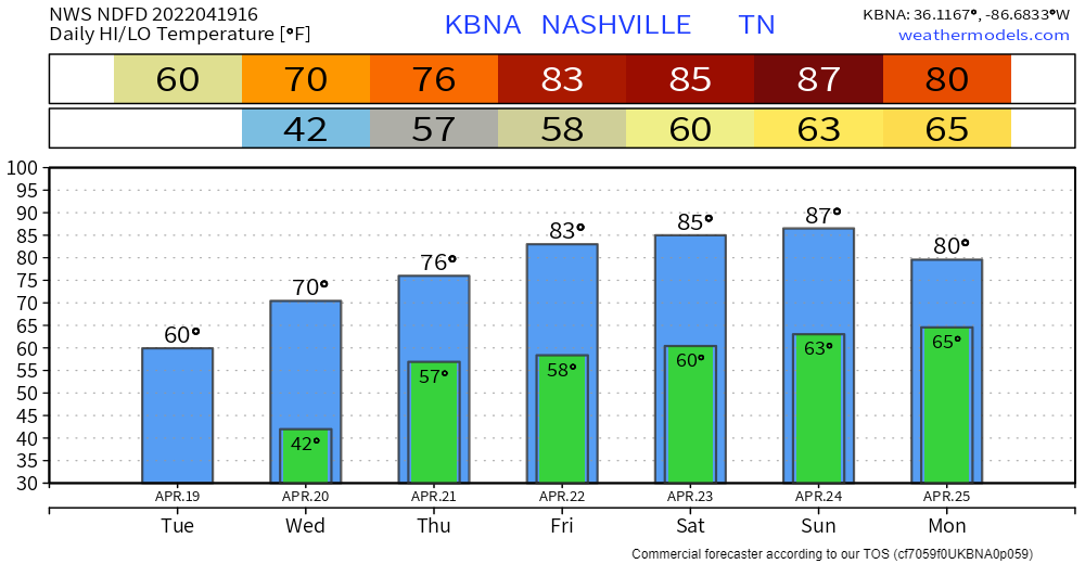
Mild temps and clear skies today… down in the low 40s tonight. No frost concerns this time. Probability of another spring frost event drops under 10% from this point on, per the NWS. Not impossible, but odds are low that we see another.
Warmer air moving in tomorrow. With it, rain. Scattered showers starting tomorrow night…out Thursday morning:
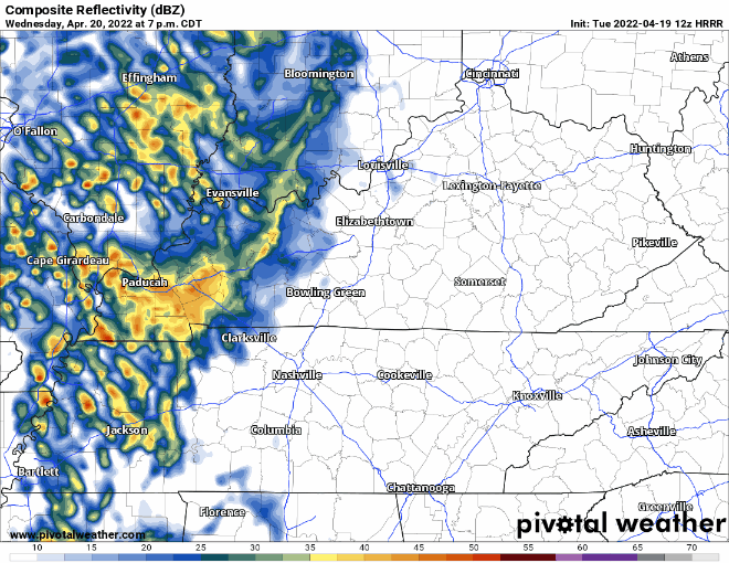
No severe/flooding threat with this system. Some of you may not even know it rained until the next morning. Perfect rain on a tin roof weather… won’t even need your sound machine.
Warming trend continues Thursday through the weekend. Highs in the 80s by Friday… 10-15 degrees above average! Good news is humidity will be low. Weekend looks dry and mostly sunny. Picture perfect for your outdoor activities.
Quick References:
Weather changes constantly.
Follow @NashSevereWx on Twitter for any changes to this forecast.
Live coverage during tornado and severe thunderstorm warnings:
Look good.
Support the mission.
We are 100% community supported. No ads. No subscription fees. Keep it free for everyone.
Categories: Forecast Blogs (Legacy)
You must be logged in to post a comment.