
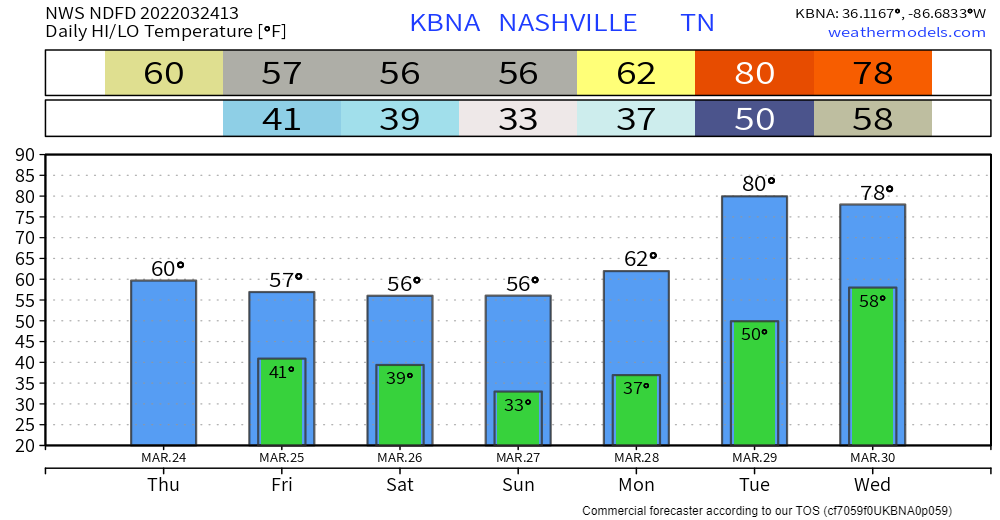
A slight cooldown from yesterday to today. Likely won’t break into the 60s again until next week. The same goes for rain.
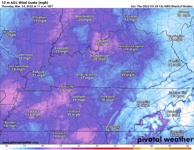
Most interesting thing about today is the wind… could see gusts up to 35 mph! That’s about as unsettled as our current weather pattern gets for awhile.
Frost possible Sunday morning. That’s the coldest we get before a warming trend kicks off Monday.
We transition to more unsettled weather midweek next week. Still a ways out, but we’ll be keeping tabs on it.
Quick References:
Weather changes constantly.
Follow @NashSevereWx on Twitter for any changes to this forecast.
Live coverage during tornado and severe thunderstorm warnings:
Look good.
Support the mission.
We are 100% community supported. No ads. No subscription fees. Keep it free for everyone.
Categories: Forecast Blogs (Legacy)
You must be logged in to post a comment.