

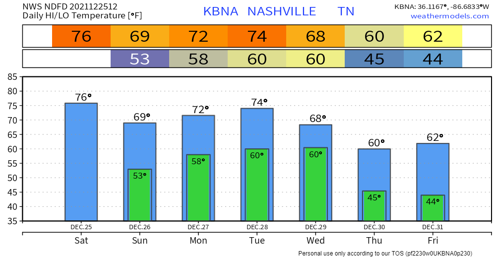
Winds will calm down this afternoon and tonight. 76° today would be the record high for Christmas, set 5 years ago.
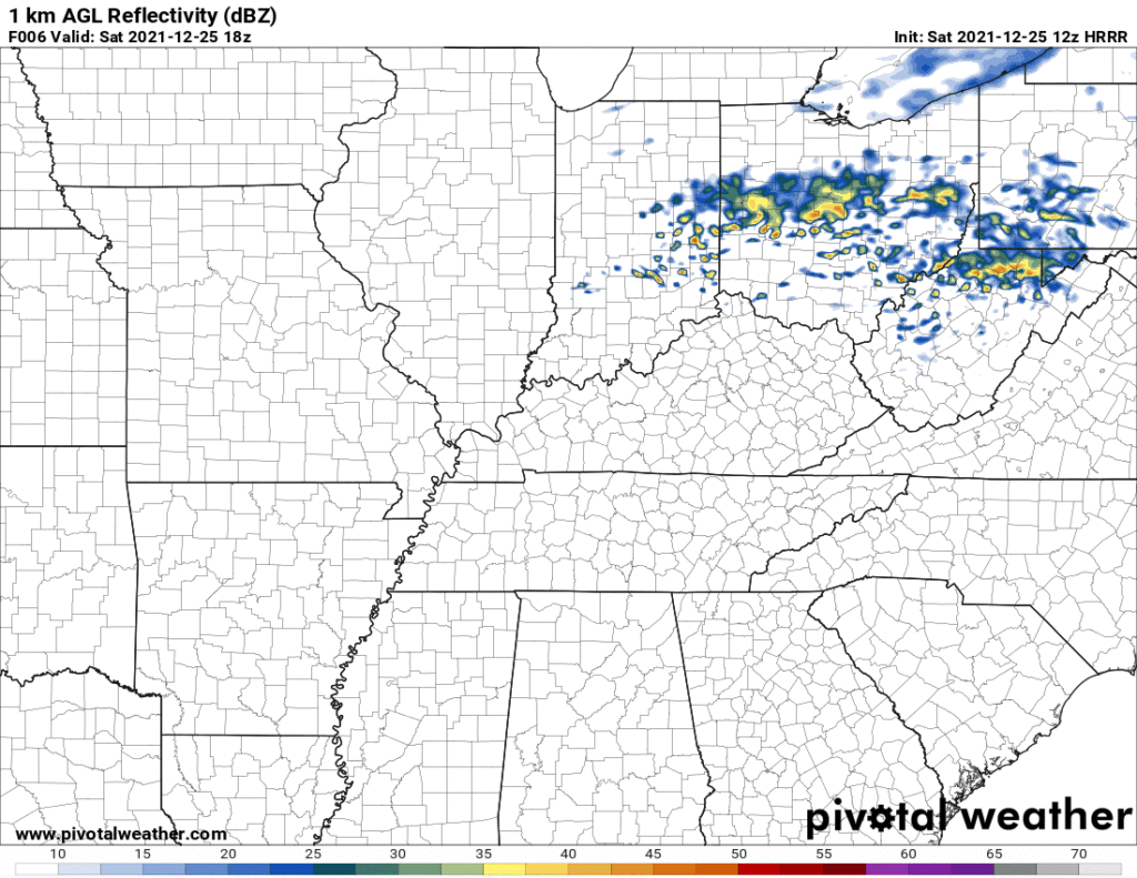
Few raindrops may cross by tonight. Inconsequential. Alter no plans. HRRR model:
Monday and Tuesday may bring showers. Models think just rain, off and on, more Tuesday than Monday. Nothing to worry about either day.
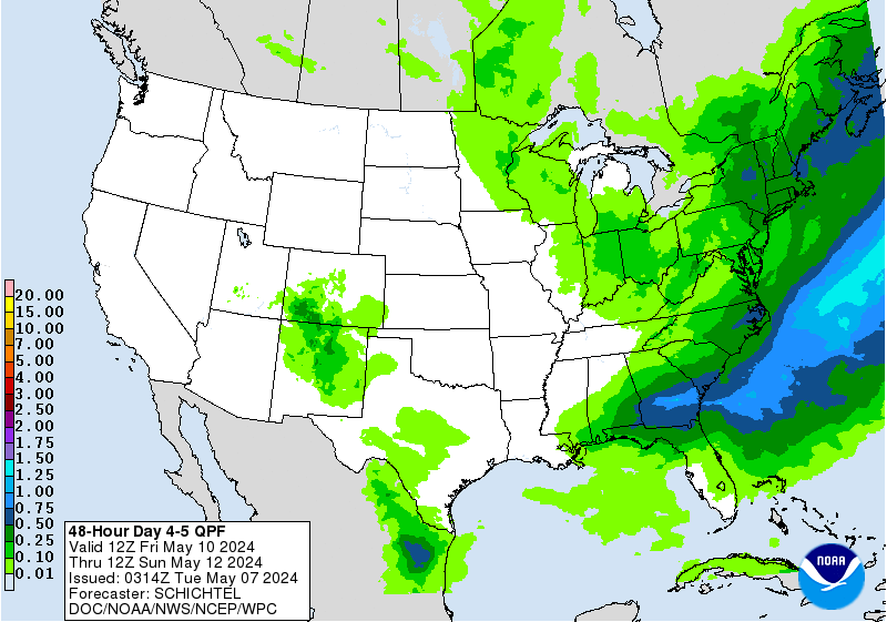
Wednesday may be a washout. Most models spit out an inch or more in a 24 hour period, which if that’s what we get, we can handle (not enough rain for flooding). Heavier rain in purple is north and east of us per WPC’s “how much we think rain ya gettin” forecast, and even those purple areas wouldn’t alarm me for flooding here:
Severe weather ingredients may come together south of us, again, this is for Wednesday:
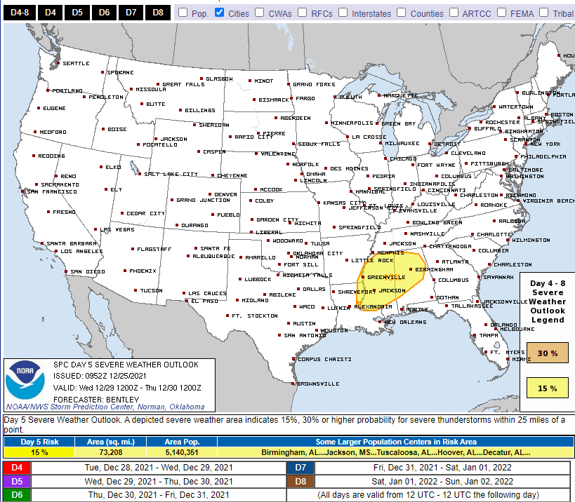
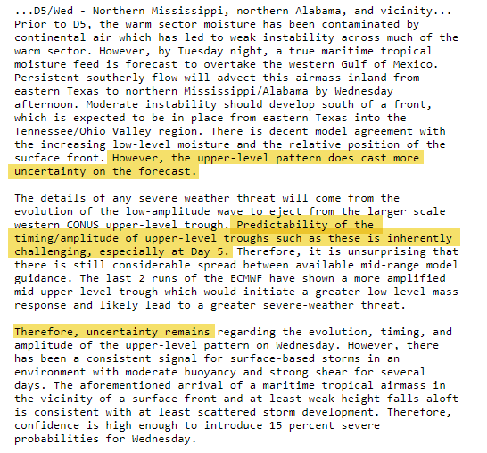
Looks like we’re too far north for severe weather (we still may get regular thunderstorms), but the models still have details to work out and that area may shift a bit. Notice the SPC discussion still has doubts about the yellow area itself:
From NWS-Nashville about Wednesday:
Not concerned about any strong storms just yet as lapse rates are modest and soundings are saturated, but we could be in for a couple inches of rain by the time Thursday morning rolls around.
This is nothing for us to worry about; this event may not even materialize for those IN the yellow area, which we are not in.
But, it’s something to watch.
Merry Christmas. You are loved.
Categories: Forecast Blogs (Legacy)
You must be logged in to post a comment.