
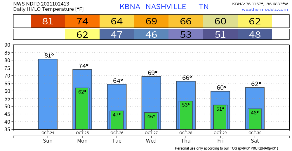
We close out the weekend dry. No rain in sight today. Temps peak in the 80’s today and dewpoints hang in the 50’s. It’ll be warm, but not humid. This will save the Titans game from being a sweat fest. If you’re wearing a hat to the game, keep it on tight because it’ll be windy out there. Gusts could be around 30 mph today and be even stronger tonight.

Storms to start off the week
Showers and storms arrive bright and early Monday morning. HRRR thinks the line of storms gets to us around 5 AM. Right in time for your morning commute. See below:
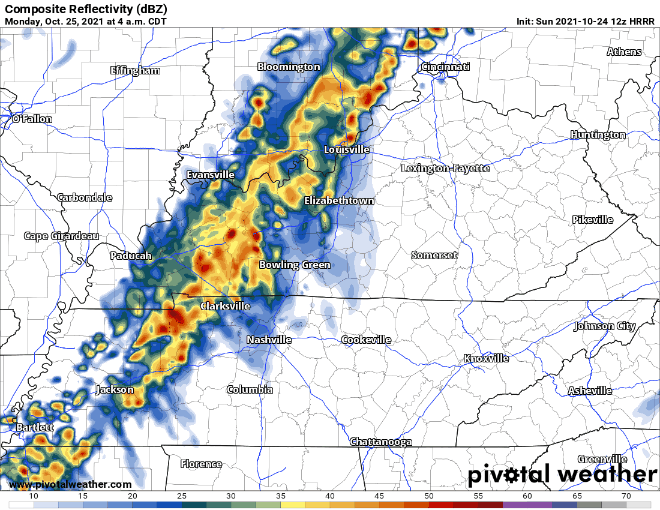
This line is expected to weaken as it moves over us. There isn’t a whole lot of instability in the atmosphere to fuel these storms. There is strong wind shear though, which can make a few of these storms rather unpleasant. The overall severe threat is low. Main concern is strong winds. NWS thinks an isolated tornado is possible with this line due to the shear present, but overall low probability. Keep phones & weather radios close just in case.
Temps drop back into the 60’s Tuesday and hang there the rest of the week. Next chance for rain looks like Wednesday night into Thursday. Better timing on this as we get closer!
Categories: Forecast Blogs (Legacy)
You must be logged in to post a comment.