Woo you made it to Friday! Now let’s talk weather.
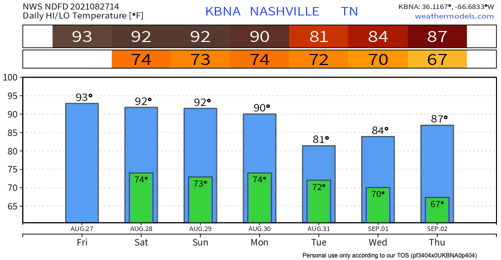
Friday for the most part is looking sunny. Temps in the low-mid 90’s coupled with dewpoints in the low 70’s will make it feel pretty hot and humid. Deodorant is our friend.

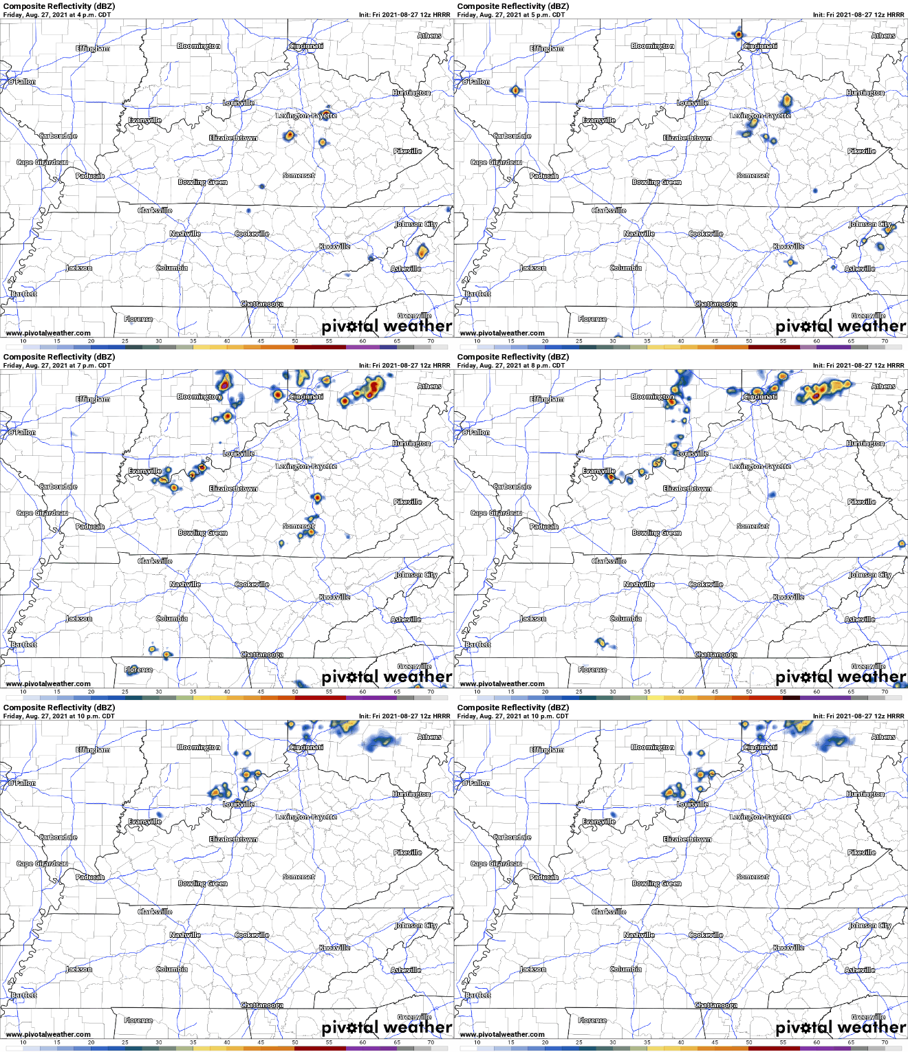
Rain probabilities are low today. HRRR is showing storms pop-up in the afternoon/evening. The overall coverage of the storms are low, so there is a real shot none hit our area.

If for some unfortunate reason your outdoor plans get caught in one of these storms, it should be brief. Lightning is definitely possible with these, so keep an eye out. Storms should subside around sunset.
Copy and paste weather today for tomorrow
Saturday looks unbelievably similar to Friday weather wise. Similar high temp, similar dewps, similar heat and humidty.
Rain chances are low again. Same deal as Friday, low coverage afternoon/evening storms. Hit or miss kind we all have grown so used to.
What the heck is Ida?
You’re probably going to be hearing that name a lot more over the weekend and into next week.
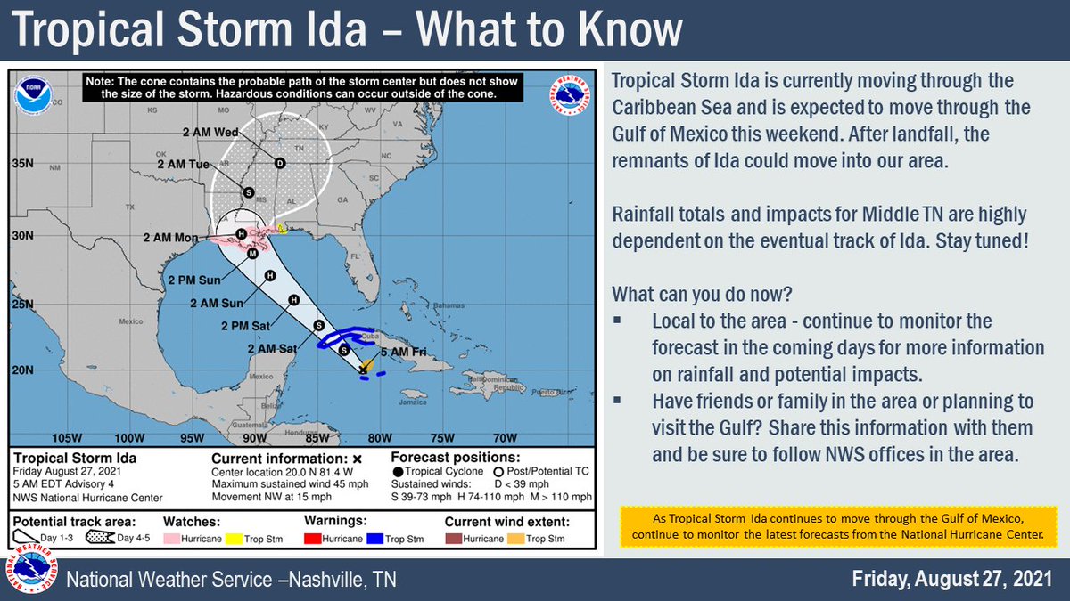
Ida is a tropical storm in the Caribbean right now. It’ll keep moving into the Gulf over the weekend. Ida is forecasted to potentially impact our area. If Ida does indeed take a trip to Williamson & Davidson Co., it will be much weaker than it will be in the Gulf. Probably a tropical depression.
Let’s all gather ’round and take a look at the cone of uncertainty:

Around 2 AM on Wednesday, the cone shows the remnants of Ida could be at our doorstep, they also could be in Arkansas or Georgia. That is why it is called the cone of uncertainty. Model confidence decreases further out in time, so the potential path of the storm widens. As we get closer to the next week, the cone will shrink and we’ll have a much better idea on the path Ida’s taking. Maybe don’t mention the cone of uncertainty around your dog at home… they might get the wrong idea.

More on Ida from us as we get closer to next week!
Categories: Forecast Blogs (Legacy)


You must be logged in to post a comment.