
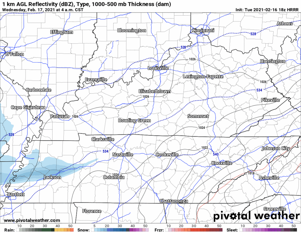
The 18z HRRR model run thinks snow will pass north of us Wednesday morning. By sundown Wednesday night, we begin several hours of snow ending around 1 AM Thursday morning. Then a pause until sunrise, when a sleet/snow event begins then transitions quickly back to snow and continues at least through noon Thursday. Then the model cuts off.
The 18z NAM3 model run sends us snow late Wednesday afternoon, changes it to sleet, then to rain late Wednesday night into the wee hours of early Thursday morning. Then the precip ends and “wrap around” light snow and flurries finish off our Thursday:
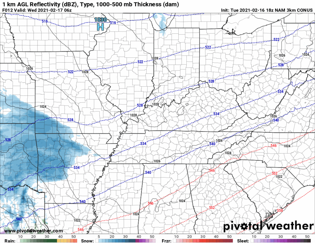
These are both higher resolution (in time and space) models. They do a good job of showing two different possibilities: the all-snow-a-palooza from the HRRR and the “warm air advection” snow/sleet/rain forecast nightmare depicted by the NAM.
The global models, running at lower resolution, are less help. The Euro model is colder like the HRRR but has much less moisture than the HRRR & NAM. The GFS looks like the NAM, initially snow but then we warm up and get sleet and rain.
If you are thinking “which model is right” — it’s a fair thought — but that is thinking about this wrong. These models are forecast tools, if any was “right” there would only ever be one model. The models all have strengths and weaknesses. The question, then, is are the models giving us a consensus to assist the forecast?
No. They are not. The models require expert interpretation by forecasters at NWS-Nashville and other professionals. As messengers and data interpreters, we’d like you to know that when the forecaster says “check back” and “this is uncertain” it’s not because they are hedging their bets because they’re bad at their job. It’s because they are great at their job and they have the honesty to admit that the demand to get (and any claim of) “accuracy” is as naive as it is intellectually dishonest. Somewhere along the way TV marketing departments and phone apps got into the minds of the public that the value of a forecast was to reduce it to something simple that “ends up being right” so they can say their forecast was most accurate (this blog is already too long so I’ll leave that rant alone for now).
All current models are running 2″ to 4″ total, with the NAM the outlier at 8″. The National Blend of Models is 2″, below:

So, where do we land?
First, check back frequently for updates. New information is the best information.
Second, embrace the uncertainty and the warm assurance of knowing this forecast is to prepare you for travel problems Wednesday and Thursday and likely Friday, too.
Third, avoid reductive, simple solutions to complex problems with unknown variables. Seek updates.
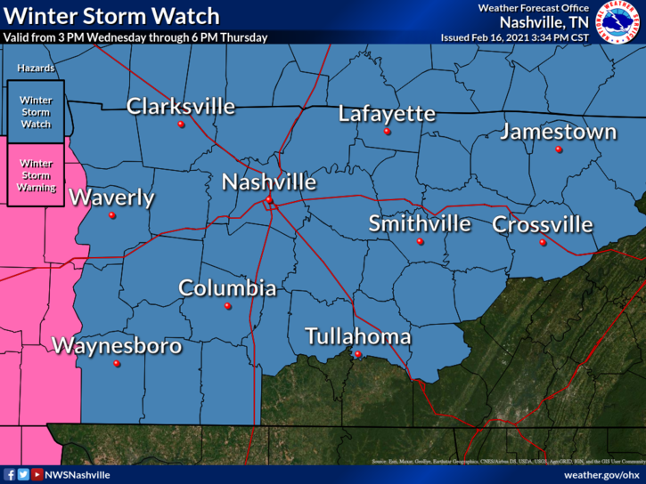
NWS-Nashville puts us in the wintry mix category for almost this entire event (snow, sleet, freezing rain):
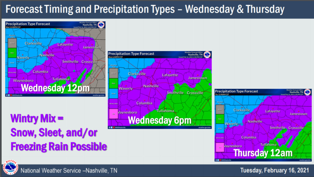
Then for Thursday:
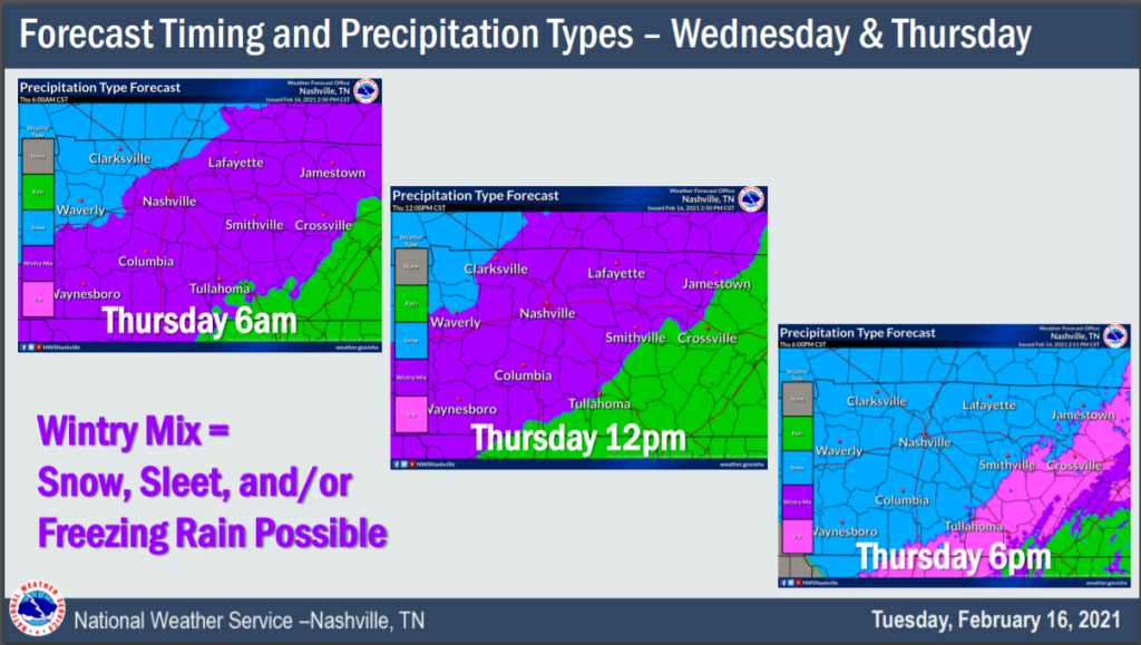
These graphics suggest we will get some form of wintry precip for about 30 hours, from Wednesday afternoon into Thursday night. The event might start Wednesday afternoon, but if it does, it probably will not continue all the way through Thursday night. It might run for more than 24 hours if the HRRR has somehow nailed this event, but even the HRRR doesn’t have continuous snowfall. The safest assumption about timing is that we will see wintry precip Wednesday night overnight into the early morning hours Thursday.
NWS-Nashville thinks the unlikely potentials for snow range on the low end from under 1″ (the NAM/GFS idea, where we get a lot of rain) to the high end of 4″ to 6″ (the HRRR solution). But the current thinking is snow 3″ to 4″ and ice (sleet or freezing rain) 0.1″ to 0.25″:
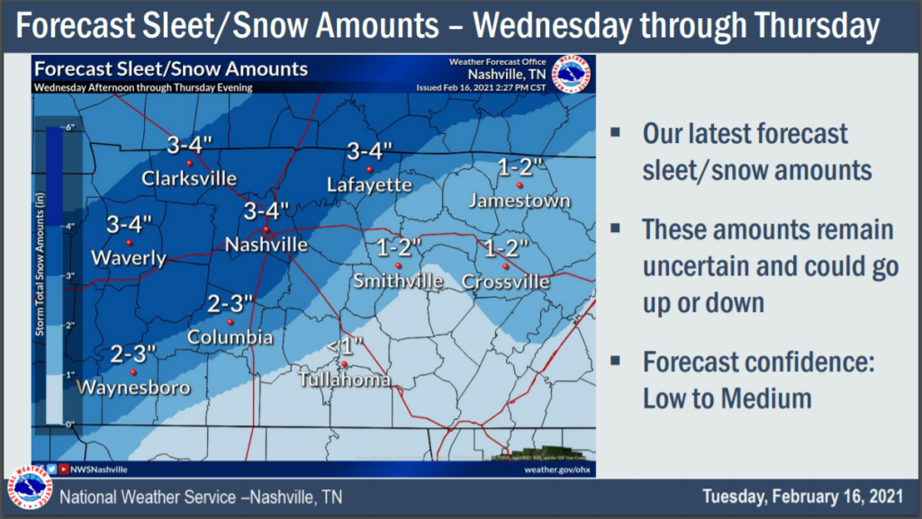
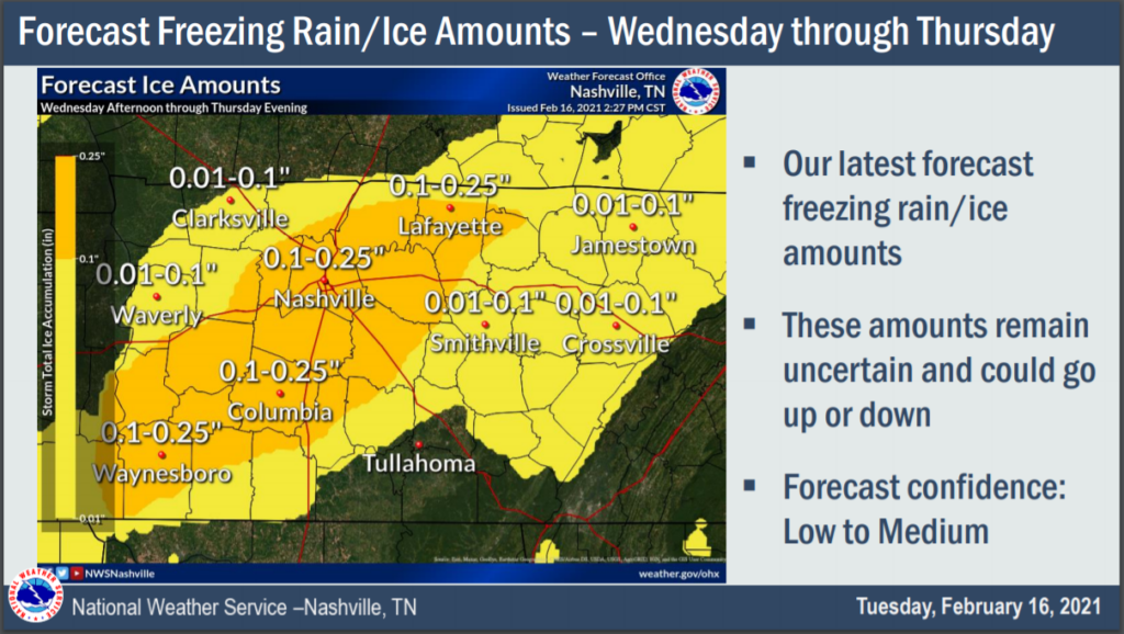
NWS-Nashville urges you to know these amounts are subject to change.
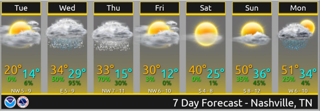
A brief window for melting arrives Wednesday afternoon, but that window will close suddenly as dusk approaches and temps nose dive well below freezing. We do not expect much/any melt relief Thursday afternoon. Road conditions should improve Saturday. So expect travel to remain hazardous until things slowly, meaningfully begin improving Saturday, and especially Sunday.
Categories: Forecast Blogs (Legacy)
You must be logged in to post a comment.