

Fall Who??
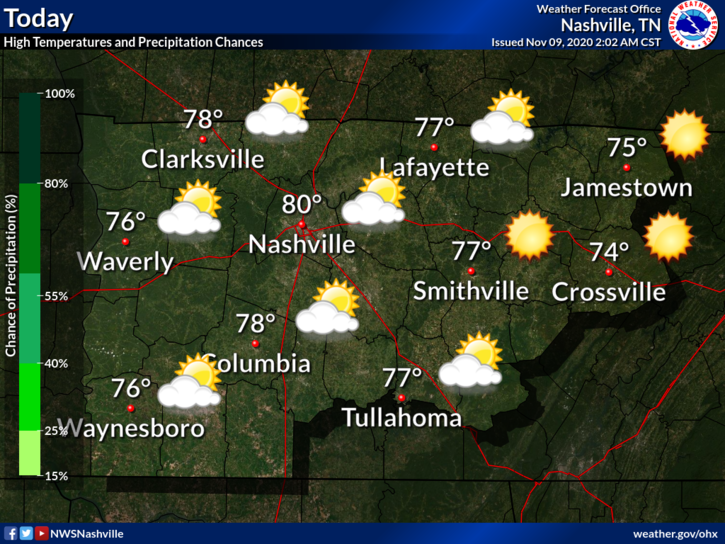
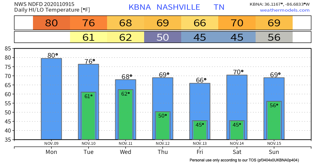
Temperatures will soar up to 80º today.
The record high for November 9 is 81º (set back in 2005). We will certainly get close. I’m placing my bets on tying the record today.
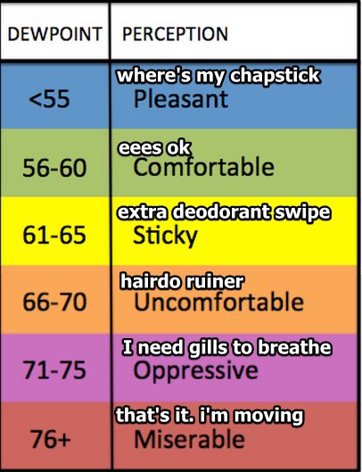
If you thought we were done with humidity, you were wrong! Dew points will peak around 60º.
Uncomfortable? No. Unusual? Yes. Pumpkin spicey? LOL no.
A few clouds today, but no rain. That comes tomorrow…
Here Comes the Cold Front & Rain!
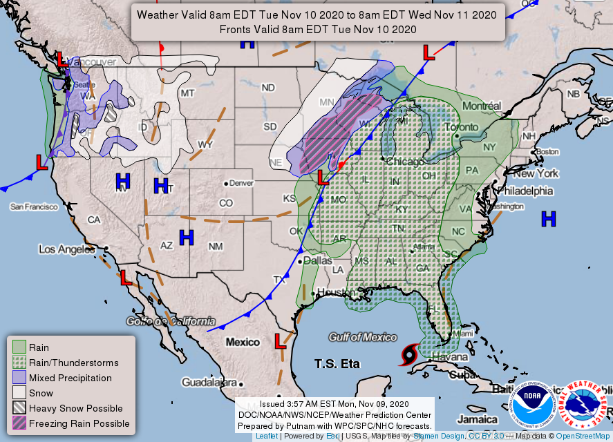
Tuesday morning the big blue line will bisect the US.
Wednesday morning it’ll be swinging through here.
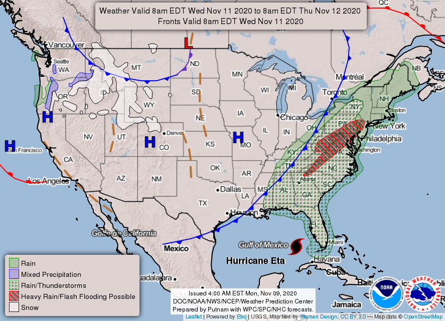
The cold front located over the Plains region will bring us rain on Tuesday and Wednesday. The Weather Prediction Center places us in the rain/thunderstorms category for both days.
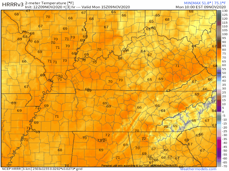
It’s still a little far out for models to have a grasp on exact timing of rain and a few week storms. The HRRR run from this morning extends to Tuesday afternoon:
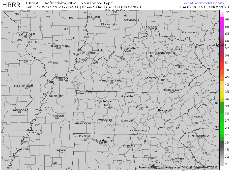
Expect scattered showers throughout the day on Tuesday. But, little/no rain.
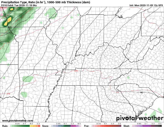
The GFS gives us a better feeling for the entire timeline of the event. The main rain line will likely pass through overnight Tuesday. Showers may linger through Wednesday morning.
Severe chances associated with the main line are located to our east. Right now, the Storm Prediction Center has left us out of their severe outlook region. Highest rainfall totals are also located east of I-65.
We will keep you updated if this changes.
Following the front, expect temperatures to drop to more seasonal values.
Our Next Chance for Rain Comes Saturday
Thursday and Friday bring our best chances to dry out.
Enjoy the sun before more rain moves in Saturday!
Models are still very inconsistent and not in agreement beyond Saturday afternoon. The operational GFS is more aggressive, bringing heavy rain Saturday night and Sunday, while the ECMWF/CMC have backed off in the precipitation department.
-NWS Area Forecast Discussion
Models are still flip-flopping on their rain forecasts. It’s probably best to pencil in rain for Saturday evening and Sunday. Keep the eraser on standby.
We will give you better plan-making guidance later in the week as it becomes available.
Categories: Forecast Blogs (Legacy)
You must be logged in to post a comment.