

Warmer and Drier Conditions Tuesday
You remember those lower dew points we were seeing last week? The ones in the mid to upper 60s?
Yeah, those are gone.
Dew points are looking to to be in the lower 70s today, getting as high as 72° this afternoon. High temps will be around 91°. Now mix those together and we’ll get some heat index values reaching the mid to upper 90s.
The HRRR is showing the possibility of some pop up storms, with the window for rain opening around 2:00 pm and closing around 8:00 pm.
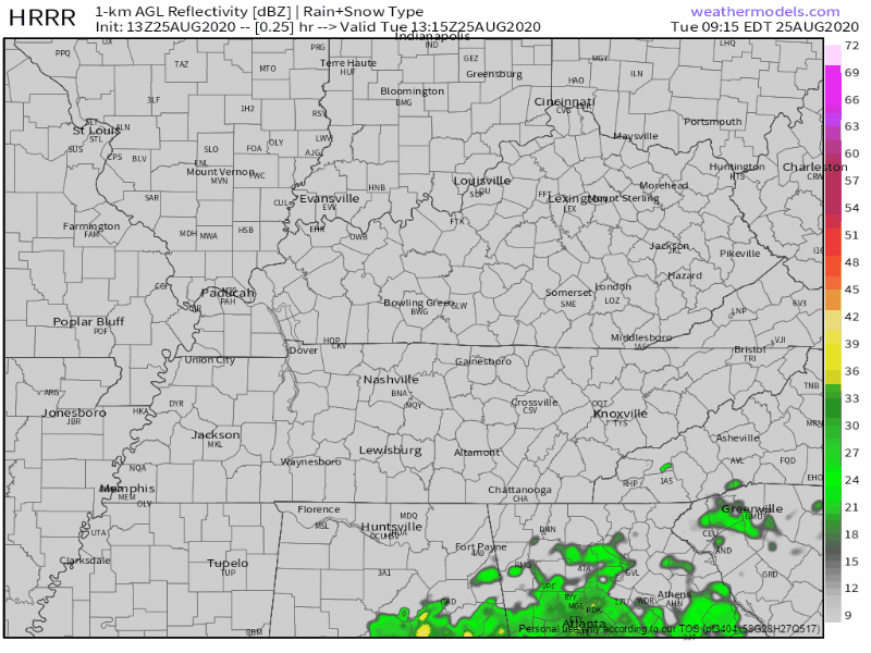
It’s hard to pinpoint when (or even if) these storms develop and affect your area, even with the models. If you have any outdoor plans this evening, keep an eye on your radar for any development!
Rain Chances Stay With Us Through Thursday
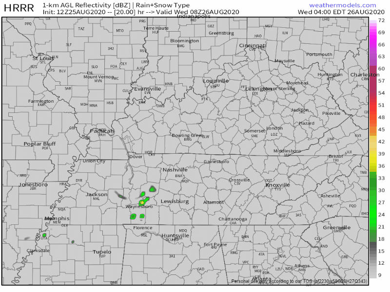
Gulf moisture being sent in our direction will keep rain/storm chances elevated Wednesday (HRRR of daytime hours Wednesday).
Thursday, much of the moisture will begin to move northward. This doesn’t mean we’ll be completely dry (especially during this time of year), but rain chances will decrease.
Neither Wednesday or Thursday look to be a washout, anywhere from a tenth to a quarter of an inch of rain is expected for both days. There could be locally higher amounts from downpours.
Severe weather is currently not in the forecast for the next couple days. Some heavier storms could be possible, containing heavy rainfall and some lightning.
When is Laura Affecting Us?
Editor’s Note: Brief Public Service Announcement.
Right now it looks like Friday will be our day to watch.
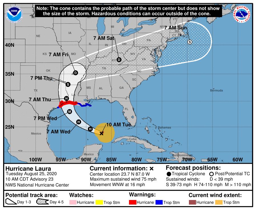
Laura is expected to make landfall late Wednesday as a major hurricane (Cat 3). She will begin to move through the Mississippi River Valley Thursday, then make a right turn toward the Tennessee Valley Friday.
The latest forecast has Laura weakening to a tropical depression and taking a hard right turn into Tn late Friday. This will bring a good chance for showers/storms and gusty winds to Middle Tn Friday and perhaps into Saturday depending on the speed/track of the system.
NWS Area Forecast Discussion
There could possibly be some severe storms embedded in the system. If it stays on track, downpours, lightning, gusty winds, and even an isolated tornado are all possible Friday.
Hurricanes can change speed and direction at any time. This will definitely be something to keep a close eye on for the next couple days.
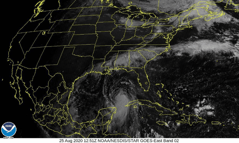
Here’s some satellite imagery from this morning of Laura moving across the Gulf!
Can’t Forget Those Temps and Dew Points
After Thursday, temps should remain in the upper 80s.
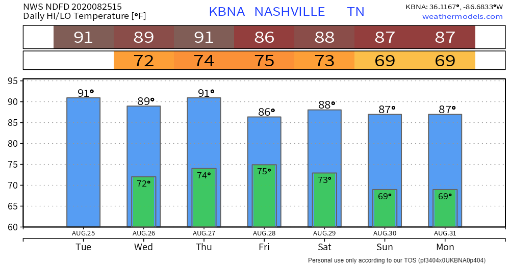
Dew points will be high though. They’ll be hanging out in the lower 70s, but on Saturday they could reach 75° in some areas!

Categories: Forecast Blogs (Legacy)
You must be logged in to post a comment.