
Today
Overcast skies are the current conditions we are seeing for now at 77 degrees.
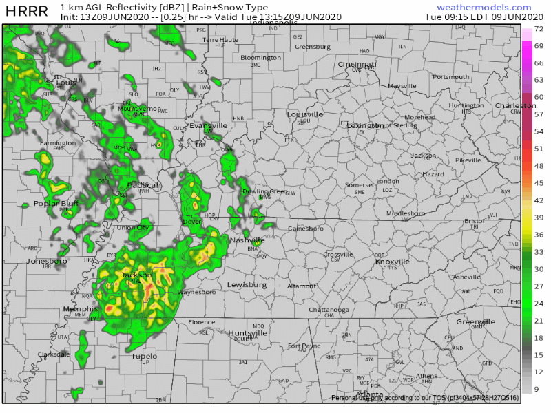
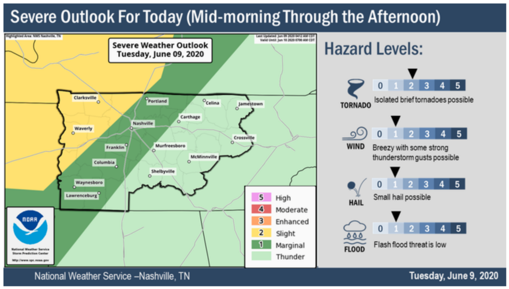
As the day continues, the threat for severe weather continues as well.
The threats that are possible with this severe weather include…
Strong winds of 15-20 mph gusting 35. Possible from late morning to early afternoon
Isolated tornadoes are also possible in any severe thunderstorm that may develop. If so, these would be short lived. Timing of those could be late morning to early afternoon as well.
Small hail could be threat produced by any storm today, but the hazard level is low.
The main timing the conditions will be right to produce these severe storms will be from 12-3pm.
Rain chances will dissipate later tonight, but will fire up again early Wednesday morning.
Be weather aware today!
Wednesday
The cold front associated with the plains will affect our weather tomorrow bringing one last wave of showers and thunderstorms.
The main threat these storms will produce are strong winds from 15-20mph gusting as high as 30mph.
The main timing for these storms will be in the afternoon hours. They will have come and gone by the night time.
High temps for tomorrow will be in the high 80’s.

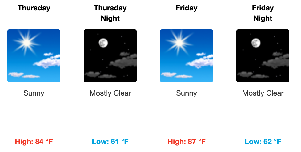
The Rest of the Week
Thursday and Friday are both going to be beautiful sunny days with warm temperatures in the mid 80’s. A nice reward from making it through all the rain and storms earlier this week!

Categories: Forecast Blogs (Legacy)
You must be logged in to post a comment.