
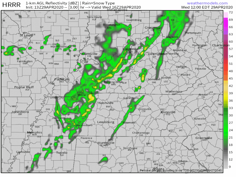
Rain and storms are expected around lunch into early afternoon.
HRRR model thinks it’ll arrive between 1 PM and 2 PM.
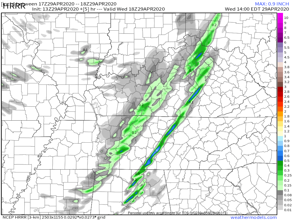
Lightning is possible but unlikely. About 0.2″ or less expected:
These storms will feed off a narrow strip of storm fuel. But — severe weather is not expected.
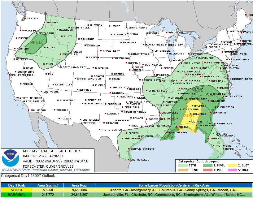
Neither hail, nor tornado, nor damaging winds are expected here. Those threats exist in the deep green and yellow shaded areas below:
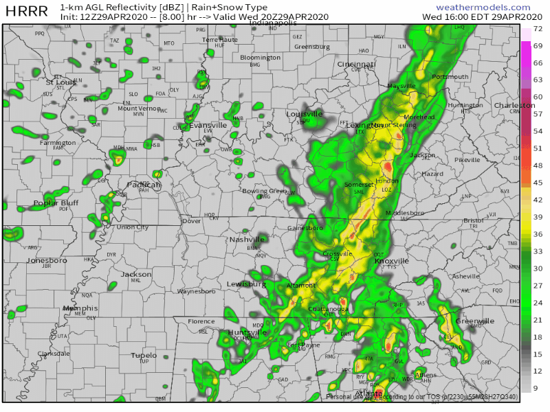
Light rain will scatter across the region late this afternoon through noon Thursday. Possible a light shower will wet your horse, but probably not. The HRRR model illustrates:
Quiet and warmer Friday and Saturday and most of Sunday.
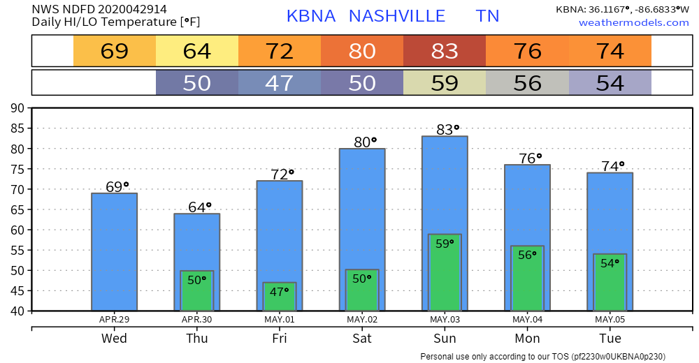
Next storm system Sunday night into Monday.
Pretty humid Sunday morning and afternoon, dewpoint 63, then here comes more rain, probably storms ahead of a cold front. ETA Sunday night into Monday morning.
Will they be severe? Data is unclear. From SPC:
a severe risk may materialize on Day 5/Sunday as deep-layer shear strengthens. However, there remains too much uncertainty in the timing/amplitude of the shortwave trough and placement of related surface features to include a 15% severe area at this time.
Storm Prediction Center, 4/29/20, Day 4-8 Convective Outlook.

Categories: Forecast Blogs (Legacy)
You must be logged in to post a comment.