
Today
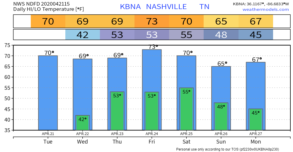
Plenty of sunshine. Northwest winds are gusty (gusting to 22 mph as of 11:00 am), but it still feels nice outside, high of 70°. Enjoy that!
One side note from NWS, however:
There are some gusty winds behind the front and this could cause a marginal fire danger. Will keep an eye on this.
NWS Nashville Mid-Day Forecast Discussion April 21, 2020
If you’re able to burn stuff in your municipality, you may want to hold off today. It could get out of hand as the air dries out and winds pick up.
Our Next Weather System
Clouds will start to increase during the day Wednesday ahead of our next storm system. We still expect to reach 68°, and rain should hold off until Wednesday night.
This system should bring plenty of rain with it. WPC is forecasting around an inch between now and 7:00 am Friday morning.
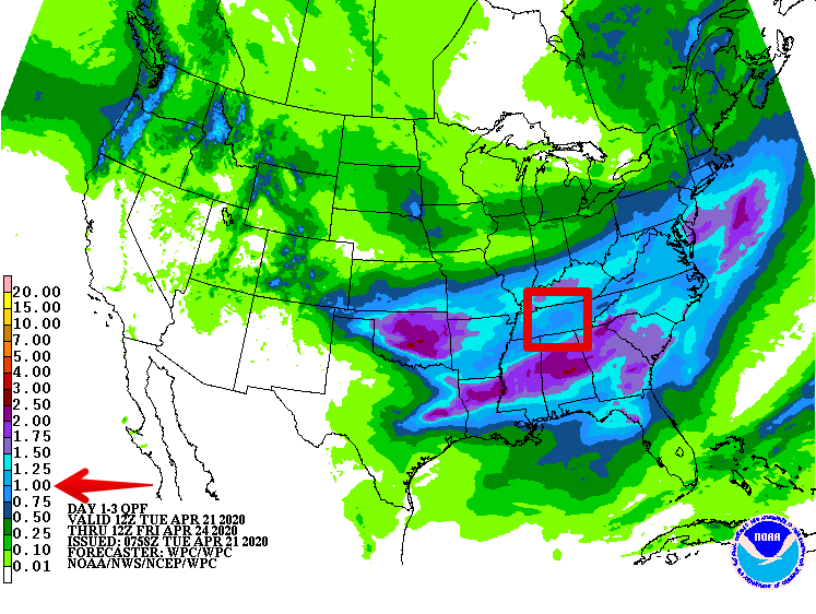
Notice the heavier rainfall stays south of us. Also staying south of us are the greatest severe weather probabilities.
Models continue to forecast the center of low pressure passing very near to us, which will keep the stronger storm dynamics well south of us.
However,
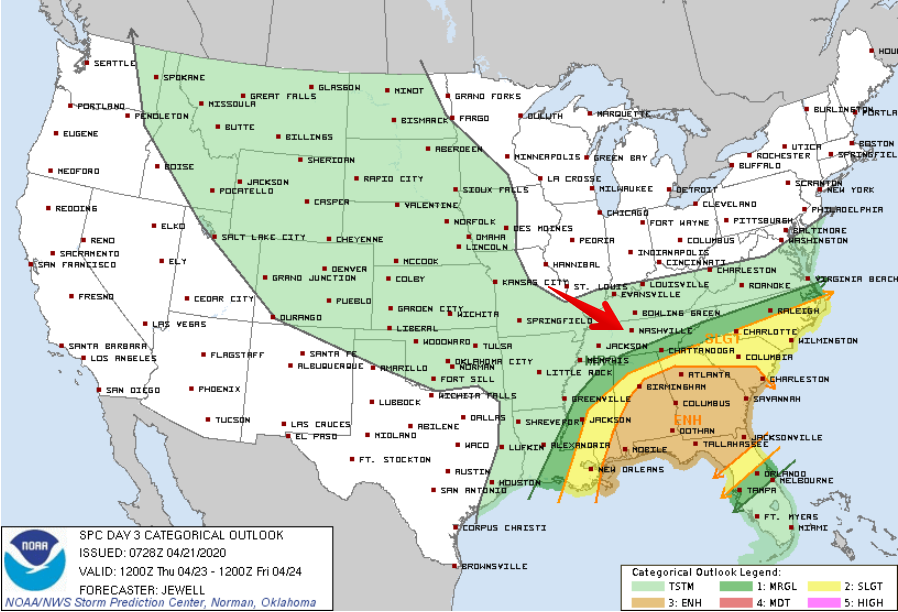
Jet structure really increases and shear will ramp way up as these features approach/pass, but instability remains limited. There is a small window late morning/early afternoon where an instability axis of 300- 500J passes. SVR potential low-end, but there could easily be a few strong/severe storms, especially south. Best chance for SVR storms as in last few events remains well south.
NWS Nashville Morning Forecast Discussion, April 21, 2020
Translation: one storm ingredient will be very available, while another is not so much. If the latter appears briefly, a strong/severe storm isn’t out of the question. That would be less likely the further north you go on I-65 from Alabama to Kentucky.
This system won’t drop our temps much, if at all. with highs +/- a few degrees of 70° as we head into the weekend.
Glimpse Into the Weekend
Right on the heels of the Thursday system will be our weekend system. Models don’t totally agree on how much rain or how strong storms will be. It looks like a rainy weekend, in general, beginning Friday night and rain chances trailing off on Sunday with slightly cooler temperatures. More on that system later.
Have a great Tuesday!

Categories: Forecast Blogs (Legacy)
You must be logged in to post a comment.