Light Rain Tonight – Overnight
Scattered light rain approaching late this afternoon, should be here tonight and continue heavier overnight, ending with just under 0.5″ sometime early Monday morning.
Heavier rain and non-severe storms expected between here and Nooga after 3 AM Monday . . .
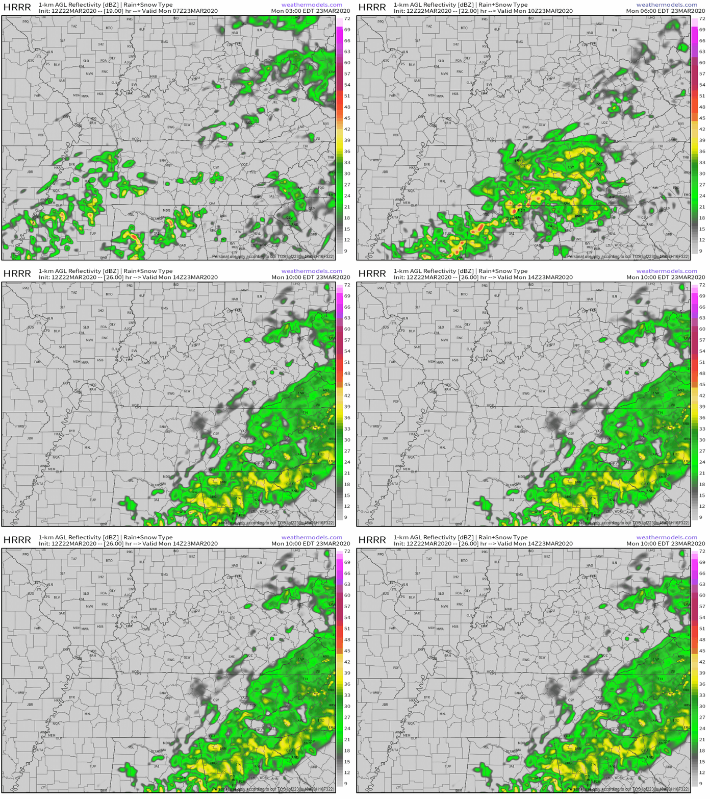
. . . but if you hear thunder while sleeping don’t be alarmed.
Warm up coming.
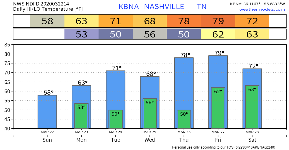
Severe Weather Threats, Risks, ETAs Tuesday
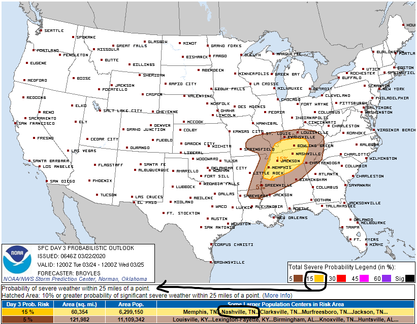
Threats. Damaging winds, large hail, possibly a couple tornadoes.
Risks. Storm Prediction Center probability of a damaging wind and/or large hail and/or tornado within 25 miles of anyone in this big yellow area Tuesday is 15%. We’re included.
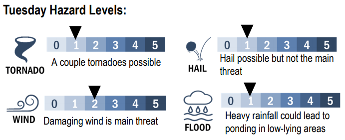
NWS-Nashville expresses risk in a six step 0 to 5 scale:
ETA Windows. Estimated times of arrival are slippery, that said, expect it afternoon/evening. Yup, that’s intentionally vague to retain intellectual honesty.
Some data suggests two rounds of storms, one around lunch as a warm front passes through and the other in the evening as a squall line.
Damaging winds look to continue to be primary concern, but large hail could be possible in stronger updrafts, and an isolated tornado threat can certainly not be ruled out. Along with the above mentioned surface feature, a short wave upper level trough will approach [the] mid state region as Tuesday afternoon progresses with large-scale ascent and deep- layer shear ahead of it. Thus squall line development may be possible during late afternoon hours across mid state region with a wind damage threat maintained into early evening hours.
NWS-Nashville, AM A.F.D.
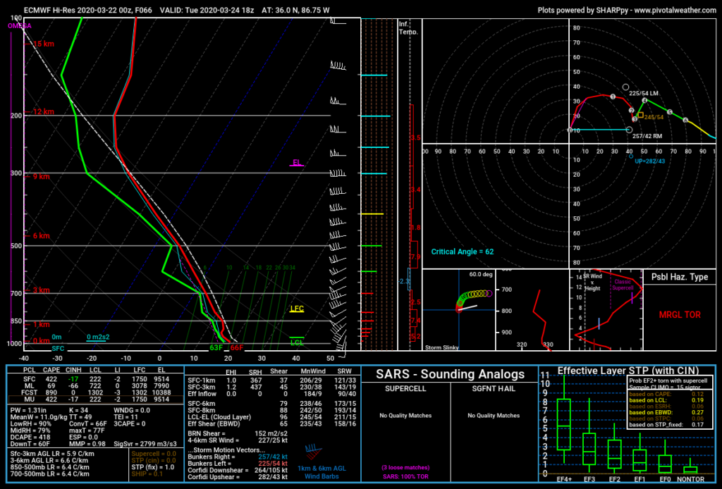
Unknowns, Uncertainties, & Comments. Euro data at 1 PM Tuesday predicts substantial severe-storm fueling wind shear, instability is low and a “cap” is seen around 900 mb, both good signs for us:
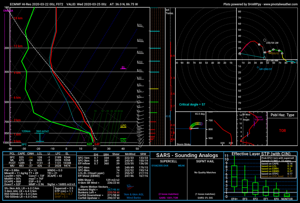
However, by 7 PM Tuesday, Euro data keeps shear strong, raises instability to near 500 j/kg, removes the “cap,” and drops LCL heights to 128m, all suggesting a damaging wind and low-end tornado threat.
GFS data has all the same ingredients as the Euro data, but in various combinations.
What actually makes a tornado is not wholly understood. You can’t create a checklist, see if the models tick the boxes, then panic or climb in your hammock based on results.
The point: there’s enough evidence Tuesday afternoon and/or evening will be a storm day. There are no answers, just threats and various risks/probabilities. Threats will show themselves and probabilities will be better defined tomorrow and all day Tuesday, so because you live here you should frequently replace older, lower res, less actionable information with newer, higher res, more actionable information. Check multiple reliable weather sources often.
A system’s designer and builder can tell you what the system will do. Meteorology didn’t design or construct the weather, it’s just trying to understand and predict it, all at the same time.

Categories: Forecast Blogs (Legacy)

You must be logged in to post a comment.