
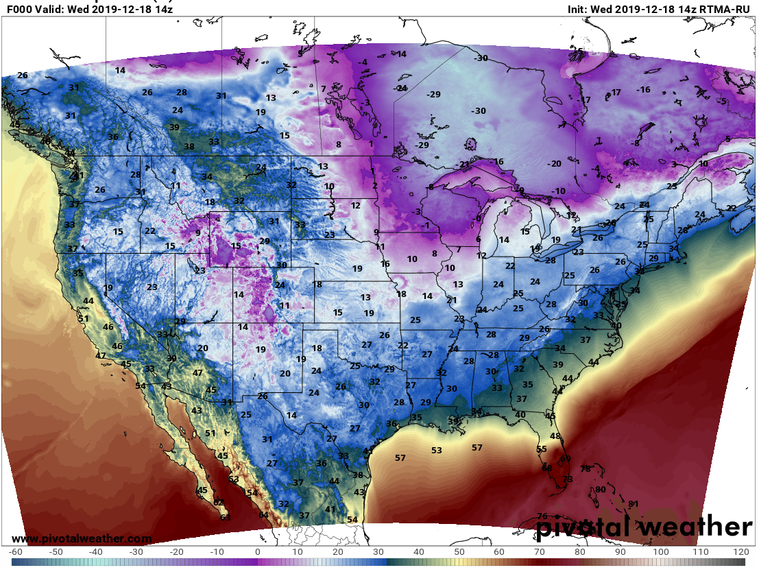
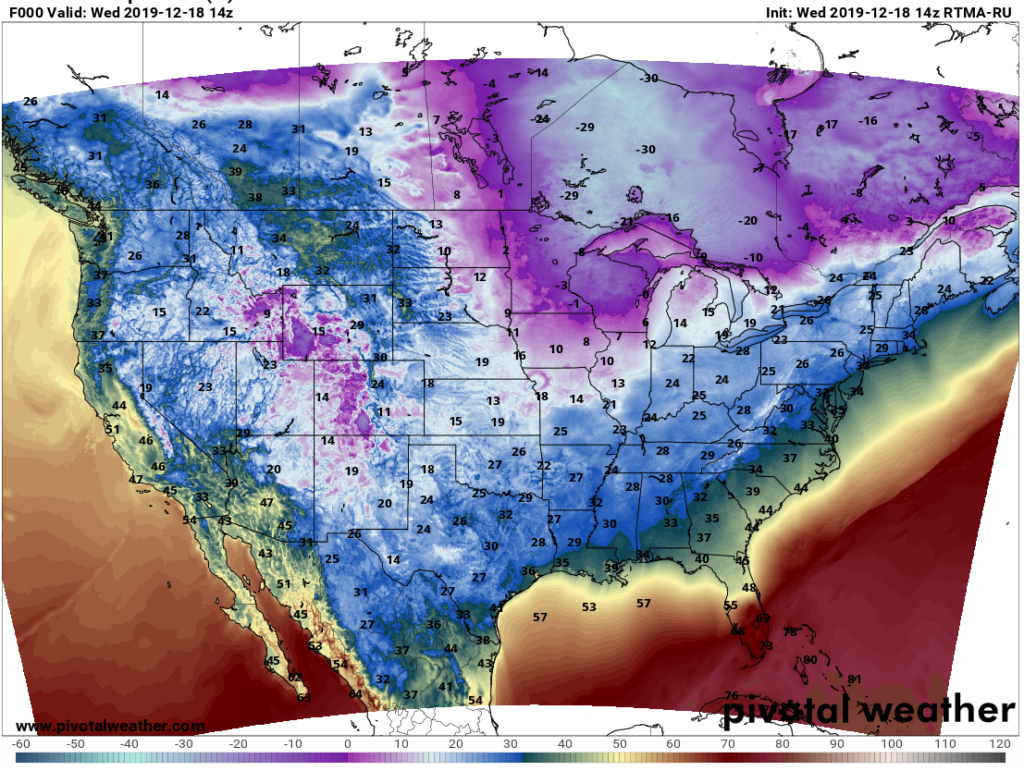
This morning a good chunk of the continent is at or below freezing, except for some regions along the coastline.
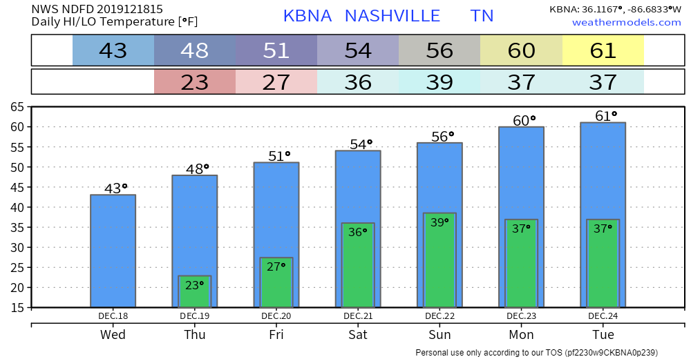
The high in and around Nashville today will barely breach into the 40°s, around 43°F.
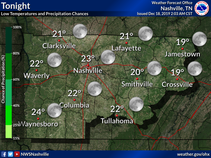
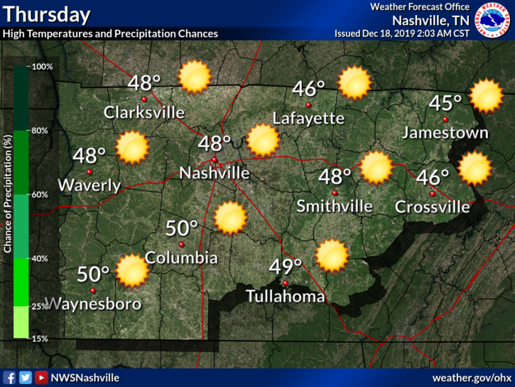
Very cold Thursday morning: 23°.
Thursday afternoon we warm up into the upper 40°s.
This is still chilly, but hey – not bad.
27° Friday Morning
That’ll be our last below-freezing morning until Christmas Eve (and probably beyond).
Good news Friday afternoon, NWS-Nashville :
By Friday, we could crack the 50 degree mark for highs as a light southerly return flow couples with increasing heights.
NWS Nashville, Morning Forecast Discussion on 12/18/2019
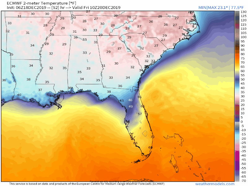
Why the warm-up? Because the high pressure which has been keeping us cold with north winds will move east and bring us warmer south winds. You can kinda see it happening on the Euro model below:
Warmer Weekend
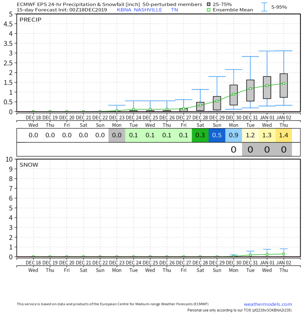
Pretty good. Slight rain chance — a weak system may work its way up from the south on Saturday, so there could be a chance of rain then – but it’s hard to say right now. Odds of rain are pretty low. The Euro model keeps all the rain in MS, AL, and GA.
Temps look warm through the weekend and Christmas Week:
Warm, Dry Christmas; Next Rain Guess Dec 28-31
Euro Ensemble data thinks we will stay warm and dry during Christmas week. This medium-range data (warning! low resolution, questionable accuracy, unknown specifics) suggests rain the weekend after Christmas into the the New Year. Timing, amounts all subject to big changes. Forecast accuracy and confidence as we get closer to the event. Anyway, here’s that data:
As always, check back for updates to the forecast here, and especially on Twitter @NashSevereWx

Categories: Forecast Blogs (Legacy)
You must be logged in to post a comment.