
Beautiful Day Ahead
High temperature for Thursday? 83°.
Skies? Mostly sunny, though we could see a few showers later.
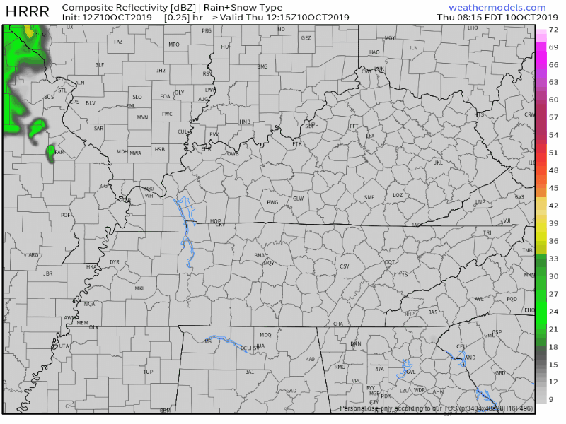
Here’s the HRRR model. Any chances of showers will be in the late afternoon/evening hours. Most of you shouldn’t see one, and if you do, they will be light and brief.
Cold Front Brings Chance of Rain Friday
Attention turns to the west Friday as a cold front marches east, with rain and a couple storms reaching the TN River by midday. Wet weather will work in from west to east, with rain chances maximizing during the afternoon and evening rush hour. Thermodynamics and kinematics are all too meager to expect any strong storms.
NWS-Nashville, Forecast Discussion, 10/10/19
The HRRR model is just in range now and shows the rain reaching us around 5pm Friday:

The NAM3 model also thinks the first few showers should reach us by 5 or 6pm:
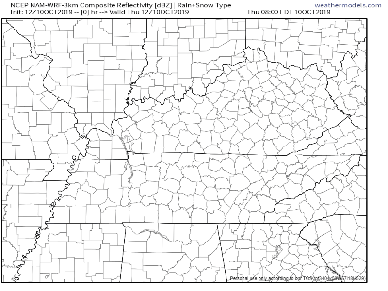
While it is possible the rain could arrive sooner or later, it looks like the greatest chance as of right now will be in the evening according to the models. Both models tend to agree, so at least that is a win.
Aside from the rain, high temperatures will reach 82°.
Cooler Temps Return this Weekend
This is no weaksauce cold front.
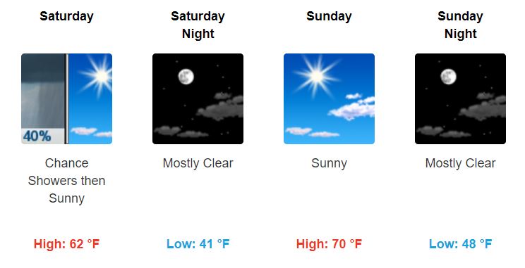
The coldest air will stay to our north, but our high temperatures will drop roughly 20° Saturday, and increase to more comfortable temps Sunday. Low temps also take a punch. Waking up early Sunday? You may want to bring a jacket:
Some showers from that cold front may linger over from Friday into early Saturday, but this probably won’t affect most of you.
If Fall was a person, this would be me right now because I’ve missed it so much:

Drought Monitor Update
Yup, it’s Thursday, which means the new Drought Monitor has been released!
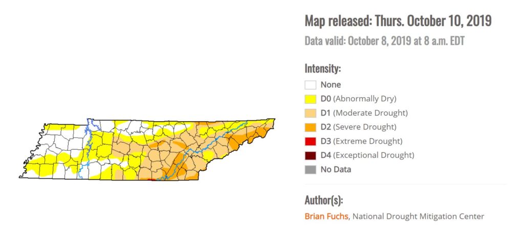
Thanks to the rain, we were able to knock the “Severe Drought” out of Davidson and Williamson Counties.
“Abnormally Dry” and “Moderate Drought” conditions still linger in the area, but it is definitely an improvement from last week.

Categories: Forecast Blogs (Legacy)
You must be logged in to post a comment.